Download
1 / 17
170 likes | 363 Views
Getting Planetary Science Data. Dr. Eric E. Palmer Principal Investigator of the Asteroid/Dust Subnode of the PDS. Deployed to Saudi Arabia. Studying Asteroids. ?. Hard to find data. ?. ?. Lunar and Planetary Lab U of Az. Two Projects. Shape Models for OSIRIS-REx.

E N D
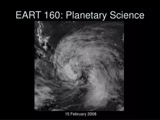
Getting Planetary Science Data Dr. Eric E. Palmer Principal Investigator of the Asteroid/Dust Subnode of the PDS
Studying Asteroids ? Hard to find data ? ?
Lunar and Planetary Lab U of Az
Two Projects Shape Models for OSIRIS-REx Archiving Asteroid/Dust Data
My Goal: Help you understand how to get data from the PDS
Where does planetary data come from? • Current missions • Many missions actively support Citizen Science
Where does planetary data come from? • Make your own data • Backyard telescopes
Old data Missions and some ground-base observations Where does planetary data come from?
Planetary Data System • Federation of nodes focused on different types of data • Range from simple optical images to complex magnetic fields • Primary Goal: Archive data • The archive has matured over time with better searching and metadata as time has gone on • Secondary Goal: Host the data • Provide the data for access • Started with physical images and print documents • Eventually CDs/DVDs. Now downloads • Host the data in usable format • Provide tools to search through huge collections of data
PDS Nodes • Node are generally set up by “Discipline” — meaning they focus on a category of data rather than a specific target • Geoscience • Imaging (Cartography) • Atmosphere • Planetary Plasma Interactions (solar wind, magnetosphere) • Navigational & Ancillary Information (NAIF) • Two are more “Target” specific • Ring-Moon Systems • Small Bodies
Challenges • Lots of data • Not always organized the way expected • Difficult to find out who to talk to • Contact any node • Contact a node that appears to be relevant • http://pds.nasa.gov • Card by the PDS table in the lobby
Geosciences — • Mercury • Venus • Moon • Mars • Jupiter’s 4 largest moons • Imaging and Cartography — • A copy of every image (except for LRO) • Topography of Moon and Mercury • Geologic Map • Planetary Plasma Interactions — • Solar Wind • Magnetosphere and fields • Atmosphere — • Saturn • Uranus • Neptune • Rings and Moon Systems — • Jupiter and Saturn’s rings • Small moons that interact with the rings • Small Bodies — • Asteroids • Comets • Dust • NAIF — • Handles spacecraft telemetry to calculate spacecraft position and what it was pointing at when data was collected
Things to Consider • Almost every instrument was custom built to be optimized for the mission • Data is complex • Require careful calibration, processing and evaluation • Data formats are frequently unique • Standard “consumer” tools seldom work • Documentation, if available, is usually technical
Things To Consider • Most of the data is in large groups called Bundles or Collections • Thus, require large downloads and effort to parse through the data to locate specific things • As of right now, only “images” can be searched as a specific observation • Nodes with image data have tools to search by latitude, longitude, pixel resolution, observational parameters, etc. • Other data (spectra, dust count, magnetic fields, etc.) were not provided in a way that facilitates search • Images are one of the most used data sets