Download
1 / 51
530 likes | 873 Views
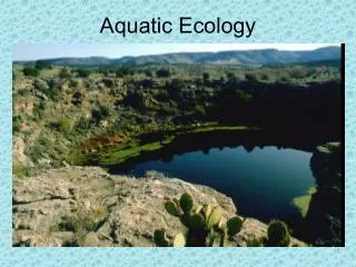
AQUATIC ECOLOGY CHAPTER 7b. FRESHWATER ENVIRONMENTS. I. FRESHWATER:. -Water with dissolved salt concentrations less than 1% by volume. Classified as… A) STANDING (Lentic) B) FLOWING (Lotic). A. Standing Water (Lakes and ponds). Large bodies of water that are created by… a. Glaciation-

E N D
AQUATIC ECOLOGY CHAPTER 7b FRESHWATER ENVIRONMENTS
I. FRESHWATER: -Water with dissolved salt concentrations less than 1% by volume. Classified as… A) STANDING (Lentic) B) FLOWING (Lotic)
A. Standing Water (Lakes and ponds) • Large bodies of water that are created by… a. Glaciation- form KETTLE LAKES b. Crustal Displacement due to earthquakes c. Volcanic Activities
Kettle Lakes • http://www.guardian.co.uk/environment/video/2011/oct/11/lake-imja-climate-change
1. Zones within a Lake • LITTORAL ZONE- Shallow sunlit waters near the shore. • LIMNETIC ZONE- Open, sunlit waters. From surface to depth of last sunlight. • PROFUNDAL ZONE- Deep open water, below level of sunlight D. BENTHIC ZONE- Bottom, low oxygen level
Sunlight Painted turtle Green frog Blue-winged teal Muskrat Pond snail Littoral zone Limnetic zone Diving beetle Plankton Profundal zone Benthic zone Bloodworms Northern pike Yellow perch
2. Classification of Lakes - Classification of lakes is according to nutrient content and primary productivity. -Lakes are classified into three main types…
a. OLIGOTROPHIC: • Deep, clear water • Few minerals • Steep sides • Low Primary Productivity • Low, large fish populations
Sunlight Narrow littoral zone Little shore vegetation Low concentration of nutrition and plankton Limnetic zone Profundal zone Steeply sloping shorelines Sparce fish population Sand, gravel, rock bottom Oligotrophic Lake
Shallow, murky water • High Primary Productivity • Large Fish Populations b. EUTROPHIC:
Sunlight Much shore vegetation Much shore vegetation Wide littoral zone High concentration of nutrition and plankton Limnetic zone Dense fish population Gently sloping shorelines Salt, sand, clay bottom Eutrophic Lake
c. MESOTROPHIC: -Somewhere in-between the two extremes -Category under which most lakes fall
Oligotrophic Eutrophic Secchi Disk Comparison
3. Seasonal changes within lakes -Water is most dense as a liquid & least dense as ice (why ice floats on water) a. Properties of water cause THERMAL STRATIFICATION in deep lakes in temperate areas. In the SUMMER lakes form three distinct layers: 1. EPILIMNION- upper layer of warm water 2. THERMOCLINE- temp changes as go down 3. HYPOLINMION- lower layer of colder, denser water
Summer 22˚ Epilimnion 20˚ 8˚ 6˚ Hypolimnion 5˚ Thermocline 4˚C
b. FALL: 1. Surface waters cools and sinks, the Thermocline disappears. 2. Nutrients from the bottom, come up and oxygen from the top goes down. 3. Process is called… FALL OVERTURN -Stratification disappears and all water is about the same temperature.
Fall Overturn 4˚ 4˚ 4˚ 4˚ 4˚C
c. Winter: 1. Cold Temperatures again cause the water to split into different layers. 0˚ 2˚ 4˚C 4˚C 4˚C 4˚C
d. SPRING: 1. Strong vertical currents mix surface and deep waters 2. Temperature and oxygen levels about the same 3. Process called… SPRING OVERTURN
Spring Overturn 4˚ 4˚ 4˚ 4˚ 4˚C
Pa facts -In PA all IMPOUNDMENTS (lakes and ponds) fall under the jurisdiction of the Pennsylvania Fish and Boat Commission (PFBC) -Reservoirs are defined as having surface areas greater than 500 acres. (31 in state managed by PFBC) (Pymatuning and Kinzua) -Lakes are defined as bodies of water with greater than 50 acres of surface area and range in depth from 15-5000 feet. (124+ in state managed by PFBC) (Conneaut Lake) -Ponds are less than 50 acres of surface area and run an average of 12-15 feet. (250 in state managed by PFBC)
How did the Great Salt Lake get so salty? • Great Salt Lake is the remnant of Lake Bonneville; a great ice age lake that rose dramatically from a small saline lake 30,000 years ago. • Streams leading to it deposited salt picked up from the land. • The Lake has no outlet besides evaporation.
B. Flowing Water (Rivers, Streams, Wetlands) - Created by surface water runoff - Runoff for a particular area is called WATERSHED or DRAINAGE AREA. (6 major watersheds are found in PA) - Most streams/rivers start in mountains or hilly areas.
SUSQUEHANNA: Largest in state Covers 46 percent of the state *Ultimately dumps into the Chesapeake Bay OHIO: Second largest in state Covers nearly 16,000 miles of the state Most waterways empty into the Ohio River Ultimately dump into the Mississippi DELAWARE: Third largest in state Covers nearly 6,500 miles of the state Most waterways empty into Hudson Bay GENESEE: Small part of Great Lakes Basin Drains into lake Ontario POTOMAC: About 1500 square miles Drains to the Potomac River even though it is not in the state. ERIE: Small part of Great Lakes Basin Drains into lake Erie
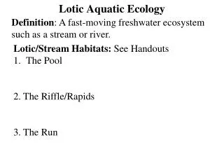
Streams/River Characteristics a. Source Zone (HEADWATERS) - Cold, Clear -Many large rocks as base material, waterfalls - High amounts of dissolved oxygen - Algae and Moss are predominant and adapted to attach to rocks - Fish ,especially Trout, and organisms that require higher D.O. levels.
b. Transitional Zone (middle): - Headwaters converge - Stream bed of rock, pebbles, some silt - Water slows - Water Warms - Various fish with different oxygen requirements
c. Floodplain Zone (bottom) - Streams join into wider and deeper rivers that meander across broad flat valleys. -Stream bed silty, few rocks - Low oxygen levels - Higher water temps. - Murky water
Rain and snow Lake Glacier Rapids Waterfall Tributary Flood plain Oxbow lake Salt marsh Ocean Delta Deposited sediment Source Zone Transition Zone Water Flood-Plain Zone Sediment
2. Stream Order -A measure of the relative size of streams • First-Third Order: Headwaters b. Fourth-Sixth Order: Medium Streams c. Seventh Order -Larger: River
PENNSYLVANIA FACTS -Runoff from PA is delivered to other states through three main rivers. -PA has 11 main rivers that run through three drainage basins (Ohio, Susquehanna, Delaware) -Rivers stretch over 1,200 miles and cover 145,000 acres. -Historical threats to rivers: AMD, coal mining, logging, Siltation, Sewage, agriculture.
3. COLDWATER STREAMS -Water temp. rarely over 68 degrees ”typically the maximum temp.” -High amounts of oxygen -Classified as LIMESTONE and FREESTONE -Usually considered to be headwaters or first-order streams. • Cooler temperatures in headwater stream are due to the higher altitude, narrower channel, and higher water velocity. -Stonefly, Caddisfly,Craneflies (larvae) -Top consumer is Trout. (Brook, Brown, Rainbow)
3. WARMWATER STREAMS -Water temp. over 68 degrees -Lower amounts of oxygen -Usually considered to be first-order or second –order streams. -Diving beetles, Dragonflies, caddisflies, whirligigs, damselfly… -Forage fish like shiners, fallfish, minnows -Top consumer vary – bass, sunfish, pike, walleye, muskie, eels, carp, catfish, pickerel, gar
C. Wetlands • Defined as lands covered with fresh water all or part of the time. • Include… • Marshes • Swamps • Bogs • tundra
1. Roles of Wetlands • Provide food and habitat • Improve water quality • Reduce flooding and erosion • Keep down levels of carbon dioxide • Provide recreation
2. Human Impact on Wetlands • Estimated that 150 square miles of wetlands are lost each year in the U.S. • Lost to development, agriculture, mining, forestry, oil/gas extraction, and highways.