Download
1 / 20
200 likes | 376 Views
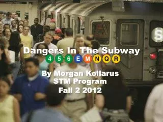
TTC Subway Map With Bus Routes in Android. By Md Shahinur Rahman 500540204 mdshahinur.rahman@ryerson.ca December 09, 2013. Agenda . Introduction Requirements Challenges Project Description Conclusion References . Introduction. Visualization of TTC subway map on Google map

E N D
TTC Subway Map With Bus Routes in Android By MdShahinurRahman 500540204 mdshahinur.rahman@ryerson.ca December 09, 2013
Agenda • Introduction • Requirements • Challenges • Project Description • Conclusion • References
Introduction • Visualization of TTC subway map on Google map • Populating android spinner dynamically • Drawing TTC bus routes
Requirements • Android SDK bundle can be downloaded from http://developer.android.com/sdk/index.html • It includes library files, Google play services, IDE editor and emulator • Physical device is used because emulator does not support Google map • Android OS device like Google nexus 4. • Google API key To generate API key, search “Google API console”, login using Google account and generate the API key. The generated API key is used to communicate your apps to Google server
Challenges • Starting of the project as it is my first project in android • Generation of API key • Difficult to figure out the error as a starter • I tried to display Google map using emulator but after couple of days I figured out it is not supported • Buy new physical device for the project. • I faced problem to handle marker click events • I also faced challenges to load data into the spinner after clicking on a marker • I spent lot of time to connect my physical device to my development workstation
Project Description Step By Step Application is installed in my physical device Figure 1: Installed Application
Project Description Step By Step This is the first screen of the application Click here to enter inside of the application Figure 2: First Screen of the Application
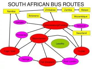
Project Description Step By Step This is the Main screen of the application Subway stations where washroom is available Subway stations where Escalator is available Subway stations where elevator is available Subway stations where parking is available Main Map Spinner where connecting buses will be loaded Colors for Bloor-Danforth Subway Colors for Spadina-University Subway Colors for Sheppard-Yonge Subway Colors for RT Subway Figure 3: Main Screen of the Application
Project Description Step By Step-Washroom Figure 4: TTC Map Where Washroom is available
Project Description Step By Step-Escalator Figure 5: TTC Map Where Escalator is available
Project Description Step By Step-Elevator Figure 6: TTC Map Where Elevator is available
Project Description Step By Step-Parking Figure 7: TTC Map Where Parking facility is available
Project Description Step By Step-Main Map Subway Station Subway Interchange Washroom Elevator Elevator Figure 8: TTC Main Map with all facilities
Project Description Step By Step-Marking Operation: Pape Station Figure 9: Marking Operation to draw bus routes Output next page
Project Description Step By Step-Marking Operation: Pape Station Bus Stop Figure 10: TTC Bus Route- Bus no.25 Don Mills
Project Description Step By Step-Marking Operation: Yorkmills Station Figure 11: Marking Operation to draw bus routes Output next page
Project Description Step By Step-Marking Operation: Yorkmills Station Bus Stop Figure 12: TTC Bus Route- Bus no.95 Yorkmills
Conclusion • Usage of Google API • Learn a lot of things for doing this project • Also learn how to use SQLite Database • Learn how to connect physical device to the development workspace • Learn how to retrieve latitude and longitude from input address • Learn how to use emulator (virtual device) • Thankful to everyone who helped to do the project
References • [1] http://developer.android.com/sdk/index.html. • [2] http://www.mkyong.com/tutorials/android-tutorial/ • [3] http://www.vogella.com/android.html