Download
1 / 91
910 likes | 1.03k Views
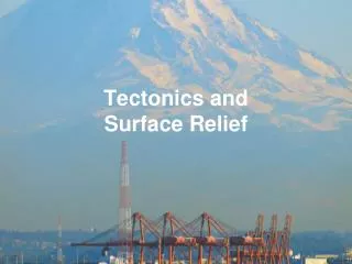
CREATING HIGH RESOLUTION SHADED SURFACE RELIEF MAPS USING ARCVIEW. DEM Mapping. Acquiring DEM data. Directory Structure. Before downloading SDTS DEMs into ArcView, a good thing to do is first build a directory structure. A good format might be 75_minute_demMichigan (State_name)

E N D
CREATING HIGH RESOLUTION SHADED SURFACE RELIEF MAPS USING ARCVIEW
DEM Mapping Acquiring DEM data
Directory Structure • Before downloading SDTS DEMs into ArcView, a good thing to do is first build a directory structure. • A good format might be \75_minute_dem\Michigan (State_name) • Subdirectories will be created beneath state_name \75_minute_dem\Michigan\evans_creek
On the Internet • Log into the USGS EROS DATA CENTER site at http://edcwww.cr.usgs.gov/doc/edchome/ndcdb/ndcdb.html • This is the place to start acquiring high resolution DEM data for mapping applications
7.5’ minute USGS quadrangles appear, select quadrangle of interest
Select directory in which to download file and change this filename to the example on next slide
Downloading files • When down loading a file it is best to rename it before actually downloading. The example file from the previous slide is 30.1.1.1231106.tar.gz • We can actually rename this file evans_creek_MI.tar.gz • When you rename it be sure it has the .tar.gz extension on the end
NOTE: new name still has .tar.gz extension, but is more comprehensive than the original name
Tarred & Zipped • The downloaded files are tarred and zipped • Tar puts all the files together into one file • Zip compresses the tarred file • On the PC use a utility such as Winzip. Winzip will unzipp and untar at the same time.
ArcView • Once you have the files you want you can begin importing them into ArcView. • One thing to be aware of is that the DEM files can be in meters or feet and they can be in 30x30 (most common) meter grids or 10x10 meter grids. • Differences in vertical units will cause some extra processing steps
Add grid directory to directory structure Using Windows explorer add a directory to put your ArcView grid files in. I usually just call mine grid. \75_minute_dem\Michigan\grid
USGS DEMs in ArcView • Importing DEMs into Arcview. • Combining multiple DEMs in ArcView (mosaic). • Generating shaded relief maps in Arcview. • Overlaying cultural data.
Click on down arrow then select USGS SDTS DEM
Select directory to store ArcView grid theme and name ArcView grid then click OK
To display the DEM data you must click on the box beside the theme name as shown in the next slide
Adding adjacent quadrangles • We have downloaded 4 adjacent quadrangles in the same fashion as the first • The next slide shows the 4 quadrangles displayed on the screen separately • We will eventually mosaic these tiles together to form one quadrangle map • Note on the following slide differences in the scale of the vertical units (meters & feet)
FEET Note differences in vertical scales METERS
Converting meters to feet • First we combine the quadrangles with meter units • We perform a calculator function to convert the grid data from meters to feet • Finally we combine all the grids with vertical units in feet
New theme appears. Remember we have to check the box to the left of the name to get it to appear
Notice now that the bottom panel covers the previous two
Map Calculator • Now that we have the meter quadrangles spliced together we can perform a mathematical operation to convert from meters to feet
Click on Map Calculator
Click on evaluate, then x in the upper right corner to get rid of Map Calculator box
Deleting unnecessary themes • Once we’ve checked to make sure our new theme is correct by adding it to the view, we can eliminate the precursory themes. • We do this by highlighting the themes we want to delete. • To highlight one theme, click on it. To highlight multiple themes shift-click on them
Once we know our mosaic was successful we can now delete the precursory files by highlighting them and clicking Delete Temes in the Edit menu
Combining the entire region • Now we have the entire region we started with in the same vertical units • We can now mosaic the files in feet together to get one continuous map. • This process is the same that we used before. • Transformation:Mosaic and then select the relevant files
NOTE: Here we have two other themes selected
Again, for the new combined theme to show up we must click the box left of its name