Download
1 / 32
320 likes | 497 Views
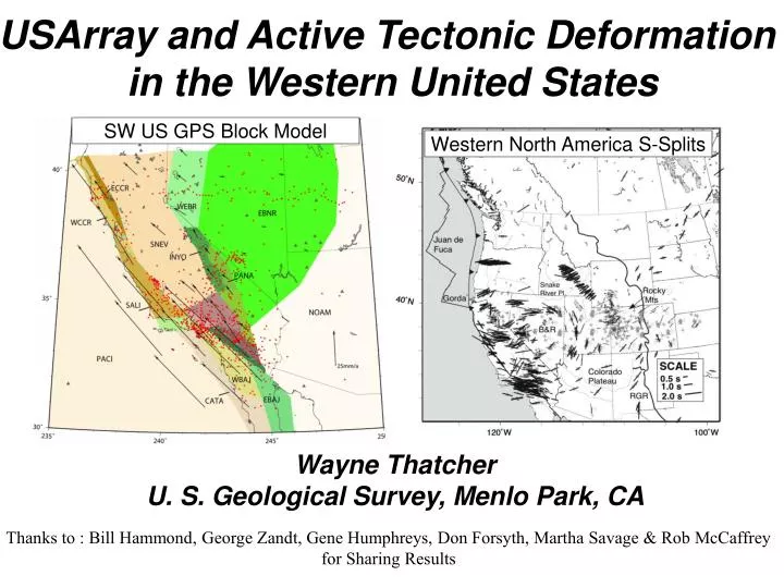
USArray and Active Tectonic Deformation in the Western United States. SW US GPS Block Model. Western North America S-Splits. Wayne Thatcher U. S. Geological Survey, Menlo Park, CA.

E N D
USArray and Active Tectonic Deformation in the Western United States SW US GPS Block Model Western North America S-Splits Wayne Thatcher U. S. Geological Survey, Menlo Park, CA Thanks to : Bill Hammond, George Zandt, Gene Humphreys, Don Forsyth, Martha Savage & Rob McCaffrey for Sharing Results
Applied Forces & Rheology Determine Continental Deformation Forces + Rheology = Deformation . (F) () eij(x, y) • plate flexure • post-glacial rebound • post-seismic deformation • GPS & InSAR • tectonic geology • seismic anisotropy (z) • seismic constraints • dynamic modeling
Model Grid & Applied Forces Humphreys & Coblenz [2006]
Model Constraints from Focal Mechanisms Humphreys & Coblenz [2006]
Modeled Stress Field in Western US Humphreys & Coblenz [2006]
Forces + Rheology = Deformation . (F) () eij(x, y) • (x, y) ~ easy (GPS) • (z) difficult (S-splits) The hardest part!
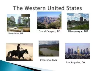
Western US Topography, Holocene Faults & Plate Tectonic Setting Sierra Nevada Colorado Plateau GPS Transect Faults from M. Machette & R. Dart, USGS
GPS Velocities Across Western US Basin & Range Province Sierra Nevada Colorado Plateau WEST EAST Hammond & Thatcher (2004)
Geodetically Even Topographically Impressive Toiyabe Range is Unimportant
Southwest U. S. Block Model & GPS Sites McCaffrey [2005 JGR]
GPS maps surface deformation but provides no strong constraints on depth extent of blocks How can we learn more about this?
Western North America S-Splits ABSOLUTE PLATE MOTION M. Savage (2003)
California & Nevada S-Split Orientations (Polet & Kanamori 2002 GJI)
Southwest U. S. Block Model McCaffrey [2005 JGR]
Observed Mantle Deformation Fabric Orientation& Modeled Absolute Velocity of Surface Blocks Observed S-Split Orientations (Polet & Kanamori 2002 GJI)) Modeled Absolute Surface Velocity (Hot-Spot Reference Frame) Acceptable Agreement in Central & Northern California (Motion of Lithosphere Blocks Causing Ductile Flow of Asthenosphere?) Notable Disagreement in Southern California (Local Perturbation by Transverse Ranges Tectonics?)
Southern California Surface Wave Tomography Yin & Forsyth [2006]
Surface Wave Tomography Shows High Seismic Velocity Blobs under Transverse Ranges Possibly Related to Anomalous S-Split Orientations? EAST WEST Yin & Forsyth [2006]
Sierra Nevada Earthscope Project (SNEP) • Lithospheric X-section Images: • Based on CCP stacking Of ~1300 RFs from 66 FA/PASSCAL &19 TA stations • Results relevant to active deformation processes: • Basin & Range crustal character extends far into the Sierran Range • Disappearance of Moho beneath western foothills may be related to Lithospheric “Drip Tectonics” • High levels of crustal seismicity and young volcanism in eastern Sierra may be linked to delamination processes Zandt, Gilbert, Owens, Jones, & SNEP Field Team, [2005 IRIS mtg.]
Alternative Kinematic Descriptions of Continental Deformation • Each argued, to exclusion of the other, since early days of plate tectonics • Based on seismicity, active faulting, eq focal mechanisms… • Elements of each have observational support Plate-Like Continuum Sea • Space geodesy (GPS, InSAR) can quantify and distinguish between extreme end-member models
GPS Data, Blocks, Rotation Axes & Small Circles Thatcher (2006)
Aegean GPS-Based Block Model Nyst & Thatcher (2004 JGR)
ENGLAND, MOLNAR HOLT, HAINES, SILVER… EQUIPE TAPPONNIER
Take Home Points • GPS uniquely quantifies present-day Tibetan deformation • Deformation simply&usefully described by relative block motions (i.e microplates follow rules of plate tectonics) • Internal deformation of microplates small but measurable • GPS slip rates on major Tibet strike-slip faults low, 5-12 mm/yr • GPS slip rates << geologic estimates of ~12-30 mm/yr Cause of discrepancy is unknown •S-Splits suggest microplate drag of lithospheric mantle
Some Unanswered Questions • Are larger microplates fragmented into smaller blocks? • Are ‘GPS microplates’ geologically long-lived or transitory? • To what depth in lithosphere do block structures extend? • Why do GPS and geologic slip rates disagree in Tibet?
Comparison of Zhang et al (2004) GPS Data (blue) and Data Used in this Study (red)