Download
1 / 82
820 likes | 961 Views
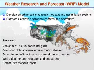
Performance of CWB WRF in 2008 Typhoon track forecast and relocation Test of WRF V3.0 and next generation of CWB WRF. Outline. Evolution of operational CWB WRF in 2008 Verification Jan to Aug (cold start cycling) May to Aug (cycling) Typhoon track forecast Problems in CWB WRF

E N D
Performance of CWB WRF in 2008 • Typhoon track forecast and relocation • Test of WRF V3.0 and next generation of CWB WRF
Outline • Evolution of operational CWB WRF in 2008 • Verification • Jan to Aug (cold start cycling) • May to Aug (cycling) • Typhoon track forecast • Problems in CWB WRF • Preliminary results of DFI
Operational change of CWB WRF • 2007.05.09 • Parallel run in WRFVAR V2.1+ WRF V2.2, cold start • 2007-11-12 • Operation of WRFVAR V2.1+WRF V2.2, cold start2008.02.22 • 2008.02.22 • WRFVAR SATEM code bug fix(DA_Read_Obs.inc, DA_get_innov_vector_satem.inc) • 2008-03-12 • Modify the ingest fields of the CWBGFS (B00100B02100, B00200B10200, B00210B10210, B00510B10510) • 2008.04.09 • Update WRFVAR • Additional output forqcobs, filterobs, thickerr, pseudo. • Modify the namelist.3dvar as analysis_type = 'QC-OBS' sfc_assi_options = 2, cv_options_hum = 1, Interpolate_Stats = .FALSE. • 2008-05-12 • Operation of update cycle in WRF V2.2.1 update cycle 版本上線。 • MP, WSM5Goddard microphysics, LSM, thermal diffusion NOAH, num_soil_layers 45)
Operational change of CWB WRF • 2008-05-14 • Operation for member run: WRF V2.2.1, cold start, first guess from NCEP GFS • 2008-05-23 • Bug found as RAINC=0 (thanks Jim’s help) CUP chanf from old kf to grell temporally. • 2008-05-30 • Bug fix of the RAINC=0, compile option in WRF changes from O3 –qhot to O2. (thanks Jim again) • Compile option in WRF VAR changes from O3 to O2. • Modify registry.EM to remove out the unnecessary radiation output. (thanks Jim double again) • modify OBS_FGGE_PROC, to withdraw the sounding at DonSa island (46810) • 2008-07-22 • Bug fix in Goddard MPS (error in a real variable declaration (cloud ice), fixed code reduced the could ice slightly)
Description of the assimilation system • Model version • WRF WPS V2.1 • WRF 3D-VAR V2.1 • WRF V2.2.1 • 4 times per day, 84-hr forecast with 1-hr output frequency • IC: WRF 3D-VAR analysis over 3-nested domain • Cycling, firstguess from 6-hr fcst of the previous WRF run • assimilation windows: -3h~+3h • BC: CWB GFS • 16 pressure levels
Domains D1: 45-km resolution 222X128 dt=180 s D2: 15-km resolution 184X196 dt=90 s D3: 5-km resolution 151X181 dt=30 s
Physical process *Initialized by the 2-layer LSM (OSU) of CWB GFS
Cycling run Most of the worse AC occurred at 500 hPa were related to the typhoon activities.
Bug fix for old KF Has a trend to reduce the ME of T at 850 hPa in op WRF Large ME at 300 hPa for NCEP cold start run
No significant change on RMSE in the update of old KF In 72-hr fcst, the RMSE of the cycling run was reduced a lot.
Systematic characteristics are not only model dependent (NFS vs WRF), but also initial condition dependent (WRF-OP v.s. WRF-AVN)
The worst RMS of 500-hPa H in op WRF is very critical in the application of the NWP products to the forecaster.
24-hr 24-hr 72-hr 72-hr 5-8 1-8 • Systematic characteristics are not only model dependent (NFS vs WRF), but also initial condition dependent (WRF-OP v.s. WRF-AVN) • Cold start and cycling run in WRF-OP is very similar, it looks that the difference between WRF-OP and WRF-AVN is a BC issue. • How to spread the ensemble run as possible?
The characteristics of the verification results in D2 is similar to D1
Summary • The bug fix of old KF results in abrupt change of ME, however, has no evident change in RMSE • The 850-hPa T fcst has a trend to reduce the ME and RMSE. • The bad AC at 500 hPa is mostly related to the typhoon activities. • In RMSE, the cold start from WRF-NCEP has the best performance. • The worst RMS of 500-hPa H in op WRF is critical. • In ME, the three models have their own characteristics. In overall, the WRF-OP has smaller ME through the whole atmosphere. • All the verification is based on their own analysis fields. What is the difference among the analysis?
Tau = 00 forecast SH in WRF-OP is stronger than WRF-NCEP
012 WRFOPS 012 WRFAVN Obs rainfall
24 hrs forecast Too stronge
024 WRFOPS 024 WRFAVN Obs rainfall
Tau = 36 forecast Both WRF are comparable for SH fcst
036 WRFOPS 036 WRFAVN Obs rainfall
48 hrs forecast Underfcst for SH
048 WRFOPS 048 WRFAVN
Tau = 0 forecast Mean : 500 hpa Height SLP 08060300-08063012
Tau = 12 forecast Mean : 500 hpa Height SLP 08060300-08063012
Tau = 24 forecast Mean : 500 hpa Height SLP 08060300-08063012
Tau = 36 forecast Mean : 500 hpa Height SLP 08060300-08063012
Tau = 48 forecast Mean : 500 hpa Height SLP 08060300-08063012
012 WRFOPS 012 WRFAVN
024 WRFOPS 024 WRFAVN
036 WRFOPS 036 WRFAVN
08060300 – 08063012 Tau = 36 forecast 10 m –Wind Bias