Download
1 / 41
410 likes | 626 Views
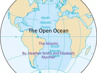
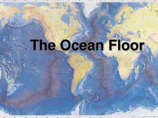
The Ocean. EARTH: The only planet w/ Oceans (or liquid water) Covers 71% of earth’s surface “Divided” into 4 large basins Pacific (largest, deepest) Atlantic Indian Arctic (smallest, shallowest) A fifth? The Antarctic…. Ocean basins. South pole view. Ocean Basin Depths.

E N D
The Ocean • EARTH: The only planet w/ Oceans (or liquid water) • Covers 71% of earth’s surface • “Divided” into 4 large basins • Pacific (largest, deepest) • Atlantic • Indian • Arctic (smallest, shallowest) • A fifth? The Antarctic…
Ocean basins South pole view
The Difference Between an Ocean and a Continent…ROCKS! • Continent: very thick, very old, less dense and made up of Granite • Ocean (floor): younger, more dense, not as thick and made up of Basalt • Thus, the “Ocean Floor” “sinks” below the continent(s) and provides the habitats of marine organisms
Continental Drift • If we know the Continental Crust and Oceanic Crust have different densities…how did they “separate” to become 7 continents and 4 oceans? • We start (Pangea) 210 mya!
PANGEA (the super continent) • 180 million yrs. ago – all continents were attached together and have slowly moved apart over time • Discovered (S. F. Bacon, 1600’s) “Coasts of continents fit together like a puzzle.” • Lead to theory of continental drift and plate techtonics.
PLATE TECTONICS • Continental drift leads to the theory of Plate tectonics • Although Bacon discussed it in the 1600’s, it was not understood until the 1960’s.
The Ocean Floor (P. Tectonics) • Mid-Ocean Ridges • Underwater mountain ranges • Fault: Crack in earths crust • Rift: Ocean crust separates & creates “cracks” • Earthquakes are common • Trenches • Deep depressions in the seafloor • Mostly in Pacific, Volcanoes common
CO 2 Mid-Atlantic Ridge (above sea surface in Iceland)
Sea-Floor Spreading (plate tectonics) • New sea-floor forms at mid-ocean ridges (where the edge of these “plates” meet) • Continental Drift: If the plate (as it spreads away from the ridge) contains continental crust (on top) the continents “drift” (move) apart.
Figure 2.08 Sea Floor Spreading: X-section of sea floor @ Mid ocean ridge
Figure 2.07 Paleomagnetism: Normal magnetism @ ridge crests (but Reversed in other locations)
We get: • Plate boundaries • With geologic activity, such as earthquakes, that (may) correspond w/ these plate boundaries
How does everything move? Plate Tectonics! • The earth’s upper layer, the lithosphere, is divided into plates • Plates may contain sea-floor, continents, or both • Plates are moving (few cm per year), floating on top of the earth’s molten mantle
Subduction (plate techtonics) • sea-floor is destroyed by plunging back into the earth’s interior at trenches • When 2 plates collide, 1 dips below the other (in to the mantle) and 1 is destroyed (causing, sometimes, earthquakes) • Ocean vs. Cont. plate: ocean plate destroyed, can get coastal mountain ranges • Ocean vs. Ocean plate: 1 dips = volcano or earthquake • Cont. vs. cont: none destroyed, mnt. Ranges fold • 2 plates, no collision, lock/shear/earthquake (S. Andreas F)
Figure 2.10 Continental + Oceanic plate collision = trench, earthquake
Figure 2.11 2 oceanic plates collide = trench/earthquake
San Andreas Fault (CA) Figure 2.13
Sea Floor Regions • All of this “plate” movement and geologic activity that occurs under the water yields different sea floor regions • Each dependent upon depth, width, slope etc.
Regions of the sea-floor • Continental Margins contain continental shelf, slope and rise • Cont. shelf = shallow, most “rich” (diverse) • Deep Ocean Floor, “Abyssal Plain” • The Ocean “floor” (on average) is 2-3.5 miles BELOW the oceans (water) surface!
Figure 2.17 Continental margin
Active vs. Passive Margins An active margin is a geologically very “active” area; whereas a Passive margin is a geologically in-active area.
(Passive Margin) Continental Shelf (19 mi. off of Atlantic City, NJ) Figure 2.18 Tom’s Canyon Shelf break
The California Coast Monterey Canyon
Margins • We know what it looks like at the top of the (Continental) margin but what does it look like AT the margin (at the ridge line, deep under the oceans surface)?
“Black Smoker” Hydro- thermal Vent (at a Mid Ocean Ridge) Figure 2.24
Who are we? • Iceland, Azores = fault (mountain) • Andes (mts.) = subduction trench (o-c) • Aleutian/Mariana (Is.) = sub. trench (o-o) • Himalayas (mts.) = sub. Trench (c-c) • Hydrothermal vents: Deep Ocean • See Fig. 2.5 for locations and other “interesting” places to visit.