Download
1 / 36
360 likes | 533 Views
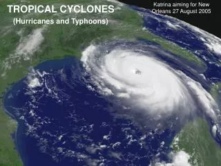
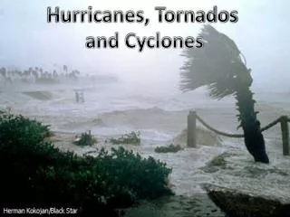
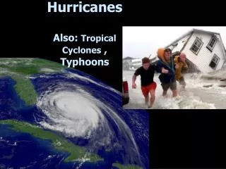
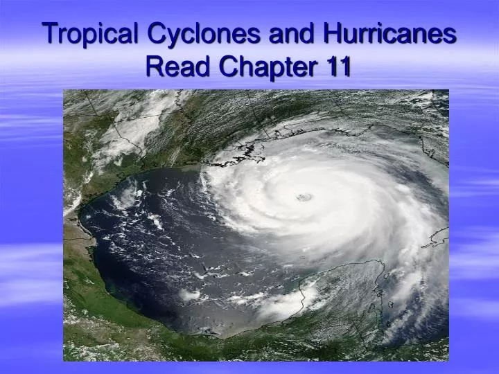
Tropical Cyclones and Hurricanes Read Chapter 11. Charley. Ivan. Katrina's landfall. The Hurricane. A low pressure system of tropical origin that produces sustained surface winds >=74mph Organized convection around center

E N D
Charley Ivan Katrina's landfall
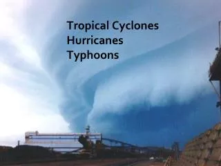
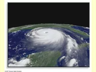
The Hurricane • A low pressure system of tropical origin that produces sustained surface winds >=74mph • Organized convection around center • Tropical cyclone is generic name given low-pressure systems forming over warm, tropical seas (typhoon in western pacific, super typhoon if winds >150 mph)
The Hurricane: Birth Regions • Not over land • Not high latitudes, but not at the equator either (Graphic by Robert Simmon, NASA GSFC)
Active Season last year, Inactive this year 2006 8 5 2
A Recipe for Hurricane Formation • 1) Sea surface temperature (SST) >80°F (26.5°C) & deep layer of warm water • 2) Conditional/absolute instability through a deep layer of troposphere- Important for thunderstorms! • 3) Moist air in mid-troposphere • 4) Weak vertical wind shear • 5) Genesis region at least 5° away from equator • 6) Source of low-level cyclonic spin
Ingredient #1: Warm water • Warm water ensures high evaporation rates, thus high low level dew points…promotes instability & convection! • Tropical cyclones can rapidly strengthen if they move over patch of warm water
Atlantic Hurricane Season Peaks ~ Sept.10 – around when ocean is warmest
Why is a relatively deep layer of warm water needed? • Strong hurricane wind can lead to upwelling of colder water from below as high winds at surface mix the ocean water • Cooler surface waters lead to less evaporation, more stabilized atmosphere
Ingredient # 2: Conditional Instability- How convection leads to pressure falls Animation on CD – let’s take a look
Ingredient #3: Mid-Tropospheric Moisture • Dry mid-level air promotes hurricane decay by leading to precipitation evaporating => downdrafts => cooler, more stable air near ground => less convection
#4) Vertical wind shear separates low level circulation from tall thunderstorms Less wind shear => better environment for hurricane formation
Ingredient #5: Cyclonic vorticity (spin) • Earth vorticity is increased as one head toward poles, it’s zero at equator (related to Coriolis force) • Earth vorticity needed for cluster of t-storms to obtain cyclonic spin • Tropical cyclone formation at least 5° from equator
Ingredient #6: Tropical Waves • Emerge every 3-4 days off coast of Africa from June-October, about 60/year • When waves spawn hurricanes in east-central Atlantic, storm is termed “Cape Verde” storm…Cape Verde season is from August to October
Intertropical Convergence Zone (ITCZ): The source for tropical waves
Stages of Development I • Tropical disturbance: disorganized blob of thunderstorms, often forms within the ITCZ • If atmosphere and ocean conditions favor development, we enter a positive feedback loop • Latent heat release in thunderstorms through condensation • Increased pressure aloft • Upper-level divergence, latent heating & compressional warming lead to lower surface pressure • Increased inflow deflected to right and cyclonic circulation enhanced, more evaporation into air =>more fuel for t-storms… • Animation of this process on CD
…->Tropical Depression • organized thunderstorms, circular wind flow around center, wind speed less than 39 mph • Given number-letter tag (i.e. Tropical Depression 5-A)
Stages of Development II • Tropical Storm: sustained wind speeds from 39-73mph with higher gusts • Storm gets a name • Six-year cycle (http://www.nhc.noaa.gov/aboutnames.shtml) • Names reused or retired if storm is historic • If all names used in a season, storms named with Greek alphabet • If conditions remain favorable, positive feedback loop continues, leading to…
Stages of Development: Hurricane • Wind speed (sustained) at least 74 mph • An eye forms • Spiral bands • Conservation of angular momentum • Strength dictated by SSTs
Strength of tropical cyclone related to number & intensity of thunderstorms around eye
Winds fastest near surrounding calm eye of hurricane…known as eye wall
Relative Velocity Strongest winds in a tropical cyclone are in the right front quadrant
How does the eye form? • As air spirals into center of storm, outward acting centrifugal force increases…eventually, centrifugal force equals PGF and air stops spiraling inward….leads to increased convergence and rising air motion • Diameter ~ 25 mi • Smaller eye-stronger hurricane
Loop of Hurricane Katrina showing cyclonic flow • http://www.atmo.arizona.edu/products/radar/kat_lix_rad.gif
Importance of anticyclonic flow aloft above a hurricane…increased upper-level divergence
Vertical Wind Profile in a Hurricane • Speedy ring of air at surface in eye wall expands outward as it rises due to upper-level divergence • Wind speed decreases with height conserving angular momentum
Hurricane: Saffir-Simpson Scale (in need of revision?) This graphic was created by Lynn A. Dombrowski, Ed. D.
Storm Surge • Water, not wind, is by far the biggest killer (includes both storm surge and fresh water flooding) • Right front quadrant is most dangerous (N.Hemisphere) • Strongest winds (rotation + translation velocities) • Winds blow on-shore which piles up water
Demise • Loss of fuel • Moves into colder water • Moves over land • Wind shear • Tilts the thunderstorms • Lowest pressure not concentrated, pressure gradient relaxes and winds weaken • Increased friction (landfall)
Symbols on Weather Maps • Tropical Storm Symbol • Hurricane Symbol
Hurricane Watches/Warnings • Watch - Issued when there is a possibility that a part of the coastline could experience hurricane conditions within 36 hours • Warning – Issued when hurricane conditions are expected for a part of a coastline within 24 hours
Understanding National Hurricane Center (NHC) Forecasts • http://www.nhc.noaa.gov/archive/2005/KATRINA_graphics.shtml