Download
1 / 17
370 likes | 790 Views
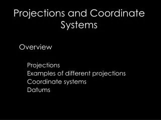
Map Projection & Coordinate Systems. ArcView_module_6 May 13, 1:30 PM. Outline. Map Projection Coordinate Systems Setting a Map Projection in ArcView Manipulating a Map Scale in ArcView. Map Projection. Map Projection. Transforming three-dimensional space onto a two-dimensional map.

E N D
Map Projection & Coordinate Systems ArcView_module_6 May 13, 1:30 PM
Outline • Map Projection • Coordinate Systems • Setting a Map Projection in ArcView • Manipulating a Map Scale in ArcView
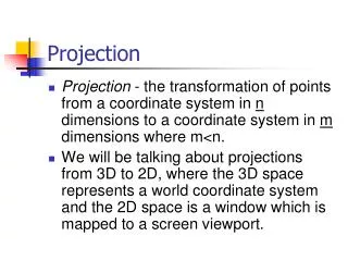
Map Projection Map Projection • Transforming three-dimensional space onto a two-dimensional map Curved Earth surface Flat Map
Map Projection Projection Types • Projections can be conceptually created by projecting from one geometric shape (a sphere) onto another (a cone, cylinder, or plane) • Cylindrical: projects a sphere onto a cylinder • Conic: projects a sphere onto a cone • Planar: projects a sphere onto a plane.
Map Projection Cylindrical Projection Good for displaying the world
Map Projection Conic Projection Good for displaying mid-latitude area such as U.S.
Map Projection Planar Projection Good for displaying hemisphere with one focus
Map Projection Point or Line of Tangency • Point or line of zero distortion • Projection distortion increases with distance from the point of contact • Point for planar projection • Line for conic/cylindrical projection
Map Projection Point or Line of Tangency • Cylindrical/Conic projections have • Standard parallel (line of tangency) • Central meridian • Planar projections have • Reference latitude (point of tangency) • Central meridian
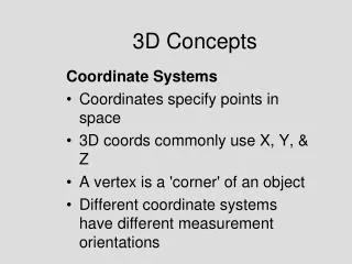
Coordinate Systems Coordinate Systems • Defined based on a variety of geodetic datums, map projections, units, and reference systems
Coordinate Systems Datum • Used as a reference as in surveying or mapping • Based on the Spheroid (earth model) • Usually referred to as a keyword (e.g. NAD83, WGS84)
Coordinate Systems Datum
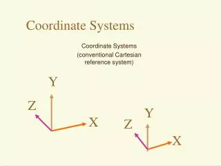
Coordinate Systems Spherical vs Planar Latitude Longitude
Coordinate Systems Global vs Local
Setting a Map Projection in ArcView Choosing a Map Projection depends on • Which region to display (e.g. world, north pole, equator, US) • Resolution of the region • Geometric properties of the region • Purpose of using maps such that the distortion can be minimized
Setting a Map Projection in ArcView View Properties menu • In ArcView. a view's map projection can only be set if the map units of the spatial data it contains are decimal degrees
Manipulating a Map Scale in ArcView Term definition • Map units are the units which the spatial data is stored in • Map scale is the relationship between the dimensions of a map and the dimensions of the Earth • Distance units are the units used by ArcView to report the result of operations (e.g. measurement (measure tool), dimension of shape (draw tool), dimension of selection box (select feature tool))