Download
1 / 29
290 likes | 423 Views
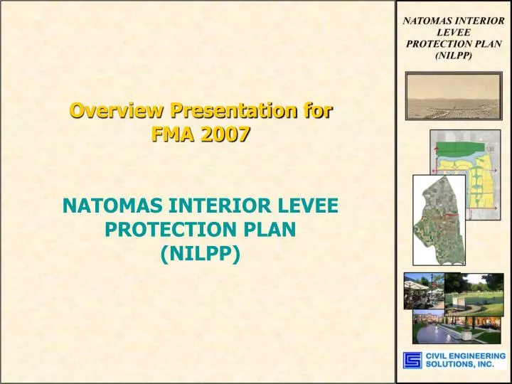
Overview Presentation for FMA 2007 NATOMAS INTERIOR LEVEE PROTECTION PLAN (NILPP). Natomas Interior Levee Protection Plan Interior Compartmentalization Levees + 200-year flood protection system . Additive protection to the Natomas Levee Improvement Program (NLIP-SAFCA)

E N D
Overview Presentation for FMA 2007 NATOMAS INTERIOR LEVEE PROTECTION PLAN (NILPP)
Natomas Interior Levee Protection Plan • Interior Compartmentalization Levees + 200-year flood protection system. • Additiveprotection to the Natomas Levee Improvement Program (NLIP-SAFCA) • Residual Risk Protection: A failure in the regional (SAFCA) levees at one compartment would result in flood damages being isolated within a single compartment. • In-basin protected “safe zone” from which rescue and recovery efforts could be mobilized. The Natomas Joint Vision Planning Area, Metro Airpark, and the Airport would be encircled by interior levees. • Proposed Facilities would be constructed to maintain the function of Existing Basin Infrastructure. For example, the levees would cross the RD-1000 canals at several locations requiring that flood gates be used so that the RD-1000 system can function normally, but the gates could be closed in order to isolate damages to a single compartment in the event of a regional system failure.
Natomas Interior Levee Protection Plan • Defining the Residual Risks (Single Hull System) • Following SAFCA NLIP Improvements, FEMA would characterize the single year probability at 0.5% (200-year). • Changes to Levee Certification Standards: for example Memorandum’s 34 and 43, Corps of Engineers Risk Based analysis, and Incorporation of New Criteria like Seismic Stability, Vegetation Setbacks, Climate Shift, or requirements to achieve a higher design event recurrence interval. • Changes in Laws: for example AB5, “Plans of Flood Protection” • Others risks such as the long term effects of deep seepage and subsidence. • The Unknown? • Decision Making Process.
NATOMAS 101 • (EXTRA CREDIT) • Stats • 16 miles tall • 8 miles wide • 57,000 acres ~ 89 sq miles. • NEARLY completely encircled by Levees • Water on nearly every border, year round • Boundaries: • Sacramento River • American River • Natomas Cross Canal • NEMDC – Steelhead Creek
NATOMAS 101 • (EXTRA CREDIT) • Two Local Agencies Completely Cover the Basin Territory: • SAFCA • RD-1000 • Other Agencies: • Sutter County • Sacramento County • City of Sacramento
NATOMAS 101 • (EXTRA CREDIT) • Key Contents: • Two Interstates, which intersect within the Basin. (I-5, I-80) • Joint State Highway 70/99 • Major Regional International Airport • Tom’s House • Habitat Lands • Agricultural Lands • ~ 28,000 structures • ~ Population in excess of 60,000 to 77,217. • ARCO Arena (for now)
EXISTING DISTRIBUTION OF STRUCTURES BY ELEVATION NATOMAS 101 (EXTRA CREDIT) BASE FLOOD ELEVATION = 33
Natomas Levee Improvement Program (NLIP) Planned Improvements(by SAFCA) “IN SAFCA WE TRUST” SAFCA Assessment increases passed with more than 80% approval
NATOMAS 101 (EXTRA CREDIT) SAFCA DEVELOPMENT FEE Based on Risk of Structural and Content Damage: Replacement Cost of Damages as a percent of Structure Only Value: • Natomas Levee • Improvement • Program (NLIP) • Planned Improvements(by SAFCA) • SAFCA Also Proposes a Development Fee to Fund improvements to mitigate added potential $ risk • POSSIBLE PHASE IN OF FEE • FEE WILL ADJUST EVERY 5-YEARS FEE POSSIBLE JAN. 2008 (AB1600 TYPE) SAFCA stated exemptions would be possible for structures which are raised out of the floodplain, and/or protected by compartmentalization
Natomas Basin Interior Floodplain Post ’90’s Levee Improvements, and Pre-RD-1000 System Upgrades
Natomas Basin EXISTING: Airport Panhandle Existing Dev.
Eastern Quadrant of Natomas Joint Vision Planning Area Shows plan for mitigating Internal Flood Plain Impacts and Development Flows (200-year)
NILPP 200-Year Flood Protection Plan NORTHERN SUPER LEVEE LAKE SECTION
Natomas Basin Development Projects (NILPP Overlay) East Quadrant (NNJVA) Central Quadrant (NNJVA) Metro Airpark County Separator – Open Space Measure M Airport Panhandle Existing Dev.
Natomas Basin Potential Future Elevation Distribution of Structures. BASE FLOOD ELEVATION = 33
Natomas Basin Development Projects: Flood Risk Factors of Added Development: * Depends on Final Level of Improvements Implemented by SAFCA NLIP (between 100-year and 200-year assumed). Does not include Dev. Fee SAFCA Improvements. Est. database.
Reduces Residual Risk by: • Reduces Flood Risk to all people, structures, and infrastructure within the Natomas Basin. At buildout could include as many as 107,000 structures, a population of 250,000 and the supporting infrastructure. • Protects the Natomas Joint Vision Area and Airport from an Exterior Levee Breach + Adds protection for the existing development areas and highways. • The plan could be expanded to protect the proposed Sutter County development • Plan Levees can Maintain Certification: Interior levees are less susceptible to damage from erosion and seepage • In the event of a Breach, flood damages are isolated to a single compartment, and infrastructure would remain operational in the protected areas.
NILPP IMPACTS - Natomas Evacuation Plan and Hypothetical Flood Depths PRE-PROJECT (BEFORE)
NILPP SINGLE EVENT IMPACTS BREACH 3 LOCATION- “TIME TO FILL”
LEGEND RD-1000 PROTECTED RD-1000 PROTECTED PROTECTED FLOODED 1-3’ FLOOD>3 FEET FLOOD>1 FEET AREA FLOODED (Ultimate Buildout Conditions Represented) PRE-NILPP 0 Mi of CANAL 0 PUMP STATIONS 624 STRUCTURES 964 STRUCTURES 105,246 STRUCTURES 106,210 PARCELS 56,894 ACRES POST-NILPP 21.5 Mi of CANAL 4 PUMP STATIONS 80,086 STRUCTURES 3,116 STRUCTURES 23,632 STRUCTURES 26,748 PARCELS 21,844 ACRES BREACH 1 - NORTH
LEGEND RD-1000 PROTECTED RD-1000 PROTECTED PROTECTED FLOODED 1-3’ FLOOD>3 FEET FLOOD>1 FEET AREA FLOODED (Ultimate Buildout Conditions Represented) PRE-NILPP 0 Mi of CANAL 0 PUMP STATIONS 1,679 STRUCTURES 1,084 STRUCTURES 104,071 STRUCTURES 105,155 PARCELS 56,626 ACRES POST-NILPP 29 Mi of CANAL 6 PUMP STATIONS 106,524 STRUCTURES 278 STRUCTURES 32 STRUCTURES 310 PARCELS 5,057 ACRES BREACH 2 - WEST
LEGEND RD-1000 PROTECTED RD-1000 PROTECTED PROTECTED FLOODED 1-3’ FLOOD>3 FEET FLOOD>1 FEET AREA FLOODED (Ultimate Buildout Conditions Represented) PRE-NILPP 0 Mi of CANAL 0 PUMP STATIONS 3,070 STRUCTURES 3,221 STRUCTURES 100,543 STRUCTURES 103,764 PARCELS 56,031 ACRES POST-NILPP 16 Mi of CANAL 3 PUMP STATIONS 76,379 STRUCTURES 714 STRUCTURES 29,741 STRUCTURES 30,455 PARCELS 20,815 ACRES BREACH 4 – SOUTH/AMERICAN RIVER
Potential Private Financing of NILPP Improvements • CFD financing study demonstrates that the Natomas Joint Vision Planning area CAN fund: • Full Fair Share Participation in SAFCA Assessment • Possible Participation in SAFCA Development Fee • Funding of Interior Levee Improvements • Funding of Lake and Flood Storage Facilities • Funding of Special Structures such as valves, gate structures, freeway crossings, and additional water storage. • Funding of Additional Maintenance $’s to RD-1000 for severance issues – and possible NILPP Maintenance.
Financing NILPP Improvements • COSTS SUMMARY • East Quadrant Plan A (Brookfield + Others) $ 81,000,000 • North Interceptor Levee Remainder $ 49,000,000 • South and West Interceptor Levees $104,000,000 • TOTAL PROJECT COSTS RANGE: $226 M to $234M • MINIMUM COSTS FOR NORTH INTERCEPTOR: $111M • CFD FUNDING BY NNJVA =~ $5,500 / LOT (Present Val) • (Assumes R/W dedication throughout)
NILPP and • 200-Year Flood Protection Plan • • What’s Needed to Implement the NILPP? • Public & Private Cooperation/Partnership • Streamlined Processing of Private & Public Permits • Community Support • Strong Leadership • Funding by Development • Right of Way – Dedicated by Land Ownership
END OF NILPP PRESENTATION QUESTIONS?