Download
1 / 11
110 likes | 124 Views
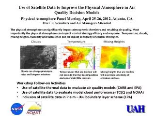
Improve air quality decision support by integrating satellite data with ground-based, modeled, and emissions data for enhanced modeling and analysis. Project goals include routine data capture, advanced analysis tools development, and satellite data visualization. Activities involve project design workshops, scope refinement, and source data acquisition. Future steps include system enhancement, data integration, and beta testing.

E N D
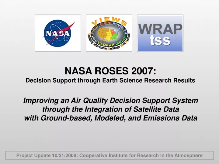
NASA ROSES 2007: Decision Support through Earth Science Research Results Improving an Air Quality Decision Support System through the Integration of Satellite Data with Ground-based, Modeled, and Emissions Data Project Update 10/21/2008: Cooperative Institute for Research in the Atmosphere
Overall Project Goal To enhance and add value to a currently operational air quality decision support system (VIEWS/TSS) by integrating and utilizing satellite data from NASA satellites Aura, Terra, Aqua, and CALIPSO. Specific Project Goals • Develop routine capture, analysis, and processing algorithms with high temporal and spatial resolution to provide land use/land cover data as inputs to emissions and air quality modeling • Achieve more complete temporal and spatial resolution of activity data and emission rates from natural and anthropogenic emission sources in remote areas and from individual sources and source clusters • Obtain multiple-dimensional vertical profiles and column measurements of pollutants to improve model inputs and provide evaluation data for gridded chemistry-transport models such as CMAQ • Develop advanced analysis tools to better understand the relevant atmospheric processes and their representation in the CTMs • Visualize and analyze satellite data in combination with existing monitoring, emissions, and modeling data within a unified decision support platform
Activities So Far • Conducted a project design workshop (May 12-13, 2008 - CIRA) • Discussed and refined project scope • Created a project steering committee composed of end user representatives • Created a “wiki” website for project communications and document-sharing • http://vista.cira.colostate.edu/AirDataWiki/ROSES2007.ashx • Participated in the EPA’s Air Quality Data Summit (February 2008, RTP) • Presented an overview of the VIEWS/TSS decision support system • Explored parallel efforts being conducted by other organizations • Suggested best practices for air quality data exchange and decision support • Attended the GEOSS Architecture Implementation Workshop (NCAR) • Presented an overview of VIEWS/TSS and the NASA ROSES project • Determined the GEOSS architectural standards to be implemented for future interoperability with other air quality data- and decision-support systems • Investigated the available and relevant satellite data and products to be integrated into VIEWS/TSS
Next Steps: Source Data Extraction (What do we need?) • Observation time • Latitude, longitude, and elevation • Spacecraft attitude • Solar and viewing angles • Relevant data fields • Ground pixel quality flags • Measurement quality flags • Other flags: Fit Quality, AMF Quality, Unpolled Field Quality, VCD Quality • Collection and Inventory Metadata
Schedule and Deliverables • Finalize design of system enhancements: 2008 • Integrate satellite data and implement data portals: 2008-09 • Implementation of advanced analysis tools: 2009-10 • Second project workshop and begin beta testing: 2010 • Integrate model evaluation tools and test with CMAQ outputs: 2010-11 • Final demonstration workshop and report: 2011