Download
1 / 7
70 likes | 90 Views
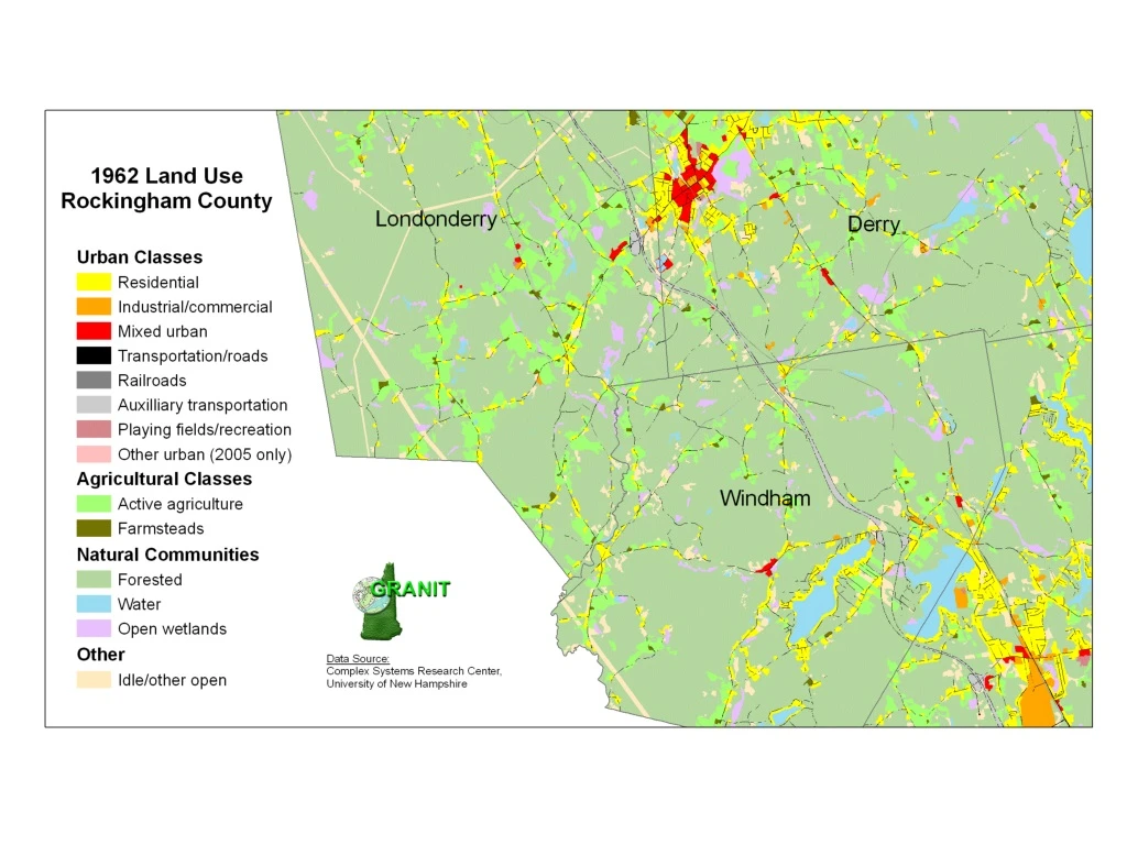
This project involves using 2005 aerial imagery with 1-foot resolution to map 59 land use classes. The Complex Systems Research Center coordinates the development of project standards, provides training in aerial photo interpretation, assembles regional data sets, and produces final data sets, maps, and documentation. The Regional Planning Commissions actively participate in standards development, apply protocols for generating regional land cover data sets, conduct quality control checks, and produce town-based maps from the regional composite. The data will be downloadable from the GRANIT website in October 2007. The presenter should note that the 2005 imagery allows mapping at a more detailed level compared to 1962 data, with 59 classes in 2005 versus 16 in the older data. Crosswalking between old and new classes is approximate, and some categories have been redefined. The 2005 data is provisional as of early September 2005.

E N D
Land Use Project Overview • Primary source data: 2005 aerial imagery, 1-foot resolution • Complex Systems Research Center role: • Coordinate development of project standards • Provide training in aerial photo interpretation • Assemble regional data sets and mosaic into corridor-wide data set • Produce final data set, final map, and data documentation • Provide technical support through project • Regional Planning Commissions’ role: • Actively participate in standards development • Apply standards and protocols to generate regional land cover data set • Conduct QC to verify data accuracy • Produce town-based maps from regional composite • Data will be available for download from GRANIT web site in October, 2007
Land Use Classification 59 land use classes: 45 developed 14 agriculture/forest/wetlands/barren
Notes for Presenter in showing 1962-2005 changes • 2005 source imagery is much more resolved, so possible to map at much more detailed level • Many I93 land use categories didn’t exist in the older data – 59 2005 classes vs. 16 older classes. • Crosswalking between old and new classes is approximate. Some categories didn’t exist, and others were redefined, e.g. previously mapped only open wetlands and now mapping all wetlands (including forested). • 2005 data is provisional as of early September, 2005.