Download
1 / 50
510 likes | 885 Views
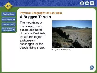
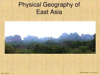
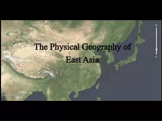
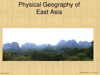
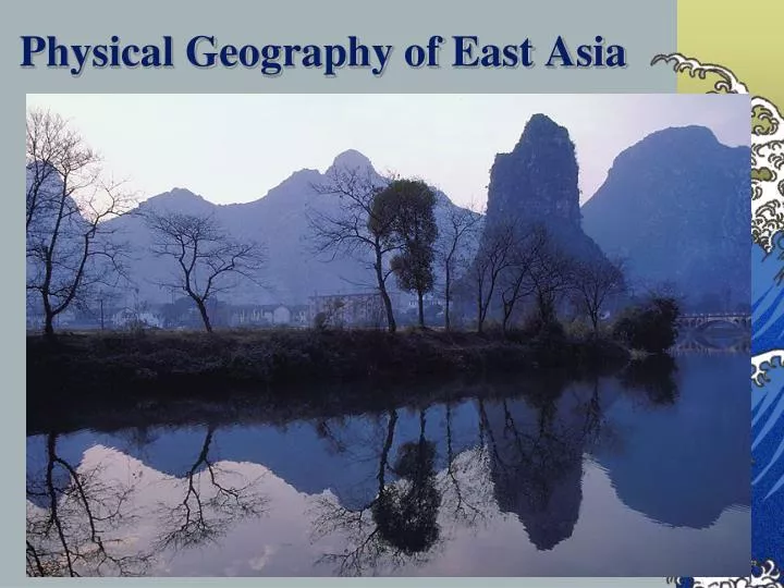
Physical Geography of East Asia. Satellite View of China. The East Asian Realm. Physical landforms *Q1: What accounts for these complex landforms?* Limited flat land : *Q2: What are some solutions to this problem?*. - Tectonic Activity. Terracing and irrigation.

E N D
The East Asian Realm • Physical landforms *Q1: What accounts for these complex landforms?* • Limited flat land: • *Q2: What are some solutions to this problem?* • - • Tectonic Activity • Terracing and irrigation. • Maximize agricultural productivity.
China • The People's Republic of China (PRC) • Est. in 1949 • China is ruled by the Communist Party of China under a single-party system
China’s Geography • 1. 3rd largest country in the world. • 2. Comparable to the US • 3. 65% of the country is mountainous. • 4. Arable land represents 12% of the national territory as opposed to 25% for the United States. • 5. Per capita (0.086 hectare) is well below the world average. China United States
Q3: What is this type of agriculture called? AND, why do you think that it was developed? Terraced farming; rugged terrain/topography/mountainous
Bodies of Water Amur River Sea of Japan Yellow Sea Huang-He River Yangtze River Xi River Pacific Ocean SouthChinaSea
The Yellow River! • Huang He (Yellow River). • -Floods frequently. • -Extremely polluted • -Industrialization along the river
The Yangtze River • Chang Jiang River (Yangtze) • -Flood of 1998 left 14 million homeless. • -Home to the Three Gorges Dam • -Created a reservoir that made 1,000 towns and villages disappear
The West River and the Pearl River • Xi Jang (West River) • Important mineral resources are along this river • Zhu Jiang (Pearl River) • Most productive and sustainable ecosystem in the world.
Q4: What is the name of each river (One point per name) China 1. Huang He (Yellow River) 2. Chang Jiang (Yangtze River) 1 • Xi Jiang (West River) OR Zhu Jiang (Pearl River) 2 3
Mountains & Peaks Altai Mts. Greater Khingan Tian Shan Kunlun Shan Himalayan Mts.
Kunlun Mountains • Located in the west • Where two of China’s great rivers begin (Yellow and Yangtze)
Deserts & Plateaus Gobi Desert Taklamakan Desert Tibetan Plateau
Mongolian Plateau • Most who live here are sheep herders and raise livestock • Tibetan Plateau • Averages more than 3,000 feet above sea level • Gobi Desert • Stretches more than 500,000 miles • Prime area for finding dinosaur fossils • All three are scarcely populated because of severe climates and topography
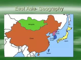
China • The Chinese Realm • East sea border. • West: Deserts and mountains. • North: Deserts. • South: Himalayas. *Q5: What will these borders cause?* • Cultural division between the Han realm and the China of the minorities. Maritime border Cultural border Physical border Turkic Mongols Arid China Gobi Takla Makan Koreas Highland China Isolation Han Tibetan Tai Miao-Yao Taiwan Political border
Monsoon Precipitation Patterns This region also benefits/suffers from the rainfall from monsoons Sometimes receive typhoons = tropical storms
Warm Up • Composition Notebooks need to be turned in on the stool. • Have notes out from yesterday ready to go.
Natural Resources
Major Chinese Industries Major Industrial Areas near Beijing and Shanghai
Fuels, Power, Minerals, & Metals in China Large reserves of petroleum, coal, and natural gas. Mineral resources include iron, lead, zinc, copper, etc. Allowed them to be self-sufficient for much of its history
Environmental issues • Suffering from: • Deforestation • Desertification • Soil erosion • Coastal pollution • Flooding • Poor urban air quality
Korea • “The shrimp between the whales” • *Q6: What are the two whales?* • Japan and China • About the size of Indiana. • Highly homogenous ethnicity and linguistically • Religiously divided between Christianity (49%) and Buddhism (47%). • 75% urban with 27% of the population living in Seoul (13 million). China North Korea Sea of Japan Demilitarized zone South Korea Japan
Korea is practically surrounded by water: *Q7: What is this called? Peninsula
Japan: Physical Geography • 1. The homeland of Japan consists of four main islands: Hokkaido, Honshu, Shikoku, and Kyushu, and several hundred smaller islands. • 2. Japan is formed largely of mountains separated by narrow valleys. • 3. Japan is part of the Pacific “Ring of Fire.” • There are about 60 volcanoes in Japan • 4. Japan is subject to frequent and powerful earthquakes.
Japan • Physical constraints • 16% of the land is habitable. • Efficient management of existing agricultural land. Hokkaido Honshu Kanto Plain Nobi Plain Yamato Plain Shikoku Kyushu
Mt. Fuji Largest mountain in Japan. Last erupted in 1707)
Japan: Vegetation 2/3 of the entire country is forested and the Japanese make use of wood in almost endless ways
The Japanese Farm the Sea TokyoFish Market
Raw Materials and Resources
Natural Resources Less abundant natural resources than China. *Q7: What will this force Japan to do?* Trade with other countries for what it needs
Taiwan Now a free-market, multiparty democracy Home of 23 million well-traveled, well-educated, and industrious people. Chungyang Range
Taiwan • 1. About 100 miles from the coast of southeast China. • 2. Similar constraints to neighboring countries: • 60% of the territory is composed of mountains. • Chungyang Range covers about 50% the land area. • 25% usable for agriculture. • 3. Bulk of the population lives in the western coastal plain. Matsu China Taiwan Formosa Strait Quemoy Chungyang Range
In a group of two…. • Answer the following questions on a sheet of paper to turn in: • 1. How does East Asia’s physical geography shape its historical philosophy of isolation? • 2. What are some similarities between each of these regions? • 3. What are some differences between each of these regions?