Download
1 / 45
450 likes | 468 Views
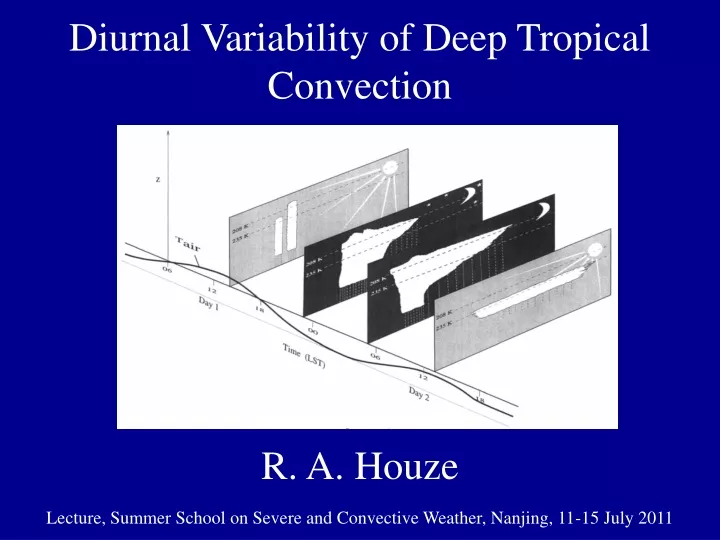
Diurnal Variability of Deep Tropical Convection. R. A. Houze. Lecture, Summer School on Severe and Convective Weather, Nanjing, 11-15 July 2011. Convective Clouds. Lecture Sequence. Basic convective cloud types Severe convection & mesoscale systems Tropical cloud population

E N D
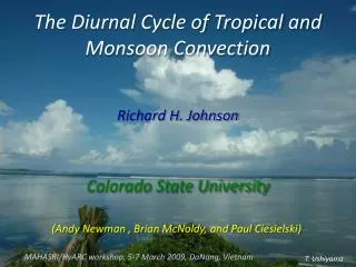
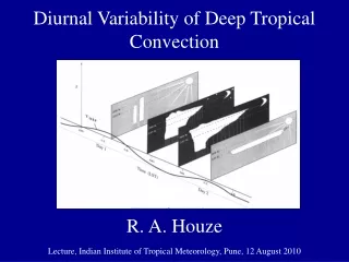
Diurnal Variability of Deep Tropical Convection R. A. Houze Lecture, Summer School on Severe and Convective Weather, Nanjing, 11-15 July 2011
Convective Clouds Lecture Sequence • Basic convective cloud types • Severe convection & mesoscale systems • Tropical cloud population • Convective feedbacks to large-scales • Extreme convection • Diurnal variability • Clouds in tropical cyclones
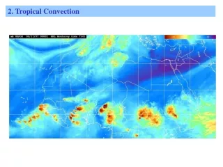
This talk will illustrate that… • Diurnal cycle of tropical convection depends on: • the scale of the convective phenomenon—time scale of large systems not separable from diurnal time scale • The location of the convection—open ocean, near coastline, over mountains
Convective systems over the West Pacific Cloud shield <208 K • <80 km • 80-170 km • 170-300 km • >300 km Chen & Houze 1997
Convective systems over the West Pacific Time needed for large systems to reach maximum size Chen & Houze 1997
Convective systems over the West Pacific Cloud systems tracked in time in IR satellite data Small (<80 km) Large (80-170 km) Convective systems over the West Pacific Chen & Houze 1997
Convective systems over the West Pacific Cooler than Day 1 Relationship to surface air temperature Chen & Houze 1997
Convective systems over the West Pacific “Diurnal Dancing” MJO MJO Chen & Houze 1997
Diurnal cycles of different types of extreme convective systems in mountainous regions Romatschke et al. 2010
This illustrates the effect of nocturnal downslope flow on the diurnal cycle of wide convective core occurrence Wide convective core occurrence by time of day during monsoon season Romatschke et al. 2010
Example from pre-monsoon season in South Asia Δ Small 600-8,500 km2 Medium 8,500-35,000 km2 IEC Mountains can lead to small and medium sized systems having different diurnal cycles—mesoscale lifecycle effect Romatschke et al. 2010
JASMINE1999 Pre-monsoon NOAA ShipRonald H. Brown Bay of Bengal Equator 100E 60E Webster et al. 2002
Diurnalcycle, mean percent high cloudiness, 1999 Cloud Top < 210 K Zuidema 2002
Propagational diurnal cycle occurs over Bay of Bengal JASMINE 1999, Ship Track & Satellite Data 85-90 E Ship Track Webster et al. 2002
IR Temperature 08:30 LST
IR Temperature 11:30 LST
IR Temperature 14:30 LST
IR Temperature 17:30 LST
IR Temperature 20:30 LST
IR Temperature 20:30 LST Ship radar
JASMINE 1999 Ship Radar Data 2345 LST 22 May 99 0215 LST 23 May 99 0615 LST 23 May 99
JASMINE 1999 Ship Radar Data Reflectivity Reflectivity Doppler Radial Velocity 22 May 1999 2300 LST
Winter MONEX December1978January1979 Johnson & Houze 1987
Stratiform Precipitation Radar Obs. of WINTER MONEX Borneo cloud system BORNEO S. CHINA SEA Bintulu Houze et al. 1981
Andes Pacific South America Andes Pacific South America Diurnal gravity wave generation of mesoscale convection over coastal South America Mapes et al. 2003
Summary • Over open tropical oceans: • Small systems max in late afternoon • Large MCSs max around dawn • 2-day cycle at a given location (“diurnal dancing”) • In mountainous regions: • Isolated deep convective elements max in late afternoon • Nocturnal downslope generates early morning max MCSs • Max of small rain systems precedes max of medium systems • Downstream of mountains and/or coastlines: • Large MCSs generated apparently as response to afternoon heating over high terrain propagate away from the mountainous region or coastline
Convective Clouds Lecture Sequence • Basic convective cloud types • Severe convection & mesoscale systems • Tropical cloud population • Convective feedbacks to large-scales • Extreme convection • Diurnal variability • Clouds in tropical cyclones Next
This research was supported by NASA grants NNX07AD59G, NNX07AQ89G, NNX09AM73G, NNX10AH70G, NNX10AM28G, NSF grants, ATM-0743180, ATM-0820586, DOE grant DE-SC0001164 / ER-6
Monsoon Season Composite Surface Winds for Cases of Wide Convective Systems Romatschkeet al. 2010
Percent High Cloudiness in the Summer Monsoon May-September 1999 < 235 K < 210 K 850 mb wind 300 mb wind & sfc pressure Zuidema 2002
r = 85-140 km r < 85 km r = 140-210 km r > 210 km Location of cloud systems by horizontal dimension May-September 1999 CloudTop < 210 K Zuidema 2002
JASMINE Mesoscale Convective Systems Defined & tracked by 218 K infrared threshold Zuidema 2002
WINTER MONEXDiurnal variation of high cloudiness near Borneo Bintulu December 1978 Mean fractional area covered high clouds in IR images S. CHINA SEA BORNEO 08 LST 20 LST 14 LST 02 LST Houze et al. 1981
WINTER MONEXDiurnal variation of precipitation near Borneo Bintulu BORNEO December 1978 Mean fractional area covered by radar echo .1 .5 Houze et al. 1981
Pre-monsoon Season in South Asia Romatschke & Houze 2010
23 May 1999 0650 LST JASMINE Ship RadarData TRMM PrecipitationRadar Swath
TRMM PR shows extensive stratiform structure 23 May 1999 0650 LST ~270 km
Example from pre-monsoon season in South Asia Δ Small 600-8,500 km2 Medium 8,500-35,000 km2 CHF Mountains can lead to small and medium sized systems having different diurnal cycles—mesoscale lifecycle effect Romatschke et al. 2010