Download
1 / 10
100 likes | 264 Views
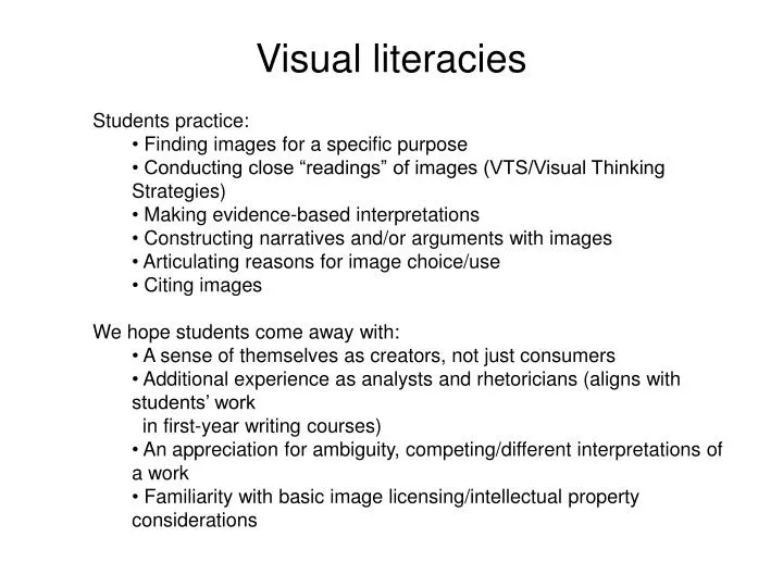
Visual literacies. Students practice: Finding images for a specific purpose Conducting close “readings” of images (VTS/Visual Thinking Strategies) Making evidence-based interpretations Constructing narratives and/or arguments with images Articulating reasons for image choice/use

E N D
Visual literacies • Students practice: • Finding images for a specific purpose • Conducting close “readings” of images (VTS/Visual Thinking Strategies) • Making evidence-based interpretations • Constructing narratives and/or arguments with images • Articulating reasons for image choice/use • Citing images • We hope students come away with: • A sense of themselves as creators, not just consumers • Additional experience as analysts and rhetoricians (aligns with students’ work • in first-year writing courses) • An appreciation for ambiguity, competing/different interpretations of a work • Familiarity with basic image licensing/intellectual property considerations
Intellectual Property literacy (?) • Students: • Come up with a “complete” list of things covered by IP • Work on a “complete” definition for IP based on examples • Discuss “terms of use” agreements (explicit and implicit) affecting them • Think about setting “terms of use” for their own work (Creative Commons) • Work together to think about Fair Use • Discuss advantages/disadvantages of the protection of IP • We hope students come away with: • A broader sense of what IP covers • An better understanding of their full role in IP as creators/consumers • A better understanding of the ambiguity around the use and fair use of IP • A set of “best practice” guidelines for the use of IP in their academic work
Hertzsprung-Russell (H-R) diagram Red Giants White Dwarves Hot blue stars Cool red stars
Spatial Literacy • The spatially literate student can: • Recognize and interpret patterns in graphs, diagrams, maps, and other spatial representations of data. • Comprehend basic spatial concepts such as scale, resolution, spatial interaction, and neighborhoods/zones. • Use location as a basis for organizing and discovering information. • Overlay different types of information to make an argument or solve a problem. • Evaluate data quality. • We want students come away with: • An appreciation for geography as more than just a list of places on the earth’s surface. • An understanding of spatial concepts and principles. • The ability to capture and communicate knowledge in the form of a map, graph, or diagram. • Familiarity with GIS (Geographic Information Systems) and geospatial technology.