Download
1 / 60
600 likes | 829 Views
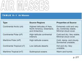
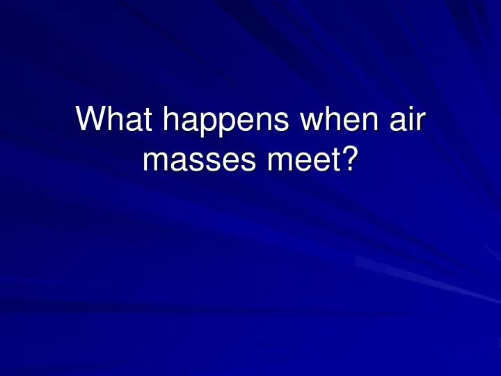
What happens when air masses meet?. What is an air mass?. Large volume of air with uniform temperature and humidity readings Gets its characteristics from where it forms Continental : forms over land (dry) Maritime : forms over water (moist) Tropical : forms near equator (warm)

E N D
What is an air mass? • Large volume of air with uniform temperature and humidity readings • Gets its characteristics from where it forms • Continental: forms over land (dry) • Maritime: forms over water (moist) • Tropical: forms near equator (warm) • Polar: forms nearer poles (cold)
Continental Air Masses Tropical (cT) Polar (cP)
Maritime Air Masses Tropical (mT) Polar (mP)
What happens when different air masses meet? Boundary between two different air masses is a: FRONT
Types of Fronts • Cold Front • Warm Front • Stationary Front • Occluded Front
Cold Front • Cold air moves in, replaces warm air • Cold air is more dense than warm air • Cold air pushes warm air up • Tall clouds form (cumulus and cumulonimbus)
Clouds are right along the front • Precipitation is brief, but heavy (thunderstorms) • Band of precipitation 75 miles around front (about 50 miles ahead and 25 miles behind)
Air pressure is lowest at front • After front passes: colder air mass temperature drops skies clear pressure increases • Cold fronts move faster than warm fronts (about 30 mph)
Warm air moving into cold Predictions?
What happens with a warm front? • Warm air mass advances and replaces cold air mass • Warm air is less dense than cold • Warm air rides above the colder air
Clouds start to form 1000 miles ahead of the front • Cirrus clouds develop, followed by lower level stratus clouds • Belt of precipitation is about 300 miles wide (starting 100-400 miles ahead of the front)
Rain (precipitation) is gentle, but may last for a long period (several hours or days) • Weather changes slowly (front moves about 20 mph) • Warmer air finally replaces the colder air
As the front passes: • Temperature increases • Skies clear • Pressure increases
Fronts – boundary that separates 2 air masses with different temperatures
Clouds: altostratus Warm front
HINT: sudden burst of intense rain over a small area Cold Front
HINT: this is a squall line Cold front
Stratus clouds: warm front
Clouds on Monday Clouds on Tuesday Warm front
Another squall line: COLD FRONT Robin Brueckner 2004
HINT: low gray clouds, long period of light snow WARM FRONT!!!!!!!!
Cold front Sharp break between air masses
Stationary Front • A stationary front occurs when the air masses on either side of the front are not moving toward each other.
Stationary Front • Neither air mass pushes into the other • Generally causes unsettled conditions • Rain, clouds, etc… • Flooding may occur if front does not pass
OCCLUDED FRONTWarm air mass gets caught between 2 colder air masses and is forced aloft
Occluded Front • A cold air mass catches up to another cold air mass • Warm air is ‘squeezed’ out in the middle • Causes precipitation