Download
1 / 51
510 likes | 852 Views
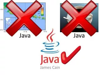
Unidata’s Common Data Model and NetCDF Java Library API Overview. John Caron Unidata/UCAR Nov 2008. Java = Programmer Productivity. Portability Object Oriented Libraries everywhere Thriving open source development Strong typing (aka type safety) needed for large development projects

E N D
Unidata’s Common Data ModelandNetCDF Java Library APIOverview John Caron Unidata/UCAR Nov 2008
Java = Programmer Productivity • Portability • Object Oriented • Libraries everywhere • Thriving open source development • Strong typing (aka type safety) • needed for large development projects • Good tools: IDEs, debuggers, profilers • Very productive • Java is faster than C for some applications • eg multithreaded server
Tomcat: The Definitive Guide, Jason Brittain (O’Reilley 2007)
Java Virtual Machine /Operating Systems • JVM options • Linux, Solaris, Windows (Sun) • Mac OS X (Apple) • AIX, Linux, Windows, z/OS (IBM) • HP-UX (Hewlett-Packard)
Java Negatives • Linking Java with C/Fortran apps is difficult • Arguably not suitable for large scale numerical computation • Type safety, array safety, strict reproducibility • Multicore CPU challenge could shift • Specialized languages can be more productive
NetCDF-Java library • 100% Java • Open Source (LGPL, MIT) • Independent implementation • Used as a component in other software (partial) • Integrated Data Viewer, THREDDS Data Server (Unidata) • Panoply (NASA) • ncBrowse (EPIC/NOAA) • Java NEXRAD Viewer (NCDC/NOAA) • MyWorld GIS (Northwestern) • EDC for ArcGIS, ERRDAP (SFSC/NOAA) • Live Access Server (PMEL/NOAA) • ncWMS (Reading) • Matlab plug-in (USGS)
THREDDS Catalog.xml Application Scientific Feature Types Datatype Adapter NetCDF-Java/ CDM architecture NetcdfDataset CoordSystem Builder NetcdfFile I/O service provider OPeNDAP NetCDF-3 NIDS NcML NetCDF-4 GRIB HDF5 GINI Nexrad DMSP …
NetCDF Java Release Plans • Current Stable Release NetCDF-Java 2.2 • Maintenance, bug fixes only • Development version 4.0 • Extensive refactor, enhance performance • Extended data types for NetCDF4 • Sequences : variable length Structures • Scientific Feature Types refactor • Nested Tables abstract model for point features (point, station, trajectory, profile) • By the end of the year
Format Readers (CDM files) • General: NetCDF, OPeNDAP, HDF5, NetCDF4, HDF4, HDF-EOS • Gridded: GRIB-1, GRIB-2, GEMPAK • Radar: NEXRAD 2&3, DORADE, CINRAD, Universal Format, TDWR • Point: BUFR, ASCII • Satellite: DMSP, GINI, McIDAS AREA • Misc: GTOPO, Lightning, etc • Others in development (partial): • AVHRR, GPCP, GACP, SRB, SSMI, HIRS (NCDC)
THREDDS Data Server HTTP Tomcat Server catalog.xml Remote Access THREDDS Server • WCS • OPeNDAP • HTTPServer • NetcdfSubset NetCDF-Java library configCatalog.xml Datasets IDD Data motherlode.ucar.edu
Application Application THREDDS dataset NcML dataset NcML dataset dataset dataset NcML Datasets
NcML example <?xml version="1.0" encoding="UTF-8"?> <netcdf xmlns="http://www.unidata.ucar.edu/schemas/netcdf/ncml-2.2" location=“/data/nids/N0R_20041119_2147"> <attribute name=“DataType" value=“Radar" /> <remove type=“attribute” name=“password" /> <variable name="Reflectivity" orgName=“R34768”> <attribute name="units" value=“dBZ" /> </variable> </netcdf>
TDS / NcML example <datasetScan name="Ocean Satellite Data" path=“/data/ocean/sat/" dirLocation="R:/tds/netcdf/"> <netcdf> <attribute name="Conventions" value="CF-1.0"/> </netcdf> </datasetScan>
TDS / NcML aggregation <dataset name="WEST-CONUS_4km Aggregation" urlPath="satellite/3.9/WEST-CONUS_4km"> <netcdf > <aggregation dimName="time" type="joinNew"> <scan location="/data/satellite/WEST-CONUS_4km/" suffix=".gini" /> </aggregation> </netcdf> </dataset>
An Abstract Data Model describes data objects and what methods you can use on them. An API is the interface to the Data Model for a specific programming language A file format is a way to persist the objects in the Data Model. A data access protocol like OPeNDAP plays the role of a file format (sort of). An Abstract Data Model removes the details of any particular API and the persistence format. What’s a Data Model?
Scientific Feature Types Point Trajectory Station Profile Radial Grid Swath Common Data Model Coordinate Systems Data Access netCDF-3, HDF5, OPeNDAP BUFR, GRIB1, GRIB2, NEXRAD, NIDS, McIDAS, GEMPAK, GINI, DMSP, HDF4, HDF-EOS, DORADE, GTOPO, ASCII
THREDDS Catalog.xml Application Scientific Feature Types Datatype Adapter NetCDF-Java/ CDM architecture NetcdfDataset CoordSystem Builder NetcdfFile I/O service provider OPeNDAP NetCDF-3 NIDS NcML NetCDF-4 GRIB HDF5 GINI Nexrad DMSP …
Common Data Model (Data Access Layer)
File location: Filename create( ), open( ), … DataType Group name: String PrimitiveType char byte short int int64 float double unsigned byte unsigned short unsigned int unsigned int64 string Dimension name: String length: int isUnlimited( ) Variable name: String shape: Dimension[ ] type: DataType array: read( ), … Attribute name: String type: DataType values: 1D array UserDefinedType typename: String Enum Opaque Compound VariableLength NetCDF-4 Data Model User-defined types, including compound types, may be stored with other data. A file has a top-level unnamed group. Each group may contain one or more named subgroups, variables, dimensions, and attributes. A variable may also have attributes. Variables may share dimensions, indicating a common grid. One or more dimensions may be of unlimited length.
Coordinate Systems as Functions Data variable V, with n dimensions Vdim = {dimk , k=0,n-1} is a function from domain Vdim to R V:Vdim → R A coordinate variable for V is also a function CV:Vdim → R A coordinate system for V, CSV, is a set of m coordinate variables for V CSV = {CVj , j=0,m-1} CSV:Vdim → Rm The coordinates of the (i,j,k) data point are the m values {CV1(i,j,k), CV2(i,j,k), CV3(i,j,k),…} A coordinate system must be invertible.
Coordinate Systems • NetCDF, OPeNDAP, HDF data models do not have integrated coordinate systems • so georeferencing not part of API • Need conventions to specify (eg CF-1, COARDS, etc) • Contrast GRIB, HDF-EOS, other specialized formats
Coordinate Variables dimensions: lat = 64; lon = 128; variables: float lat(lat); float lon(lon); float time; double temperature(lat,lon); coordinates=“lat lon time”;
Limitations of 1D Coordinate Variables • Non lat/lon horizontal grids: float temperature(y,x) float lat(y, x); float lon(y, x); • Trajectory data: float NKoreaRadioactivity(pt); float lat(pt); float lon(pt); float altitude(pt); float time(pt)
Projections (CF) • albers_conical_equal_area • lambert_azimuthal_equal_area • lambert_conformal_conic • mcidas_area • mercator • orthographic • rotated_pole • stereographic (including polar) • transverse_mercator • UTM (ellipsoidal) • vertical_perspective
Vertical Transforms (CF) • atmosphere_sigma • atmosphere_hybrid_sigma_pressure • atmosphere_hybrid_height • ocean_s • ocean_sigma • existing3DField
Add your own Transform • Pluggable framework • Add at runtime • CoordTransBuilder.registerTransform() • Implement CoordTransBuilderIF
Scientific Feature Types • Based on datasets Unidata is familiar with • APIs are evolving • Intended to scale to large, multifile collections • Intended to support “specialized queries” • Space, Time • These form the basis for NetCDF-Java implementations • Two categories : Grids and Points
Gridded Data • Grid: multidimensional grid, separable coordinates • Radial: a connected set of radials using polar coordinates collected into sweeps • Swath: a two dimensional grid, track and cross-track coordinates • Unstructured Grids: finite element models, coastal modeling
Gridded Data • Cartesian coordinates • Data is 2,3,4D • All dimensions have 1D coordinate variables (separable) float gridData(t,z,y,x); float t(t); float y(y); float x(x); float z(z); float lat(y,x); float lon(y,x); float height(t,z,y,x);
Radial Data • Polar coordinates • 2D: radials collected into sweeps • Not separate time dimension float radialData(radial, gate) : float distance(gate) float azimuth(radial) float elevation(radial) float time(radial) float origin_lat; float origin_lon; float origin_alt;
Swath • two dimensional • track and cross-track • not separate time dimension • orbit tracking allows fast search float swathData( track, xtrack) float lat(track, xtrack) float lon(track, xtrack) float alt(track, xtrack) float time(track)
Unstructured Grid • Pt dimension not connected • Need to specify the connectivity explicitly • No implementation in the CDM yet float unstructGrid(t,z,pt); float lat(pt); float lon(pt); float time(t); float height(z);
1D Feature Types (“point data”) float data(sample); • Point: measured at one point in time and space • Station: time-series of points at the same location • Profile: points along a vertical line • Station Profile: a time-series of profilesat same location. • Trajectory: points along a 1D curve in time/space • Section: a collection of profilefeatures which originate along a trajectory.
Point Observation Data • Set of measurements at the same point in space and time = obs • Collection of obs = dataset • Sample dimension not connected float obs1(sample); float obs2(sample); float lat(sample); float lon(sample); float z(sample); float time(sample); Table { lat, lon, z, time; obs1, obs2, ... } obs(sample);
Time-series Station Data float obs1(sample); float obs2(sample); int stn_id(sample); float time(sample); int stationId(stn); float lat(stn); float lon(stn); float z(stn); float obs1(sample); float obs2(sample); float lat(sample); float lon(sample); float z(sample); float time(sample); float obs1(stn, time); float obs2(stn, time); float time(stn, time); int stationId(stn); float lat(stn); float lon(stn); float z(stn); Table { stationId; lat, lon, z; Table { time; obs1, obs2, ... } obs(*); // connected } stn(stn); // not connected
Profile Data float obs1(sample); float obs2(sample); int profile_id(sample); float z(sample); int profileId(profile); float lat(profile); float lon(profile); float time(profile); float obs1(sample); float obs2(sample); float lat(sample); float lon(sample); float z(sample); float time(sample); float obs1(profile, level); float obs2(profile, level); float z(profile, level); float time(profile); float lat(profile); float lon(profile); Table { profileId; lat, lon, time; Table { z; obs1, obs2, ... } obs(*); // connected } profile(profile); // not connected
Time-series Profile Station Data float obs1(profile, level); float obs2(profile, level); float z(profile, level); float time(profile); float lat(profile); float lon(profile); float obs1(stn, time, level); float obs2(stn, time, level); float z(stn, time, level); float time(stn, time); float lat(stn); float lon(stn); Table { stationId; lat, lon; Table { time; Table { z; obs1, obs2, ... } obs(*); // connected } profile(*); // connected } stn(stn); // not connected
Trajectory Data float obs1(sample); float obs2(sample); float lat(sample); float lon(sample); float z(sample); float time(sample); int trajectory_id(sample); float obs1(traj,obs); float obs2(traj,obs); float lat(traj,obs); float lon(traj,obs); float z(traj,obs); float time(traj,obs); int trajectory_id(traj); Table { trajectory_id; Table { lat, lon, z, time; obs1, obs2, ... } obs(*); // connected } traj(traj) // not connected
Section Data float obs1(traj,profile,level); float obs2(traj,profile,level); float z(traj,profile,level); float lat(traj,profile); float lon(traj,profile); float time(traj, profile); Table { section_id; Table { surface_obs // data anywhere lat, lon, time Table { depth; obs1, obs2, ... } obs(*); // connected } profile(*); // connected } section(*) // not connected
Nested Table Notation (1) • A feature instance is a row in a table. • A table is a collection of features of the same type. The table may be fixed or variable length. • A nested (child) table is owned by a row in the parent table. • Both coordinates and data variables can be at any level of the nesting. • A feature type is represented as nested tables of specific form. • A feature collection is an unconnected collection of a specific feature type. Table { data1, data2 lat, lon, time; Table { z; obs1, obs2, ... } obs(17); } profile(*);
Nested Table Notation (2) • A constant coordinate can be factored out to the top level. This is logically joined to any nested table with the same dimension. dim level = 17; float z(level); Table { data1, data2 lat, lon, time; Table { obs1, obs2, ... } obs(level); } profile(*);
Nested Table Notation (3) Table { stationId; lat, lon; Table { time; Table { z; obs1, obs2, ... } obs(*); // connected } profile(*); // connected } stn(stn); // not connected • A coordinate in an inner table is connected; a coordinate in the outermost table is unconnected. Table { trajectory_id; Table { lat, lon, z, time; obs1, obs2, ... } obs(*); // connected } traj(traj) // not connected Table { lat, lon, z, time; obs1, obs2, ... } point(sample);
Relational model • Nested Tables are a hierarchical data model (tree structure) • Simple transformation to relational model – explicitly add join variables to tables Table { stationId; lat, lon, z; Table { time; obs1, obs2, ... } obs(42); } stn(stn); RTable { stationId // primary key lat, lon, z; } stn RTable { stationId // secondary key time; obs1, obs2, ... } obs;
Nested Model Summary • Compact notation to describe 1D point feature types • Connectivity of points is key property • Variable/fixed length table dimensions can be notated easily • Constant/varying coordinates can be easily seen • Can be translated to relational model to get different performance tradeoffs • More details
Encoding Feature Types in NetCDFUsing CF Conventions • CF-1.0 focused on Grids • Other types are being studied / proposed • Unidata proposal for point obs • NCAR/EOL working on Radial data (netCDF4) • NPOESS/GOES-R using netCDF4 for satellite (swath) • Unidata has proposal to NOAA/NASA • Working group for unstructured grids • Happening now!