Download
1 / 62
620 likes | 705 Views
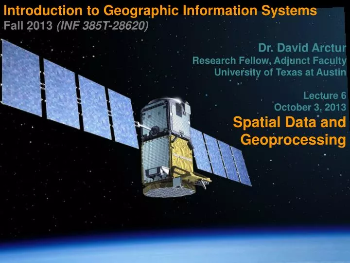
Introduction to Geographic Information Systems Fall 2013 (INF 385T- 28620) Dr. David Arctur Research Fellow, Adjunct Faculty University of Texas at Austin Lecture 6 October 3, 2013 Spatial Data and Geoprocessing. Outline. Attribute extraction Feature location extraction

E N D
Introduction to Geographic Information Systems Fall 2013 (INF 385T-28620) Dr. David Arctur Research Fellow, Adjunct Faculty University of Texas at Austin Lecture 6 October 3, 2013 Spatial Data and Geoprocessing
Outline INF385T(28620) – Fall 2013 – Lecture 6 Attribute extraction Feature location extraction Location proximities Geoprocessing tools ModelBuilder
Lecture 6 Attribute extraction INF385T(28620) – Fall 2013 – Lecture 6
Attribute query extraction INF385T(28620) – Fall 2013 – Lecture 6 You have tracts for an entire state, but want tracts for one county only
Attribute query extraction INF385T(28620) – Fall 2013 – Lecture 6 • Select tracts by County FIPS ID • Cook County = 031
Attribute query extraction INF385T(28620) – Fall 2013 – Lecture 6 Cook County tractsselected Export to new featureclass or shapefile
Export selected features • Right-click to export selected features INF385T(28620) – Fall 2013 – Lecture 6
Add new layer INF385T(28620) – Fall 2013 – Lecture 6 Cook County tracts
Lecture 6 Feature location extraction INF385T(28620) – Fall 2013 – Lecture 6
Select by location INF385T(28620) – Fall 2013 – Lecture 6 Powerful function unique to GIS Identify spatial relationships between layers Finds features that are within another layer
Select by location INF385T(28620) – Fall 2013 – Lecture 6 • Have Cook County census tracts but want City of Chicago only • Can’t use Select By Attributes • No attribute for Chicago • Use “Municipality” layer • City of Chicago is a municipality within Cook County
Select by location INF385T(28620) – Fall 2013 – Lecture 6 Select “Chicago” from municipalities layer
Select by location • Selection, select by location INF385T(28620) – Fall 2013 – Lecture 6
Export selected features INF385T(28620) – Fall 2013 – Lecture 6
Lecture 6 location proximities INF385T(28620) – Fall 2013 – Lecture 6
Points near polygons INF385T(28620) – Fall 2013 – Lecture 6 Health officials want to know polluting companies near water features
Points near points INF385T(28620) – Fall 2013 – Lecture 6 School officials want to know what schools are near polluting companies
Polygons intersecting lines INF385T(28620) – Fall 2013 – Lecture 6 Transportation planner wants to know what neighborhoods are affected by construction project on major highway
Lines intersecting polygons INF385T(28620) – Fall 2013 – Lecture 6 Public works official wants to know what streets or sidewalks will be affected by potential floods
Polygons completely within polygons INF385T(28620) – Fall 2013 – Lecture 6 City planners want to know what buildings are completely within a zoning area.
Lecture 6 Geoprocessing tools INF385T(28620) – Fall 2013 – Lecture 6
Geoprocessing overview INF385T(28620) – Fall 2013 – Lecture 6 GIS operations to manipulate data Typically take input datasets, manipulate, and produce output datasets Often use multiple datasets
Common geoprocessing tools INF385T(28620) – Fall 2013 – Lecture 6 • Analysis • Extract – clip • Overlay – intersect and union • Data management • Generalization – dissolve • General • append • merge
Accessing tools INF385T(28620) – Fall 2013 – Lecture 6 Geoprocessing menu
Accessing tools INF385T(28620) – Fall 2013 – Lecture 6 ArcToolbox
Accessing tools INF385T(28620) – Fall 2013 – Lecture 6 Search window
Clip vs. Select By Location INF385T(28620) – Fall 2013 – Lecture 6 • Clip • Clean edges • Looks good • Select By Location • Dangling edges • Better for geocoding(chapter 8)
Dissolve INF385T(28620) – Fall 2013 – Lecture 6 Combines adjacent polygons to create new, larger polygons Uses common field value to remove interior lines within each polygon, forming the new polygons Aggregate (sums) data while dissolving
Dissolve INF385T(28620) – Fall 2013 – Lecture 6 • Create regions using US states • Use SUB_REGION field to dissolve • Sum population
Dissolve INF385T(28620) – Fall 2013 – Lecture 6
Dissolve results INF385T(28620) – Fall 2013 – Lecture 6 States dissolved to form regions Population summed for each region
Append INF385T(28620) – Fall 2013 – Lecture 6 • Appends one or more datasets into an existing dataset • Features must be of the same type • Input datasets may overlap one another and/or the target dataset • TEST option: field definitions of the feature classes must be the same and in the same order for all appended features • NO TEST option: Input features schemasdo not have to match the target feature classes’ schema
Append • DuPage and Cook County are combining public works and need a new single street centerline file. INF385T(28620) – Fall 2013 – Lecture 6
Append INF385T(28620) – Fall 2013 – Lecture 6 Append will add DuPage streets to Cook County streets
Resultant layer • One street layer (Cook County) with all records and field items INF385T(28620) – Fall 2013 – Lecture 6
Merge INF385T(28620) – Fall 2013 – Lecture 6 • Combines multiple input datasets of the same data type into a single, new output dataset • Illinois campaign manager needs a single voting district map but wants to preserve the original layers
Merge INF385T(28620) – Fall 2013 – Lecture 6
Resultant layer INF385T(28620) – Fall 2013 – Lecture 6 New voting district layer
Union INF385T(28620) – Fall 2013 – Lecture 6 • Overlays two polygon layers • Resulting output layer has combined attribute data of the two inputs • Contains all the polygons from the inputs, whether or not they overlap
Union INF385T(28620) – Fall 2013 – Lecture 6 Neighborhoods and ZIP Codes
Union INF385T(28620) – Fall 2013 – Lecture 6
Union INF385T(28620) – Fall 2013 – Lecture 6 • Better describes characteristics of a neighborhood • Central business district 15222 vs. 15219
Union • Attributes tables contain different fields and data INF385T(28620) – Fall 2013 – Lecture 6
Union results • New polygons with combined data INF385T(28620) – Fall 2013 – Lecture 6
Union vs. Merge vs. Dissolve INF385T(28620) – Fall 2013 – Lecture 6
Intersect INF385T(28620) – Fall 2013 – Lecture 6 Computes a geometric intersection of the input features Features (or portions of features that overlap in all layers and/or feature classes) will be written to the output feature class Inputs can have different geometry types
Intersect INF385T(28620) – Fall 2013 – Lecture 6 City manager needs to know what buildings intersect flood zones and wants the flood data attached to each intersecting building
Intersect INF385T(28620) – Fall 2013 – Lecture 6
Intersect result INF385T(28620) – Fall 2013 – Lecture 6 Only building polygons that intersect flood zones with combined data fields
Lecture 6 Modelbuilder INF385T(28620) – Fall 2013 – Lecture 6