Download
1 / 56
560 likes | 724 Views
Themes in World Regional Geography. Geo100 - Fall 2003 Julie Hwang Lecture #3. Outlines. Environmental Geography Landform Climates Vegetation Water resources Food resources. How is Earth’s surface shaped?. Jigsaw puzzle fit of South America to Africa Mid-Atlantic Ridge

E N D
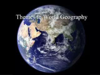
Themes in World Regional Geography Geo100 - Fall 2003 Julie Hwang Lecture #3
Outlines • Environmental Geography • Landform • Climates • Vegetation • Water resources • Food resources
Jigsaw puzzle fit of South America to Africa • Mid-Atlantic Ridge • Himalaya Mountains
Continental Drift • The continents are in constant movement resting upon the plates • Some 250 million years ago, continents were connected into one single landmass called Pangaea • Pangaea was later separated into continents in the present day
Laurasia Pangaea Gondwanaland 180 million years ago 225 million years ago The present day 65 million years ago
Continental Drift • So what drives continental drift? • Exchange of heat energy from the inner Earth • Described by Plate Tectonics theory
Earth’s interior • Core • Mantle • Crust
Plate Tectonics (solid) Plates (molten) Plates drift upon the asthenosphere
Plate Tectonics Plates Convection cell Plates move relative to one another driven by convection cell
Volcanoes Subduction zone Plate Tectonics • Convergent plate boundary
Plate Tectonics – landforms shaped by convergent plate boundary
Mid-Ocean Ridge Rift Valley Plate Tectonics • Divergent plate boundary
Plate Tectonics – landforms shaped by divergent plate boundary
Plate Tectonics • Earth is made up of a large number of geological plates that move slowly across its surface • Explains the inner workings of our planet and many landforms in a global scale • Gives clues about the world distribution of earthquakes and volcanoes
1. Solar Energy Greenhouse effect
3. Arrangement of oceans and continents • Land areas heat and cool faster than do bodies of water • Continentality • Maritime climates
4. Pressure & Wind patterns 40° N 20° N Equator 20° S 40° S
Climographs • Horizontal line show average high and low temperature in degree Fahrenheit. • Vertical bars show precipitation in inches. • For an entire year
Köppen climate classification systems • A - Moist Tropical Climates • B - Dry Climates • C - Humid Middle Latitude Climates • D - Continental Climates • E - Cold Climates
Climate Type (cont.) • Tropical (A) • Tropical rain forest (Af, Am) • Tropical savanna (Aw) • Dry (B) • Steppe (BS) • Desert (BW) • Temperate – Mild and rainy winter (C) • Mediterranean (Cs) • Humid subtropical (Ca) • Marine west coast (Cb)
Climate Type • Temperate – Cold and snowy winter (D) • Humid continental, warm summer (Da) • Humid continental, cool summer (Db) • Subarctic (Dc) • Polar (E) • Tundra (ET) • Icecap (EF) • Highland (H)
Causes of Global Warming • Emission of anthropogenic (human-caused) greenhouse gases • Carbon dioxide (CO2) • Chlorofluorocarbons (CFCs) • Methane (CH4) • Nitrous oxide (N2O)
Effects of Global Warming • Climate changes • Increase in global temperature • Rise of sea levels • Intensity and frequency of cyclones • Drought and flood • Shift in major agricultural areas • Depletion in the earth’s ozone layer (CFCs)
International debate on limiting greenhouse gases • Rio de Janiero Earth summit (’92) • The first legal instrument addressing global warming was formulated • Kyoto protocol (’97) • 38 industrialized countries agree to reduce the emissions of major greenhouse gases below 1990 levels
Conflict with economic growth • Fear that controls will constrain business, slow the economy, and increase the cost of living • U.S. more reluctant to comply than other nations
Vegetation • Product of climate, geology, and hydrology • Influence on climate, geology, and hydrology • Human modification (eg. domestication, agriculture) • Threatened by global economy
Biome (Bioregion) • Grouping of the world’s flora and fauna into a large ecological province or region • Closely connected with climate regions, but the linkage has got less clear since industrialization (eg. irrigation, domestication) • Globalization is having an impact on world bioregions
Vegetation Type Tropical Tropical forest Savannas Deserts Grasslands: Mediterranean, Temperate Temperate Forests: Deciduous, Coniferous Tundra Icecap Dry, Temperate Temperate Polar, Highland
Vegetation Type (cont.) • Tropical forests and Savannas • Mostly found in equatorial climate zones • Covers around 7% of the world’s land area • Deserts and Grasslands • large areas of arid and semi-arid climate that lie poleward of the tropics • Comprise one-third of the Earth’s land surface • Prairie: North American grassland • Steppe: shorter, less dense grassland found in Russia and Southwest Asia
Vegetation Type • Temperate forests • Large tracts of forests found in middle and high latitudes • Two major tree types dominate: Coniferous and deciduous • In many regions, these forests have been cleared for agricultural purposes
Deforestation in the Tropics • Cutting-off of tropical forests in Africa, Latin America, and Southeast Asia • Caused by • International wood sales • Cattle grazing (demand for beef) • Settlement purposes
Desertification in the Grasslands • A spread of desert-like conditions in Africa, Australia, and South Asia • Caused by • Poor cropping practices • Overgrazing • The buildup of salt in soils from irrigation • Climatic fluctuations
Water stress • Calculated from the amount of fresh water available per person • describes and predicts where water resource problems will be the greatest • Africa stands out as a region of high water stress
Flooding • Cause the most deaths of all natural disasters (accounts for 50% of natural disaster-related deaths) • Caused by • Population growth (forced people to settle in low-laying delta lands subject to flooding) • Deforestation