Download
1 / 4
40 likes | 136 Views
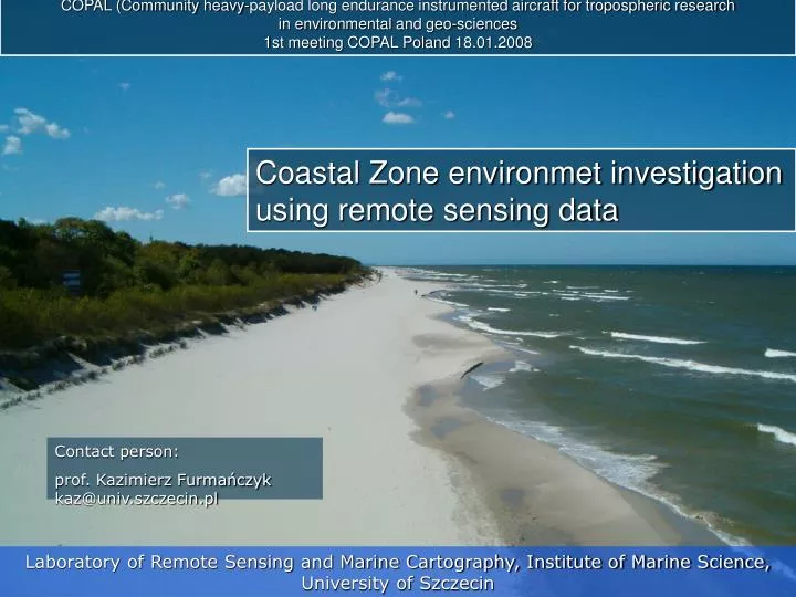
COPAL (Community heavy-payload long endurance instrumented aircraft for tropospheric research in environmental and geo-sciences 1st meeting COPAL Poland 18.01.2008. Coastal Zone environmet investigation using remote sensing data. Contact person:

E N D
COPAL (Community heavy-payload long endurance instrumented aircraft for tropospheric research in environmental and geo-sciences 1st meeting COPAL Poland 18.01.2008 Coastal Zone environmet investigation using remote sensing data Contact person: prof. Kazimierz Furmańczyk kaz@univ.szczecin.pl Laboratory of Remote Sensing and Marine Cartography, Institute of Marine Science, University of Szczecin
Field of our activities: • coastal changes and performing coastal protection studies with the • use of remote sensing methods • coastal changes as a result of an extreme storm events • shoreline evolution and coastal dynamics related with sea-level • rise and storm risk and its interaction with human activities • coastal classification and historical coastal vegetation changes • GIS applications to coastal morphodynamics and landscape • analysis
Projects: • BASYS/1996 – 1999/ - (Baltic Sea System Study), Subgroup 4, • Nearshore and Coastline Processes - MAST-3 • 4.1. Shoreline evolution. 4.2. Investigation of wide range circulation patterns by aerial photographs / satellite images. • Coastlearn /2001-2003/ - Multimedia distance training package for Central and Eastern Europe on Integrated Coastal Management - Leonardo da Vinci, PinMatra • EUROSION /2002-2003/ - an European initiative for Sustainable coastal erosion management. Assessment on Coastal Erosion in West Polish Coast - pilot site. • MESSINA/2004-2006/ - Managing European Shoreline and Sharing Information on Near-shore Areas – INTERREG III C • MICORE /2008-2010/ - Morphological Impacts and COastal Risks induced by Extreme storm events - 7 Framework Programme • and 3 KBN grants connected with coastal zone investigation
Requested equipment: • Multispectral scanner - spectral bands: visible and near-IR • High resolution photogrammetry camera • Topo/Bathy LiDAR (red and green)