1 / 10

Locating Smoke Source with Bearings Intersection: Stanislaus River Fire Search

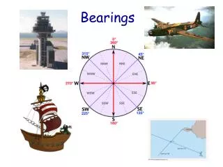
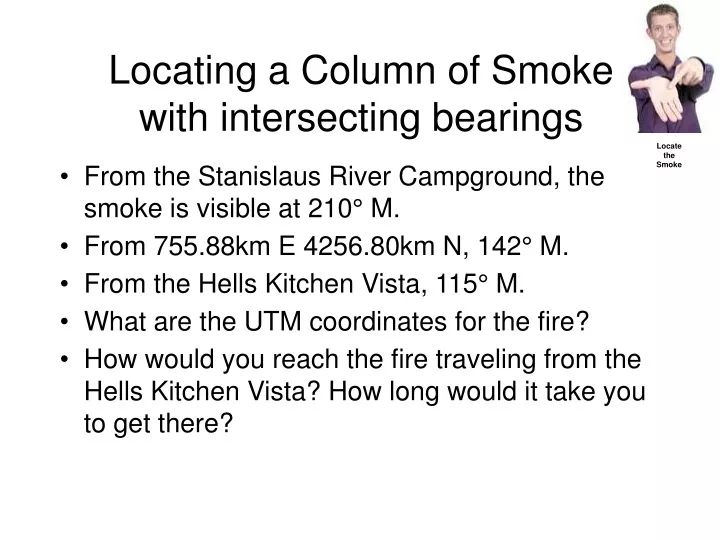
Discover the exact UTM coordinates of a fire by utilizing intersecting bearings provided from different locations. Starting points include the Stanislaus River Campground, specific distances and bearings to identify the exact location of the fire. Learn the process and duration to reach the fire from the Hells Kitchen Vista.

jermaineg
Download Presentation

Locating Smoke Source with Bearings Intersection: Stanislaus River Fire Search

An Image/Link below is provided (as is) to download presentation Download Policy: Content on the Website is provided to you AS IS for your information and personal use and may not be sold / licensed / shared on other websites without getting consent from its author. Content is provided to you AS IS for your information and personal use only. Download presentation by click this link. While downloading, if for some reason you are not able to download a presentation, the publisher may have deleted the file from their server. During download, if you can't get a presentation, the file might be deleted by the publisher.

E N D

Presentation Transcript


  1. Locating a Column of Smokewith intersecting bearings Locate the Smoke • From the Stanislaus River Campground, the smoke is visible at 210° M. • From 755.88km E 4256.80km N, 142° M. • From the Hells Kitchen Vista, 115° M. • What are the UTM coordinates for the fire? • How would you reach the fire traveling from the Hells Kitchen Vista? How long would it take you to get there?

More Related