Download

1 / 41
410 likes | 429 Views
Learn about the critical role of NRCS in snow survey, water forecasting, climate data analysis, and support for various environmental aspects. Explore locations, staffing, and operational details.

E N D
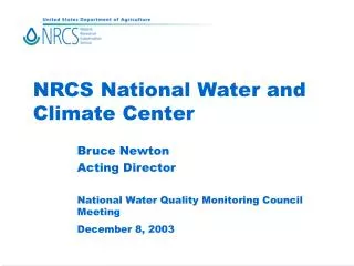
NRCS National Water and Climate Center Bruce Newton Acting Director National Water Quality Monitoring Council Meeting December 8, 2003
Mission • Snow survey and water supply forecasting • Soil Climate Analysis Network • Climate data for conservation planning • Technical tools and support for: • hydrology • nutrients, pesticides, animal waste, water quality • air quality • irrigation and water management
Locations and staffing Amherst, 2 staff Great Falls, MT Portland, 33 staff Beltsville, 6 staff West Lafayette Ft. Collins Durham, NC Lafayette, LA
Snow Survey / Water Supply Whiskey is for drinking; water is for fightin’ over.- Mark Twain • 50-80% of useable water derives from mountain snowpack. Snowpack highly variable year to year. • Snow monitoring and water supply forecasts are essential to the western economy
Snow Survey / Water Supply • Users of NRCS data and forecasts: • irrigation districts and farmers • hydroelectric utilities • reservoir operators • flood managers • disaster management agencies • wildfire managers • recreation interests
Snow Survey / Water Supply • 709 Locations • 12 States • Jan-Jun • 11,411 Forecasts
Manual Snow Survey • 1100 sampling sites • Sampled 2 - 4 times a year • NRCS field office staff and many cooperators • Majority are candidates for automation
Remote Stations (SNOTEL) • 702 stations in 12 States • approximately 10 new stations added per year • located in high elevation mountainous areas • three communication master stations relay data to NWCC Data Center
Wind Solar Radiation Air Temp Relative Humidity Snow Depth Snow Water Equivalent
Snow Survey / Water Supply • Resource investment: • 61 full time NRCS staff • 22 at NWCC • 39 at State level • Additional staff on part time basis • Portland Data Center • Electronics Maintenance Facility • Equipment investment of $30 million (replacement cost)
Data Center Operations • Major data center within NRCS configuration responsible for snow survey and climate data systems • 900,000 monitoring observations per week incoming • 24/7 operation • System is classified mission-critical by Department
Data Center Operations • Resource investments • seven NRCS staff dedicated to IT • we use programming services contracts • expenditures for hardware, software, and operations run one million dollars per year.
New Usage Measure • Counting web hits and FTP downloads is flawed • Developed a new measure narrowly focused on user access to snow survey data and forecasts • For FY03 there were 3.9 million user accesses
FY04 Priorities • Upgrade SNOTEL stations • replace obsolete station transceivers and data loggers • soil moisture and other sensors • Data Center software and products • Pilot test short-term forecasting • Expand staffing as resources allow • Improve data QA
Strategic Issues • Short-term streamflow forecasting • issue short-term discharge forecasts in addition to current seasonal volume forecasts • System automation • replace manual snow courses with SNOTEL stations
Short-term forecasting • supplement seasonal volume forecast with short-term discharge forecast • peaks; onset of low-flow • currently forecasting 29 basins in MT • 2-week forecast • issued weekly
Short-term forecasting • major resources implications • pilot project • various models • various potential partnerships • NWS • State agencies
System automation • about 40% of the snow survey system is automated • forecast accuracy improved • important for short-term forecasting
SCAN Soil Climate Analysis Network
SCAN • Climate and soil moisture monitoring to • support farm operations (planting, waste spreading, irrigation scheduling) • improve drought assessment and flood forecasting • to advance scientific knowledge of soil hydrology and climate relationships
SCAN • Stations located in low elevation agricultural areas • Joint with National Soil Survey Center • Expanding primarily through cooperator funding • Utilizes the SNOTEL infrastructure for design, equipment, data management, user access to data
SCAN • Principle cooperators: • USDA World Agricultural Outlook Board, ARS, FS • Land Grant Universities • State Climatologist Offices • Regional Climate Centers • Principle users: • local farmers • WAOB • researchers • State climatologists • Weather Service
SCAN • Currently 85 stations in 41 States • Demand for new stations to be paid for by partners exceeds our ability to install and maintain them • Greatest need is for technician-level staff and data QA analysts
Climate Services • Climate is a major factor in natural resources management • Climate data are used extensively by our conservationists and partners in planning • Our role is to coordinate research, obtain data, complete value-added analyses, and make information easily accessible to resource professionals
Climate Services • Provide expertise, analyses, and data for • wetland determination • county soil surveys • water supply forecasting • air quality assessments • erosion estimation • crop planning and risk assessment • water quality models
PRISM World recognized technology to analyze and map climate using GIS
Ag. Climatology Work with other agencies to develop climate information and improve accessibility • climate generator for modeling • serially complete data sets • wind data analysis for air quality • Internet-based access and analysis of climate data (ACIS)
Technology Support Water Quality Animal waste engineering Nutrient management Pest management Hydrology Air Quality Irrigation and Water Management