Download
1 / 12
120 likes | 134 Views
IGRAC is an initiative of UNESCO and WMO that aims to promote global sharing of information and knowledge for optimal and sustainable groundwater resources development and management. It operates as a non-commercial center hosted by the Netherlands Institute of Applied Geoscience TNO and focuses on three clusters of activities: establishing a web-based Global Groundwater Information System (GGIS), promoting guidelines and protocols for groundwater data acquisition and monitoring, and co-operating in global or regional projects with a significant groundwater component. IGRAC also plays a role in supporting the implementation of the Water Framework Directive (WFD) by assisting in exporting WFD experience, providing information on experiences from elsewhere, and promoting international cooperation and discussion on water-related issues.

E N D
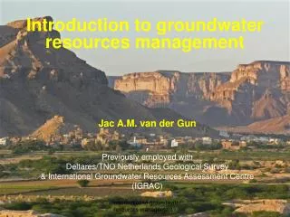
International Groundwater Resources Assessment Centre(IGRAC) G. Jousma June 2004
What is IGRAC? • An initiative of UNESCO and WMO (1999) • Principle: global sharing of information and knowledge for optimal and sustainable groundwater resources development and management • Centre with a non-commercial profile • Hosted by the Netherlands Institute of Applied Geoscience TNO at Utrecht, The Netherlands • Operating under auspices of UNESCO and WMO • Receiving financial support from the Dutch government for the initial years • Developing activities since early 2003
Why IGRAC has been established • Groundwater is extremely important, often highly vulnerable and sometimes difficult to develop • Activities at a supra-national or global level may create very significant additional value: • understanding regional or global processes and patterns • management of transboundary aquifers • internationally consistent data collection and monitoring • promoting groundwater in water resources planning
Scope of activities(3 clusters) • Establishing a web-based Global Groundwater Information System (GGIS) • Promoting use of Guidelines and/or protocols for groundwater data acquisition and groundwater monitoring (G&P) • Co-operate in global or regional projects or programmes with a significant groundwater component
Cluster1: Global Groundwater Information System (GGIS) Map of countries and groundwater regions of the world with lumped attribute sets for each of the spatial units Global Overview Selected (and standardised) information on groundwater systems or themes Detailed ground- water info Meta-information on groundwater and Collaborative Environment Services and enabling environ- ment
Cluster 2: Guidelines and Protocols Inventory of 1. guidelines & protocols 2. monitoring practices Inventory reports on 1. guidelines and protocols 2. monitoring practices Planning new (updates of) guidelines and protocols Improved access to guidelines and protocols (web site) International working groups New or updated guidelines and protocols
Groundwater MonitoringInventory and Proposals for support IGRAC’s world-wide inventory on groundwater monitoring practice shows 3 “levels”: • level 1: countries with no systematic monitoring going on • level 2: countries with systematic monitoring - far from optimal • level 3: countries with very advanced monitoring systems IGRAC proposals for working groups: • for level 1: A guideline on "Baseline groundwater monitoring” • for level 2: A guide for “evaluating and optimizing” groundwater monitoring programmes
What can be IGRAC’s role in relation to WFD ? • Assist in exporting WFD experience to other continents ? • Provide information on experiences from elsewhere ?(for instance: “HP-India”) • Use IGRAC on-line facilities to promote and support international co-operation and discussion on water-related issues ? • Other ?