Download
1 / 30
300 likes | 434 Views
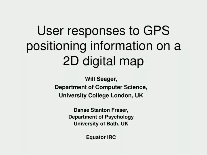
User responses to GPS positioning information on a 2D digital map. Will Seager, Department of Computer Science, University College London, UK Danae Stanton Fraser, Department of Psychology University of Bath, UK Equator IRC. Talk overview.

E N D
User responses to GPS positioning information on a 2D digital map Will Seager, Department of Computer Science, University College London, UK Danae Stanton Fraser, Department of Psychology University of Bath, UK Equator IRC
Talk overview • Describe the rationale, method, & results from a field experiment which examined user responses to GPS positioning information on a 2D plan-view digital map + draw some design lessons from the study
2D plan-view maps + GPS • Common format used in some research prototypes and most commercial products • Typically, the user is free to manipulate map using pan and zoom controls • Many incorporate positioning information (in outdoor contexts, GPS) • GPS is displayed as an icon overlaying the map; tracks the user’s changing position
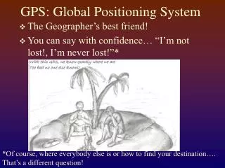
2D plan-view maps + GPS • In theory, positional information should simplify the cognitive work required to “self-locate” • With traditional maps, users self-locate by matching map & environment landmarks • Do this at the beginning, at the end, when lost, and on route to guide re-orientation decisions & for reassurance • Positioning information on mobile 2D digital maps should simplify the cognitive task: users simply need to perceive the position of the icon on the map.
2D plan-view maps + GPS • However, GPS is notoriously inaccurate • Factors such as tall buildings and atmospheric conditions can increase the amount of error =>Is positioning information supplied by GPS too inaccurate to be useful? =>Could the inaccuracy confuse users?
Field experiment • Carried out a field experiment • 24 participants were asked to navigate using a map-based application with and without GPS positioning information • Does positioning information lead to more effective navigation with respect to time taken and number of wrong turns? • What are participant’s subjective impressions of the information?
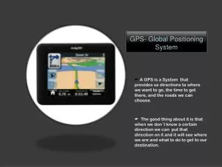
Map application • Tomtom Citymaps software • Main controls… • Pan by dragging stylus across screen • Change scale using a scroll bar • Application installed on an iPAQ 3630 handheld computer
Positioning information • Positioning information supplied by a Garmin eTREX GPS unit • Displayed as either… • A crosshair • An arrow • When “no fix”, last known estimate displayed as a clear circle • Map matching algorithm • Placed symbol on part of the street network nearest estimate
Positioning information • Positioning information supplied by a Garmin eTREX GPS unit • Displayed as either… • A crosshair • An arrow • When “no fix”, last known estimate displayed as a clear circle • Map matching algorithm • Placed symbol on part of the street network nearest estimate
Positioning information • Positioning information supplied by a Garmin eTREX GPS unit • Displayed as either… • A crosshair • An arrow • When “no fix”, last known estimate displayed as a clear circle • Map matching algorithm • Placed symbol on part of the street network nearest estimate
Automatic centring on GPS • Application included an automatic scrolling feature • Kept the map centred on the GPS icon • In a pilot study, participants found this feature confusing • The map moved when they weren’t looking • Interfered with how they wanted to position the map
Automatic centring on GPS • Interference with map positioning,,, Participants generally wanted to position the map so that two route markers were visible (e.g. the two waypoints)
Automatic centring on GPS • Interference with map positioning,,, With automatic centring on GPS, the map would “snapback” pushing one of the markers off-screen
Automatic centring on GPS • Interference with map positioning,,, To get both landmarks back on screen they had to zoom out to a lower scale Meant that map detail was harder to see
Automatic centring on GPS • Interference with map positioning,,, To get both landmarks back on screen they had to zoom out to a lower scale Meant that map detail was harder to see => Automatic centring on GPS switched off
Experimental design • Within-subjects design: each participant experienced all conditions • Conditions • Map software only • Map software + GPS positional information • Baseline paper map condition • Three routes • Conditions and routes counterbalanced • Experienced three routes in the same order but order of conditions varied (should control for route and order effects) • Dependents: timings & errors
Participants & routes • 24 participants (12 male and 12 female) • Unfamiliar with the area surrounding the routes • Routes in an urban area; no “urban canyons” • Each route… • Approximately 1 km in length • Included two waypoints • Successful navigation required 10 correct decisions • Routes indicated on the map using a markers for the starting position, the two waypoints and the destination
Procedure • Practice using zoom and pan controls • Shown symbols used for positioning information (crosshair, arrow & circle); told information could be inaccurate (lag & arrow direction) • Orientated (shown current position & how the map aligned with the environment) • Task: to navigate to the destination via the two waypoints, taking the shortest possible route • Timings; errors counted • Unstructured observations; comments on route; semi-structured interview
Timings • Main effect for timings • Post-hoc analyses revealed two significant contrasts: paper map versus other two conditions • So no evidence that positional information helped participants navigate more quickly
Errors • Main effect for errors • Post-hoc analyses revealed two significant contrasts: paper map versus other two conditions • So no evidence that positional information helped participants navigate with fewer errors
Qualitative results • Subjective impression of redundancy: • A large proportion of the participants said that the positional information provided by GPS was too inaccurate to be helpful. “because it lagged, I didn’t bother with it at all” “virtually no notice of the satellite thing. It’s too far behind. It’s nowhere near where I am so there’s no point looking at it” “not bothered about not having GPS…because it lags, it was not really useful...you are already half way down the road before it catches up with you”
Qualitative results • Clear that participants were still using traditional methods to self-locate e.g. comparing map and environment street names • Said it did not help to make navigation decisions or even provide reassurance • Could see the value of positioning information in principle but said it would need to be much more accurate (e.g. to within 5 meters)
Qualitative results Inaccuracy led to confusion… • Lag => participants thought they were further back than they really were => missed turns. • Failure of the map matching algorithm to place the position symbol on the correct street • Arrow misrepresenting actual heading i.e. pointing the wrong way Confusion despite warnings… “predisposed to thinking that technology is correct in spite of any warning that it might not be”
Qualitative results An unexpected benefit of positioning information… • Served as a useful “anchor point” when panning or zooming e.g. users could pan forwards and then re-located their position more easily • With map software only, users often got “lost on the map” i.e. when panning or changing scale, they lost track of their position (with paper maps, the current location page has a stable position with reference to the rectangular frame of the page; with atlases, it also has a stable page position)
Qualitative results Participants noted contexts where GPS might help… • In urban areas at the start of a journey • In urban areas when lost • In rural, mountainous or other areas where there were no street signs => Helps find general location “Good for mountains”
Conclusions • Conclusion from pilot study: automatic centring over GPS icon confuses users; • the map moves when not looking • it interferes with how they want to position the map • GPS positional information does not lead to significant gains with respect to improved journey timings or taking wrong turns • Strong subjective impression of redundancy; too inaccurate to be useful • Confusion (lag, failure of map matching algorithm and arrow) • Position icons help users to anchor their position when zooming or panning Overall conclusion: GPS positioning information helps users to find their general location but it’s not good enough during the navigational task itself to replace traditional self-location methods (i.e. map/environment landmark matching)
Re-design? • Dispense with the icon? • Only use GPS to position the map (but only in certain situations given problem with automatic centring on GPS)? E.g. The user switches the map on and it automatically presents the area of map surrounding his/her current position When lost, the user can press a button and it automatically centres on his/her position
Re-design? • Embody the level of accuracy in the icon? • A wider transparent icon could convey the level of accuracy • Constant size: reflects the average level accuracy of the GPS unit in that particular region • Or the size varies in response to the number of satellites, atmospheric conditions, urban/rural etc • Aids user to find general location (e.g. journey start, when lost, where no street names) but less likely to confuse • Still helps to anchor position when zooming, panning or looking away for long periods
Re-design? • Embody the level of accuracy in the icon? • A wider transparent icon could convey the level of accuracy • Constant size: reflects the average level accuracy of the GPS unit in that particular region • Or the size varies in response to the number of satellites, atmospheric conditions, urban/rural etc • Aids user to find general location (e.g. journey start, when lost, where no street names) but less likely to confuse • Still helps to anchor position when zooming, panning or looking away for long periods
Re-design? • Embody the level of accuracy in the icon? • A wider transparent icon could convey the level of accuracy • Constant size: reflects the average level accuracy of the GPS unit in that particular region • Or the size varies in response to the number of satellites, atmospheric conditions, urban/rural etc • Aids user to find general location (e.g. journey start, when lost, where no street names) but less likely to confuse • Still helps to anchor position when zooming, panning or looking away for long periods