Download
1 / 19
190 likes | 219 Views
Showcase how GIS & geospatial data benefit Metro business by addressing issues in surveying, asset management, emergency services, and more. Implementing GIS provides advanced functionalities, customization, and integration with various systems for efficient operations. GIS applications offer improved decision-making capabilities, asset monitoring, and quick access to data across departments.

E N D
Gis implementation for metro January 6, 2020
Objective of the Presentation This presentation attempts to showcase the potential advantage of using Geographical Information System (GIS) and geospatial data to address issues related to Metro Business. It discusses the various applications and analysis of these technologies in the field of Surveying, Right-of-Way Analysis, Asset Management, Site Suitability, Data Interoperability, Photo & Document Tagging, Emergency Responsive Services and integration of various System Generated Reports etc.
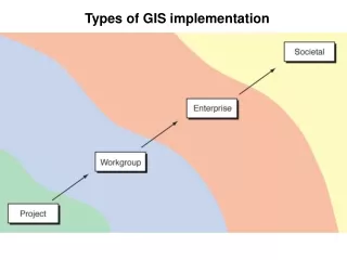
Components of GIS Environment • Architecture • System Integration • Relational Database (RDBMS) • System Functionalities, Customization and Open API’s • Data Interoperability • Cost
Asset Management Map Book Reports Site Suitability GIS – SAP Integration GIS LBS ROW Analysis Hyperlink 3D Model & Documents Emergency Evacuation Open Map API Integration GIS Applications and Analysis for Metro
GIS based Analysis & Applications for Metro : • Map Book for Metro II Corridor to Monitor Traffic Movement:
GIS based Analysis & Applications for Metro : • Identifying CCTV Location (Buildings) for Metro I & Metro II Corridor
GIS based Analysis & Applications for Metro : • ROW ANALYSIS FOR METRO II CORRIDOR
GIS based Analysis & Applications for Metro : • EMERGENCY EVACUATION
GIS based Analysis & Applications for Metro : • GIS & GOOGLE MAP INTEGRATION
GIS based Analysis & Applications for Metro : • GIS & GOOGLE IMAGERY INTEGRATION
GIS based Analysis & Applications for Metro : • 3-D Visualization of Metro I Corridor
GIS based Analysis & Applications for Metro : • HYPERLINKING OF DOCUMENTS IN WEBSITE
GIS based Analysis & Applications for Metro : • HYPERLINKING OF METRO I 3D STATION MODELS IN WEBSITE
GIS based Analysis & Applications for Metro : • HYPERLINKING OF METRO II 3D STATION MODELS IN WEBSITE
GIS based Analysis & Applications for Metro : • HYPERLINKING OF 3D CONSTRUCTION STATUS BETWEEN DN NAGAR AND AZAD NAGAR.
GIS based Analysis & Applications for Metro : • SPAD (SIGNAL PASSED AT DANGER) REPORT
Provide a single-window for Enhanced Visualization for better decision making. Mapping of Entire Topographic Data, Utility Data and Alignment Data. Proper Monitoring of Assets & their timely maintenance as they are widely spread. Provide one-stop graphical representation of Alignment Data overplayed on top of Open Map API’s (Google, Yahoo and Bing). Helps to perform various requirement based Analysis. Quick & Automated process to save time. Leverage anywhere, anytime connectivity and provide access of data to users across all departments. Benefits of Using GIS
It is imperative that for an effective and efficient implementation of Infrastructure Projects, particularly for projects which are Linear in nature, would require an Asset Management and Intelligent Decision Making capabilities, which can only be obtained by GIS Conclusion
Thank you January 6, 2020