Download
1 / 24
340 likes | 623 Views
KATHMANDU UNIVERSITY Dhulikhel , Kavre. Presentation on: OSM: Editing with JOSM. Presented to: Mr. Shashish Maharjan Department of Civil and geomatics engineering. Presented by: Binod Humagain(24) Buddha Lama(12) Kapil Aryal (01) Pawan Thapa (30) Robin Singh(21) Asish Giri (09).

E N D
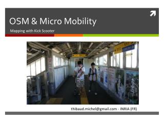
KATHMANDU UNIVERSITY Dhulikhel, Kavre Presentation on:OSM: Editing with JOSM Presented to: Mr.ShashishMaharjan Department of Civil and geomatics engineering. Presented by: Binod Humagain(24) Buddha Lama(12) KapilAryal(01) PawanThapa(30) Robin Singh(21) AsishGiri(09)
INTRODUCTION(OSM) • Maps with free data • OpenStreetMap website at http://www.openstreetmap.org/ • User account is required • Anybody can edit data in OpenStreetMap • Open StreetMap is collaborative map that is group of people can work together to gather information(dynamic map)
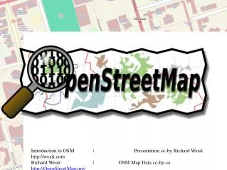
View of Open Street Map www.openstreetmaps.org
Editing Tools • OpenStreetMap editors such as Potlatch 2 and JOSM Potlatch 2 • Online editor Potlatch 2 • Allows to make edits directly to the OpenStreetMap database JOSM(Java OpenStreetMap) • The desktop editor JOSM • Download and can install on computer
Mobile phone editors Vespucci and Mapzen • Mapzen POI Collector is an application available for both Android and iPhones. • Mapzenis aimed to be easy to use and make it easy for ordinary people to start mapping easily. • Vespucci is an application for Android phones that can be used for GPS point gathering and basic OpenStreetMap editing. • Vespucci is aimed at more advanced users, tagging scheme used.
Editor JOSM • JOSM is the Java OpenStreetMap editor • Tool to download and edit maps created by the OpenStreetMap community • Don't have to be online to edit data • JOSM requires the Java Runtime Environment
Get JOSM • Go to the JOSM website at: josm.openstreetmap.de • (web page) • Click on the link for your system For Windows, click “Windows JOSM Installer” • Find .jar, the JOSM install file on your computer. Double-click it to begin setup and complete steps for installation. • At least version 1.6 of Java must be installed on system for JOSM to work
Learning basic Drawing with JOSM • Go to link http://www.learnosm.org/files/sample.osm click “Save File As..” and save the file in your drive. • Open the sample.osm, it opens with JOSM -The sample.osm appears as shown in the leftside figure.
Basic operations: • T o move the map left or right, up or down, hold your right mouse button down, and move your mouse. • To zoom in or zoom out: • You can scroll the mouse wheel as well • To select objects and features • Click left mouse button
Points, Lines and shapes • Points are single location represented by symbols. • Lines to represent linear such as road, river etc • Shapes to represent different area features such as forest buildings etc
Drawing Tools: • On the left side of JOSM, there is a column of buttons for drawing. Some important are: -Select, move, scale, rotate -Delete node or ways -Lasso selection -Make parallel copy of ways -create areas -Draw nodes -Zoom and move map -improve way accuracy node
Name objects or Features:(Add Presets) • To name the feature, use select tool to select the feature • Goto top menu >> Preset • From the preset menu you can select the appropriate preset for feature • In the pop up window, give the name and click apply preset
Changing objects • First select this tools from drawing bar • Click the object and hold on with left mouse button down and drag the object you can move the object • You can also change the shape of the feature, click and hold the left mouse button and drag
Editing Open Street Maps: steps • Step 1: Download • Get the current map data from OSM • Step 2: Edit • Modify the map using GPS, Walking Papers and notes as a guides. • Step 3: Save • Save changes to OpenStreetMap.
Prepare JOSM • Open JOSM • Load your gpx file, or walking paper map by • Menu>>File>>Open.. • JOSM supports *.gpx,*.osm,*.jpg etc formats
Download OSM Data • Before we edit, download existing OSM data of the area from OpenStreetMap • To download we need to be connected to the internet • Click “File”>>”Download from OSM”, as we have loaded the *.gpx into JOSM, it is easier to download the OpenStreetMap data of this area. • This open up the download window
Download OSM Data • When download window opens, you can see a map with a pink box drawn on it • It you can’t see map click “Slippy map”. • You can resize the pink box, to get the required area of map for editing. • After getting the appropriate size and require location, click “Download” from download window • Finally the JOSM will get the data and open it in your map window.
Edit: • Using different drawing tools, you can change, move, resize, rename, delete, add different features in the map to correct them • Digitize the GPS tracks, way points using draw tools • For every objects, select the appropriate presets and name them
Upload Changes: After finished making changes, improvements, corrections in the OSM map, • Go to top menu ,Click “File”>>”Upload Data” • This open up the upload window, then click “Upload Changes” • If is your first time to change OSM, it will ask for your username and password • Click “Authenticate”, after providing username and password. • Note: you need to be connecte to internet to save changes to OSM • Finally, you can see your apply changes in openstreetmap.org
Keyboard Shortcuts: JOSM • s – Choose the Select tool • a – Choose the Draw tool • z – Choose the Zoom tool • + (plus) – Zoom in • - (minus) – Zoom out • p – Split way • c – Combine way • o – Align in circle • l – Align in line • q – Orthogonalize (make a shape square)
References • http://booki.flossmanuals.net/openstreetmap/ • http://www.openstreetmap.org/ • josm.openstreetmap.de