Download
1 / 32
350 likes | 579 Views
Tropical Meteorology Jeff Gawrych Met. 10. Introduction. Tropical weather is very different than our mid-latitude weather. No fronts, little day-to-day variation Tropical weather systems form due to warm air rising (convection). Thermodynamics says

E N D
Introduction • Tropical weather is very different than our mid-latitude weather. • No fronts, little day-to-day variation • Tropical weather systems form due to warm air rising (convection). • Thermodynamics says • Heat added to system will increase the temperature and increase ability to perform work • Warm oceans are fuel • Latent heat release when warm air rises and condenses • Tropical storms and hurricanes act like heat engines
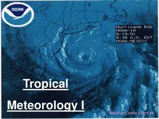
Background • Tropical cyclones/Hurricanes are perhaps the most severe of the weather phenomena. They can cause both massive property damage and loss of life. • in 1972 a TC killed an estimated 300,000-500,000 people in Bangladesh. • in 1992 Hurricane Andrew hit the southern US. • in 1999 created massive flooding & mud slides in Honduras and Guatemala • in 2004, 4 hurricanes hot the Florida coast. Charley, Frances, Ivan, Jeanne. • http://www.cnn.com/SPECIALS/2004/hurricanes/interactive/hurricane.paths/index.html
ITCZ • Inter-Tropical Convergence Zone • defined as the result of the equatorial Hadley cell where air converges near the equator, rises and diverges near the tropopause • Creates large thunderstorms called hot towers. • Usually between 5 and 10 degrees latitude.
Definition • These phenomena are commonly known as • _______________ (Indian Ocean & South Pacific), • _______________ (Atlantic and Eastern Pacific) • _______________ (North Pacific). • Tropical storms differ considerably from mid-latitude cyclones: For example, tropical storms have Tropical Cyclones Hurricanes* Typhoons * Named for Carib god of evil: Huracan Warm core No fronts Strongest wind near the surface
Stages of development • Tropical Disturbance: • Tropical depression: • Tropical storm: • Hurricane: mass of thunderstorms with slight wind circulation Some organization some closed isobars and winds 20-34 knots (more organization) packed isobars, winds 35-64 knots when winds above 64 knots (74 mph)
Atlantic Hurricanes… • Begin with easterly waves • Form as the Sahara Desert intensely warms up in the summertime • Wind blows to the west at ~ 15 deg. N • Triggers thunderstorm formation
Recipe for Tropical Cyclone Formation • Warm ocean temperatures (T> 80F): • Typical in subtropical Atlantic/Pacific in summer/early fall • N. H. hurricane season: • Rotation: • Thunderstorms must organize to produce converging air • Cannot form at equator • Weak winds: • June-November • Coriolis force=0 • Strong wind can disrupt organization
Hurricane movement • Steered by prevailing winds • Easterly winds of tropical latitudes • Westerly winds of middle latitudes • Middle latitude high/low pressure systems can cause quick changes in hurricane position. • Often challenging to predict!!
Evolution • Tropical cyclones are driven by the warm ocean temperature • Thus, they will weaken and eventually die when they move over
Evolution • Tropical cyclones are driven by the warm ocean temperature • Thus, they will weaken and eventually die when they move over • land or • colder waters.
Formation 15% 12% 12% 30% 12% 12% 7%
Hurricane Structure • Eye of hurricane • Extremely low pressure, • weak winds and generally clear skies • Eye wall • Intense thunderstorms • Strongest winds, heaviest precip • Spiral rain bands • Areas corresponding to upward motion and heavy rain • Alternating with rain free areas
Why is eyewall the most intense part of the Hurricane? • Law of Conservation of angular momentum • Wind speed (v) X distance from axis of rotation (r) must remain constant • Close to eye --> r is small --> v must be large • Far from eye --> r is large --> v is small
Hurricane Destruction • Winds can have speeds over 100mph. • Extensive damage to buildings and vegetation. • Storm surge: • Hurricane may spawn tornadoes. abnormal rise in ocean level responsible for most damage via flooding