Download
1 / 30
880 likes | 1.76k Views
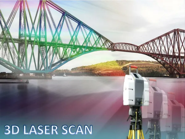
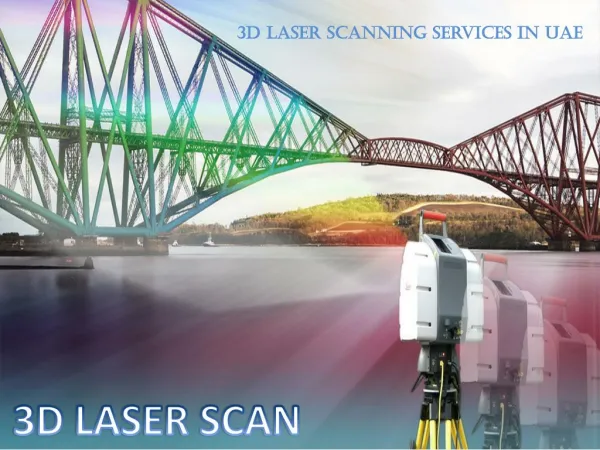
3D Laser Scanning. Laser Scanning Definitions : 1.) Laser Scanning: High speed reflector-less distance measurements coupled with angles used to produce a 3D “Point Cloud” 2.) Point Cloud – collection of 3D coordinate nodes that spatially depict a scene.

E N D
Laser Scanning Definitions: 1.) Laser Scanning: High speed reflector-less distance measurements coupled with angles used to produce a 3D “Point Cloud” 2.) Point Cloud – collection of 3D coordinate nodes that spatially depict a scene. 3.) Point Cloud Software – database driven, highly graphic intensive software that allows rich point cloud manipulation and computation 4.) Accuracy – 3D spatial uncertainty
Laser Scanning Benefits: • Reduction - Direct labor costs of field data collection. • Increased Safety of collection efforts • Tool for launching into new markets and services • Can provide traditional deliverables from scan data • Ownership of the data: • Completeness of data sets for deliverables and checks • Recurring service fees from one data set • More accurate finished product – higher density data
Reduced errors and rework: • Traditional methods: Greenfield projects see excess of 1% of the project budget to errors and rework, and Brownfield projects see excess of 5 – 10% of the project budget to errors and rework • Laser scanning methods: achieve better, faster, cheaper and lower-risk project execution by reducing errors and rework. Virtually eliminates Greenfield project errors and rework, and laser scanning reduces Brownfield project errors and rework by 2-5% • Contractor benefits: increased competitiveness and profitability • Business benefits: faster time to market, fewer days of lost production and reduction of concerns in public safety and environment
Technology drivers • Advantages over traditional methods • Accuracy: laser scanner’s direct digital measurement and recording of existing conditions reduces project execution risks and field rework • Speed: with the ability to capture thousands of point per second, laser scanning greatly improves productivity • Completeness: Laser scanning provides a more complete capture of existing conditions and reduces the potential for errors in new design work • Laser scanner measure methods • Time-of-flight: calculate distance by measuring the time of flight of a laser pulse. Good for long ranges and accuracy • Phase-based: measure distance by calculating phase differences in the laser beam. Good for short ranges and scan rate
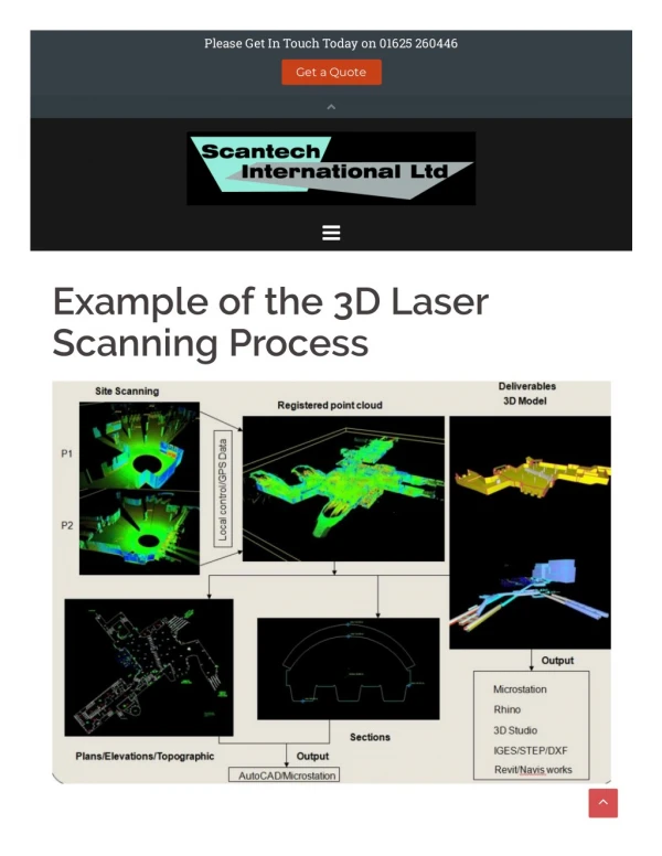
Work process practices • When to use laser scanning: • Completing manual methods are to expensive by comparison • Completing methods introduce safety risks • When methods provide inadequate level of detail • When other methods would take too long • When errors represent a significant risk to project cost and schedule • Laser scanning project: • Determine the deliverable: work with customer to determine deliverable to guard against unnecessary work • Execute scanning project: use proper field techniques to capture desired data and determine registration method and set targets accordingly • Manage point-cloud data: process data to meet customer’s deliverable
Deliverables • Process and power: • 3D models: of piping and building interiors to accurately map alignments of pipes and interior features for retrofit, new equipment install and capture of existing conditions • 2D drawings: traditional drawings for as-built conditions, documentation and biding • Snapshot Photos or Images • Civil, building and transportation: • 3D models: of existing conditions used for retrofit, road design, historic preservation and expansion design • 2D drawings: traditional drawings for as-built conditions, documentation, point creation and biding • Point clouds with 3rd Party Software
Laser Scanning Best Practices • Finish level one learning curve before attempting the first real project. • Find inside technical champion that wants to drive it… • Start using on existing projects immediately – even if only an hour a day. • Most projects require that you mix scanning data with traditional survey data. (Total Station or RTK data) • Deliver Snap Shots and Fly thru videos with your fee proposals as well as final deliverables. • Bill by the job – not the hour if possible • Branch well outside your traditional client list • Don’t “Over Scan” the project • Utilize other 3rd party software including point cloud viewers • Focus on developing “solution” workflows and deliverables; i.e. don’t just scan to say you scanned.
GLS-1000 Standard Components • Head cover • Plastic carrying case w/casters • 2 BC-30D battery chargers • 2 chargers, 2 AC-12 AC/DC converters & 2 AC cables • 4 BT-65Q batteries • 1 SD card
2005 update Market Volume and Forecast Forecast(Hardware, Software, Services) Market volume is expanding at a rate of 30-40% annually SPAR Point Research LLC http://www.sparllc.com
Scanning Applications? Road/intersection • Cross sections • DTM surfaces • Profiles • Grid Topo Alta surveys (Supplement) Volumes • Materials • Stockpiles • Quarries Forensic surveys • Accidents • Homicides • Event planning Historical preservation Industrial – Structural As-Builts • Renovations – Retrofits
Historical Preservation Scan data 2D Drawings 3D Animation
GLS-1000 Demo With Scan Master Software
Deliverables from Scanning • Mesh Surfaces • 3D Polylines – Cross Sections etc.. • Elevation Visuals • 3D Coordinate Nodes • AVI Movie Fly Thru • Models
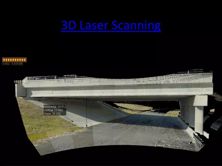
Modeling Examples • Stone Pile Volumes • Rural Road Topographic Survey • As-Built Historic Bridge
Exciting New Developments • Clear Edge 3D Software – Edge Detection Software and advanced filtering • 3D Fusion - Ground Penetrating Radar (GPR) integrated with laser scanning – map undersurface voids, rebar, and structures • Safe – highly detailed surface analysis • More downstream point cloud processing capabilities
ClearEdge 3-D Software Action 1 – Remove unwanted noise from Point Cloud Action 2 – Model Edges and Solid Fill – Arch. Application
Kubit “Point Cloud” Software • AutoCad Application • Allows for point cloud manipulation in AutoCad • Use regular AutoCad commands • Basis for creating Model if desired • Pull 3D dimensions