Download
1 / 19
190 likes | 380 Views
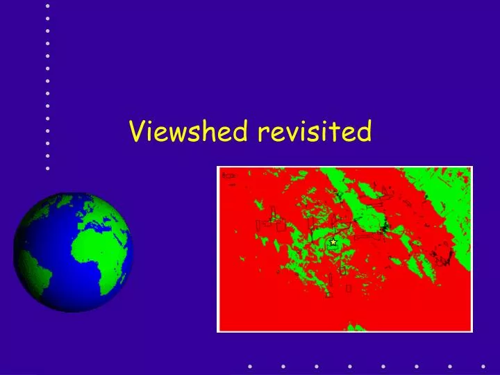
Viewshed revisited. Plan for next 4 sessions. Today is more on Viewshed and models Thursday is on finding shortest (least cost) pathway between A and B Next Tuesday is Hydrology Last class is a summary Presentations on 12/13 5 to 7+ in 140 Baker - refreshments provided!. How it is done.

E N D
Plan for next 4 sessions • Today is more on Viewshed and models • Thursday is on finding shortest (least cost) pathway between A and B • Next Tuesday is Hydrology • Last class is a summary • Presentations on 12/13 5 to 7+ in 140 Baker - refreshments provided!
How it is done • Master the GDB way of working • Smooth the DEM • Make a Hillshade of the DEM • Create the viewpoint (observer) FC • GDB, Rt Click, New, etc • Make sure the projection is correct • Edit to make point(s) and edit table • RUN Viewshed.
The GDB thing • The file GDB is faster but the personal GDB is surer • Have a Master GDB • Create project GDBs • Copy and paste (or drag) the needed data from the master GDB to the project GDB
Making the viewpoint • Click on the project GDB and select New • Make sure you get the right kind of output file (POINT, POLY, ETC.) • Make sure you have the projection right • Create the attribute file fields as the last step in creating the FC • I used Double for all fields EXCEPT ID (short integer)
These fields are inputs • SPOT – absolute elevation for viewpoint (observer) - use for airplanes. If the SPOT field is = zero (?) or not present then the elevation from the DEM is used. • OFFSETA - Adds an offset or extra height to the elevation at the viewpoint • OFFSETB - Adds a constant elevation to all non-viewpoint cells (unimportant in VISIBILITY analysis) • AZIMUTH1 AND AZIMUTH2 define the starting compass angle and ending compass angles. If not there then these values are 0 and 360 degrees • VERT1 and VERT2 define the angles above and below the horizon (respectively) to limit visibility. + above, - below • RADIUS1 and RADIUS2 limit the circles of search. Distances < RADIUS1 and distances > RADIUS2 are not searched, Creates a donut of search areas.
These fields are inputs • SPOT – absolute elevation for viewpoint (observer) - use for airplanes. If the SPOT field is = zero (?) or not present then the elevation from the DEM is used. • OFFSETA - Adds an offset or extra height to the elevation at the viewpoint • OFFSETB - Adds a constant elevation to all non-viewpoint cells (unimportant in VISIBILITY analysis) • AZIMUTH1 AND AZIMUTH2 define the starting compass angle and ending compass angles. If not there then these values are 0 and 360 degrees • VERT1 and VERT2 define the angles above and below the horizon (respectively) to limit visibility. + above, - below • RADIUS1 and RADIUS2 limit the circles of search. Distances < RADIUS1 and distances > RADIUS2 are not searched, Creates a donut of search areas.
Simple Example • Simple it may be but it is most common form of viewshed • Want to place a TV tower in Martinsburg to broadcast to folks in town • So created a viewpoint with the following…
Another But • Wanted to reach residences • Well, did not do much of a job of that! • So • Made tower higher: 90m • Ran again • Hummm – not real good even at that height • Fix?
Another Problem • What about trees? • Make 60 feet or 20m tall • And?
OK who gets TV? • How to see how well the tower will serve the residential properties • Select by attribute CLS between 200 and jlt 300 • Classify viewshed • Convert GRID to Poly and make a FC that is just the residential properties
Now do a… • Select by Location to find parcels that ????? • Intersect? • Contain? • Are completely within?
Numbers aren’t great! • May have to put a repeater in the valley!
Using the modeler • Don’t use File GDB – I had lots of trouble when using the modeler • In any case you have to be really careful about naming and when the results go • I using multiple tower heights you can…
Multiple tries • Easy way is the edit the viewpoint files --- Change the height • I tried copying the tower FC and then editing it – don’t do it – make a new FC! • Hard way is to copy and paste the model into a new model and then change the output names – ran into all kinds of trouble.
Thursday • Finding least cost pathways for traveling between point A and B • Windfarm at top of Martinsburg • Get power to one of the substations • prefer close to roads but not near existing transmission lines • Prefer Ag to forest lands • Don’t like wetlands