Download
1 / 61
610 likes | 727 Views
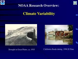
Present-Day climate variability. Objectives: ENSO mode AO and NAO mode PDO .

E N D
Present-Day climate variability Objectives: ENSO mode AO and NAO mode PDO UNBC
Anomaly : The deviation from the mean. To calculate SST anomalies, the long-term mean for a specific point in the ocean is subtracted from the current value. A negative value indicates that the current value is cooler (smaller) than usual, while a positive value indicates that the current value is warmer (larger) than usual. For example: • The Nino 3.4 value for December 2003 26.9 °C • The long-term mean for the Nino 3.4 region 26.5 °C • Anomaly = current value - mean = 26.9 - 26.5 = 0.4 UNBC
ENSO MODE UNBC
South American fishermen have noticed the appearance of warm waters in the eastern Pacific Ocean along the coast of Ecuador and Peru. As the phenomenon typically becomes apparent around Christmas, the name "El Niño", or the Christ Child was eventually used. • La Niña: A cooling of the ocean surface off the western coast of South America, occurring periodically every 4 to 12 years and affecting Pacific and other weather patterns. UNBC
Recognizing El NiñoEl Niño can be seen in Sea Surface Temperature in the Equatorial Pacific Ocean UNBC
ENSO • A scientific definition of ENSO events: When the three-month running mean of the SST anomalies in the Nino 3.4 region are greater than or equal to 0.5°C, there is a good chance of an El Niño event taking place. When the anomalies are smaller than or equal to -0.5°C, there is a good chance of a La Niña event taking place. UNBC
Scientists who studied El Niño • Sir Gilbert Thomas Walker • Credited with the discovery of El Niño • Identified the Walker Circulation • His findings represented invaluable steps forward UNBC
Scientists who studied El Niño • Dr. Klaus Wyrtki is now best known for his • ENSO research from the 1970s to 1993. • Developing breakthroughs in understanding and forecasting El Niño • Establishing the tide gage network that provided the essential oceanographic data set. UNBC
Scientists who studied El Nino • Jacob Bjerknes • Took Walker’s idea of El Niño one step further and suggested that many long-term variations in the world’s climate may be due to large-scale interactions between the oceans and the atmosphere UNBC
Irregularity of ENSO (1) noise internal to either the atmosphere or ocean (2) inherent nonlinearity of the coupled atmosphere/ocean system (or in the coupling itself); (3) changes in the external forcing; (4) interactions between ENSO and the seasonal cycle UNBC
Seasonal Cycle and ENSO Is the seasonal cycle necessary for ENSO to be realized? Not likely: Many models without an annually varying sun have proven successful at simulating interannual variability that is ENSO-like. Is the seasonal cycle fundamental to the irregularity in the ENSO events? Many models are run without an annually varying sun and the ENSO events that they produce occur irregularly. However, ENSO is sufficiently tied to the annual cycle that it is useful to think of a canonical ENSO event, formed by compositing observations fixed to the calendar year. UNBC
Effect of ENSO on Climate • In the Tropics, El Niño episodes are associated with increased rainfall across the east-central and eastern Pacific and with drier than normal conditions over northern Australia, Indonesia and the Philippines. Elsewhere, wetter than normal conditions tend to be observed 1) during December-February (DJF) along coastal Ecuador, northwestern Peru, southern Brazil, central Argentina, and equatorial eastern Africa, UNBC
2) Wetter during June-August (JJA) in the intermountain regions of the United States and over central Chile. Drier than normal conditions generally observed over northern South America, Central America and southern Africa during DJF, and over eastern Australia during JJA. UNBC
La Niña UNBC
La Niña UNBC
Flooded area in Lakeport, California as a result of the 1998 El Nino event. (Federal Emergency Management Agency) UNBC
Bush fire in Australia as a result of the 1998 El Niño event. (Photo courtesy of Fred Hoogervirst/Panos Picture/London) UNBC
Temperature UNBC
Difference in maximum Snow depth in millimeters between El Niño and La Nina and Neutral years El Niño EL Niño La Niña UNBC
The map shows typical summer precipitation response following the onset of El Niño. The numbers indicate the rate of precipitation (mm/day) by which the precipitation departs from the seasonal normal. UNBC
Significant impacts of ENSO on Canadian natural resources and environment have been documented in a variety of areas including water resources, agriculture, forestry, fisheries, power utilities, coastal zones and other climate sensitive sectors of the Canadian economy. (1)the fishery of British Columbia. (2) forestry … Hsieh and Tang, 2001. Interannual variability of accumulated snow in the Columbia basin, British Columbia. Water Resources Res. 37: 1753-1760. Hsieh, W.W., B. Tang and E.R. Garnett, 1999. Teleconnections between Pacific sea surface temperatures and Canadian prairie wheat yield. Agricul. Forest Meteorol. 96: 209-217. UNBC
During El Nino, as the sea surface temperature (SST) is above normal off B.C., the returning Fraser River sockeye salmon (with yearly landed value of about $600 million) favor traveling via the northern route of Johnstone Strait instead of the more commonly used southern route of Juan de Fuca Strait. Many fishermen with fishing permits on the west coast of Vancouver Island suffered heavy losses in 1997 as the sockeye bypassed their area. • Other impacts occur in forestry. During El Nino, temperatures in the BC interior, especially in winter, are above normal and summer precipitation is typically below normal. Mountain pine beetle and forest fires are the two major natural disturbance agents in interior forests. A warm winter climate is favorable to mountain pine beetle survival and has recently led to a severe increase in lodgepole pine mortality. At the same time fire risk increase under warm and dry summer conditions. UNBC
1997-1998: El Niño induced mild weather helped to significantly reduce motor vehicle accidents on B.C. roads. The ICBC reported that it enjoyed a substantial economic benefit this winter. The insurance corporation realized a saving of $3 million per day owing to the mild winter weather. UNBC
2002-2003: El Nino spawned storms brought damaging winds to southwestern B.C. in early January. Winds gusting over 110 km/h toppled two mobile towers, each worth about $15 million, at the shipping docks near Vancouver. UNBC
How can sea surface temperatures in the tropical Pacific Ocean have any bearing on the weather that occurs in northern America? i) Atmospheric circulation ii) Oceanic Circulation iii) Atmospheric teleconnection UNBC
1) a pronounced eastward extension of the midlatitude jet stream to the extreme eastern Pacific, and 2) an equatorward shift of the jet streams over the eastern Pacific. Overall, these conditions reflect an increasing zonally uniform distribution of both temperature and winds across the Pacific basin, and are a major factor affecting the winter weather patterns and storm tracks in the middle latitudes over both North and South America. Atmospheric circulation UNBC
Oceanic circulation • The warm water propagates poleward along the west coast of North America by coastally trapped Kelvin waves; encounters the steep Mendocino escarpment off California (about 41N) and is capable of propagating past the escarpment (Allen and Hsieh 1997). Propagation north of 41N was observed during an El-Nino (Huyer and Smith 1985). UNBC
PNA (Pacific-North American Pattern)AO (Arctic Oscillation)NAO (North Atlantic Oscillation)PDO (Pacific Decadal Oscillation) • Atmospheric Teleconnection UNBC
How is ENSO currently detected and predicted? • Satellites provide data on tropical rainfall, wind, and ocean temperature patterns, as well as changes in conditions for hurricane formation. • Ocean buoys help to monitor sea-surface and upper ocean temperatures. • Radiosondes help to monitor global weather and climate patterns, and to monitor and predict El Niño and La Niña influences on U.S. weather. High-density surface data network helps to monitor and predict El Niño and La Niña influences on U.S. weather. • Super computers are used to gather all of the weather data around the world and put it into useful formats used by scientists. They also run sophisticated computer models to help scientists better understand and predict El Niño and La Niña. • An entire suite of diagnostic and prediction tools run on high-speed computers that allow El Niño and La Niña to be monitored in near-real time. UNBC
Predictions of ENSO (1) statistical models (2) dynamical models UNBC
PNA:4 centers: Hawaii(20N,160W);North Pacific Ocean (45N 165W); Alberta (55N 115W); and the Gulf Coast region of USA (30N 80W) PNA UNBC
Red, black, and blue contours on the maps indicate positive, zero, and negative values, respectively UNBC
The PNA is associated with aRossby wave pattern with centers of action over the Pacific and over N. America. PNA index = ½ [ Z (20N,160W)-Z(45N,165W) +Z(55N, 115W)-Z(30N, 85W)] UNBC
PNA is one of the most prominent modes of low-frequency variability in the Northern Hemisphere extratropics. The positive phase of the PNA pattern features above-average heights in the vicinity of Hawaii and over the intermountain region of North America, and below-average heights located south of the Aleutian Islands and over the southeastern United States. UNBC
The positive phase of the PNA pattern is associated with above-average temperatures over western Canada and the extreme western United States, and below-average temperatures across the south-central and southeastern U.S. The PNA tends to have little impact on surface temperature variability over North America during summer. The associated precipitation anomalies include above-average totals in the Gulf of Alaska extending into the Pacific Northwestern United States, and below-average totals over the upper Midwestern United States. • Although the PNA pattern is a natural internal mode of climate variability, it is also strongly influenced by the El Niño/ Southern Oscillation (ENSO) phenomenon. The positive phase of the PNA pattern tends to be associated with Pacific warm episodes (El Niño), and the negative phase tends to be associated with Pacific cold episodes (La Niña). UNBC
AO is the dominant mode of mean-monthly sea levelpressure variability over the Northern Hemisphere withan out-of-phase relation between the sea level pressure over the Arctic basin and that at the mid-latitudes (Thompson and Wallace 1998). AO UNBC
AO Index UNBC
What is the NAO ? Sometimes AO is also referred to as the North Atlantic Oscillation (NAO) due to its strong manifestation over the Atlantic sector. A large-scale mode of natural climate variability having large impacts on weather and climate in the North Atlantic region and surrounding continents. UNBC