Download
1 / 1
10 likes | 117 Views
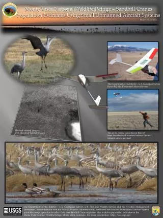
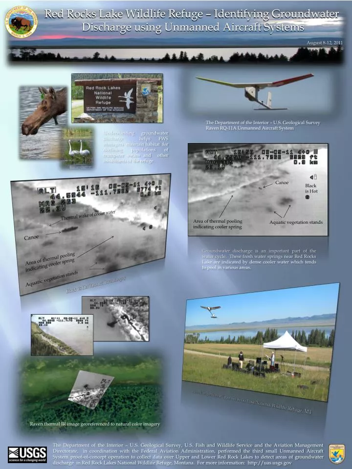
Red Rocks Lake Wildlife Refuge – Identifying Groundwater Discharge using Unmanned Aircraft Systems. August 8-12, 2011. The Department of the Interior – U.S. Geological Survey Raven RQ-11A Unmanned Aircraft System.

E N D
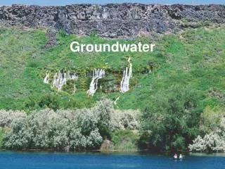
Red Rocks Lake Wildlife Refuge – Identifying Groundwater Discharge using Unmanned Aircraft Systems August 8-12, 2011 The Department of the Interior – U.S. Geological Survey Raven RQ-11A Unmanned Aircraft System Understanding groundwater discharge helps FWS managers maintain habitat for declining populations of trumpeter swans and other inhabitants of the refuge. Canoe Black is Hot Area of thermal pooling indicating cooler spring Aquatic vegetation stands Thermal wake of cooler water Canoe Area of thermal pooling indicating cooler spring Aquatic vegetation stands Groundwater discharge is an important part of the water cycle. These fresh water springs near Red Rocks Lake are indicated by dense cooler water which tends to pool in various areas. Black is Hot Thermal Raven Imagery Raven UAS operations at Upper Red Rocks Lake, National Wildlife Refuge, MT Raven thermal IR image georeferenced to natural color imagery The Department of the Interior – U.S. Geological Survey, U.S. Fish and Wildlife Service and the Aviation Management Directorate, in coordination with the Federal Aviation Administration, performed the third small Unmanned Aircraft System proof-of-concept operation to collect data over Upper and Lower Red Rock Lakes to detect areas of groundwater discharge in Red Rock Lakes National Wildlife Refuge, Montana. For more information: http://uas.usgs.gov