Download
1 / 65
700 likes | 1.11k Views
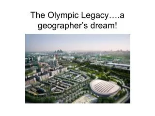
Geographer’s Toolkit. Geographer’s Toolkit. Table of Contents What is a Map? Features on a Map - “Map Essentials” Map Labelling & Colouring Map Symbols Locating Places on a Map Compass Rose Bearings Grid System Alphanumeric Grid Military Grid Latitude and Longitude GPS Time Zones

E N D
Geographer’s Toolkit Table of Contents • What is a Map? • Features on a Map - “Map Essentials” • Map Labelling & Colouring • Map Symbols • Locating Places on a Map • Compass Rose • Bearings • Grid System • Alphanumeric Grid • Military Grid • Latitude and Longitude • GPS • Time Zones • Mapping Your Location • Scale • Large and Small Scale maps • Mapping Our Location • Types of Maps • General Purpose Maps (Road Maps) • Topographic Maps • Thematic Maps • Advanced Map Types • Digital Maps • Reading and Interpreting Maps • Reading Maps Exercise #1 • Interpreting Maps Exercise #2 • Chapter Assignment • Political Map of Canada • Drainage Map of Canada
What is a Map? • A map is a representation of the Earth’s features drawn on a flat surface. • Maps use symbols and colours to represent features of an area, simplifying the real world.
Mapping Exercise • Using the provided map, in your group list the six basic features of a map – the “map essentials”. These are the things that are required on every map you create! • You’ll always want to add a “seventh” map essential for purposes of a school assignment: your first and last name. • Look at the Legend, become familiar with some of the common Map Symbols used in cartography.
Features on a Map • Title – identifies the area shown, topic, focus, or purpose of the map • Legend – explains the meaning of symbols and colours used on the map • Scale – represents the relationship between distance on the map and distance in the real world • Direction – often represented with an arrow • Border – sets the map apart from other information • Date of Publication – indicates how recent the map is
Map Labelling & Colouring • Cartography is the art of drawing accurate, easily readable, attractive maps. • Labels • Should be neatly printed • Should be spelled correctly • Should be parallel to the base of the map (except for natural features such as rivers and mountain ranges) • A dot should be used to locate cities, with the name of the city as close to the dot as possible.
Map Labelling & Colouring • Labels (continued) • Larger features usually have larger labels • Labels for similar features should be the same size and font – for example: • Water Body • City • PROVINCE • C O U N T R Y • Labels should not block other information on the map
Map Labelling & Colouring • Colouring • Maps should be properly colour coded to show the different areas on the map • Shade consistently so that there are no light or dark patches of one colour within one feature • Use solid colours only, not shading patterns • White or black are not acceptable shading colours • Grey should be used for areas not important to the map • Blue should only be used for water bodies
Locating Places on a Map • There are several ways we can locate places or items on a map: • Compass Rose • Bearings • Grid System a. Alphanumeric Grid b. Military Grid c. Latitude and Longitude • GPS • Time Zones
Locating Places on a Map: 1. Points on a Compass • A compass is a way of finding direction • The four cardinal points are N, E, S, W • The twelve ordinal points are NE, SE, SW, NW, NNE, ENE, ESE, SSE, SSW, WSW, WNW, NNW • The points all have corresponding degrees of a circle (0° → 360°)
Locating Places on a Map: 2. Bearings • Directions can be given more accurately in degrees, otherwise known as compass bearings are used. • These measure the angle of direction in relation to North, moving in a clockwise direction. • This is more accurate because all points of the compass rose, from 0° to 360° can be used.
Locating Places on a Map: 3. Grid Lines - a. Alphanumeric Grid • Alphanumeric Grid • This system uses LETTER and NUMBERS to identify squares in a grid pattern. • Mainly used on Road Maps.
Locating Places on a Map: 3. Grid Lines - a. Alphanumeric Grid • How it works: • The LETTERS represent the horizontal lines. • The NUMBERS represent the vertical lines. • This grid type is not as accurate as the Military Grid System or Latitude/Longitude
Locating Places on a Map: 3. Grid Lines - b. Military Grid • Military Grid • A grid of lines (eastings and northings) is used to identify squares in a grid pattern. • EASTING – a vertical line running from top to bottom of the map. • NORTHING – horizontal line across the map. • This grid system is used mainly on topographic maps. • Why was the Military Gird introduced? • It was easier to place a grid system on a map then to use degrees, minutes and seconds from a globe. • With the increasing range of artillery in WWI, latitude and longitude was too cumbersome.
Locating Places on a Map: 3. Grid Lines – c. Latitude and Longitude • Latitude • imaginary lines that measure the distance north or south of the Equator (0°) • lines are parallel to the Equator at regular intervals (approximately 111 kilometres apart)
Locating Places on a Map: 3. Grid Lines – c. Latitude and Longitude • Longitude • imaginary lines that measure the distance east or west of the Prime Meridian (0°) • all lines begin and end at the poles and therefore are not at a fixed distance apart • the Prime Meridian (0°) was arbitrarily chosen at a point that runs through Greenwich, England • the International Date Line (180°) is the point where one day begins and one day ends
North Pole Longitude line Equator Latitude line Coordinate System Position - Latitude and Longitude Example: Degreso Minutes’ Seconds” 39o 58’ 55” N 075o 28’ 45” W South Pole
Locating Places on a Map: 3. Grid Lines – c. Latitude and Longitude • The Prime Meridian
Locating Places on a Map: 4. GPS • Global Positioning System: • Orbiting satellites send radio signals to earth that a GPS unit uses to calculate its latitude and longitude, its location. • Signals from at least three satellites are needed by a GPS unit to determine its location. • Some uses: • Used in a car to show the user where they are and what roads to take to reach their destination. • Track animals • Monitor the process of delivery trucks.
Locating Places on a Map: 5. Time Zones • Time Zones are geographically assigned • Invented by Sir Sanford Fleming (1888) to help with train schedules. Prior to time zones everyone kept their own time for an area. • Imagine thousands of areas = thousands of different times.
+12 +11 +10 +9 +8 +7 +6 +5 +4 +3 +2 +1 0 -1 -2 -3 - 4 -5 -6 -7 -8 -9 -10 -11 -12 Y X W V U T S R Q P O N Z A B C D E F G H I K L M7
Locating Places on a Map: 5. Time Zones • There are 24 major times zones • There are a few weird ones as well (1/2 hour zones) • There are even time zones that change when you cross the street • Beacon Hill and Mexico Beach, Florida. Cross the street (18’ of asphalt) and you are in a different city and time zone. One is eastern and the other is central
Locating Places on a Map: 5. Time Zones • Time Definitions : • Daylight Savings Time • SPRING AHEAD , FALL BACK • +5 becomes… • +4 • -9 becomes… • -10
Locating Places on a Map: 5. Time Zones • Problems: • Time change riots • Customers of bars that stay open past 2 am lose one hour of drinking time on the day when Daylight Saving Time springs forward one hour…
Locating Places on a Map: 5. Time Zones There are 6 time zones in Canada • Time Zones
Scale • Scale shows the relationship between the distance on a map and the actual distance on the Earth’s surface • Direct Statement Scale uses words to describe what a distance on a map represents in the real world • 1 cm = 10 kilometres • Linear Scale uses a special ruler on a map to show what a distance on a map represents in the real world • 0 km 400 km • Representative Fraction Scale is a ratio where one unit on a map represents a specific number of the same unit in the real world • 1:50 000 (1 cm on the map represents 50 000 cm in the real world)
Scale – Mapping Our Location • Burnhamthorpe Adult Learning Centre You are here!
Scale – Mapping Our Location • Burnhamthorpe Community Map You are here!
Scale – Mapping Our Location • City of Toronto Map You are here!
Scale – Mapping Our Location • GTA Map You are here!
Scale – Mapping Our Location • Southern Ontario Map You are here!
Scale – Mapping Our Location • Ontario Map You are here!
Scale – Mapping Our Location • Canada Map You are here!
Scale – Mapping Our Location • World Map You are here!
Types of Maps • We need different types of maps to portray different information. • The three most common types of maps are: • General Purpose Maps (Road Maps) • Topographic Maps • Thematic Maps
Types of Maps - General Purpose Maps (Road Maps) • General Purpose Maps (Road Maps) • A map drawn to scale using symbols and colours to indicate major roads for transportation purposes • Often includes parks, hospitals, and tourist attractions • Can be both small scale (a country map) and large scale (a city map)
Types of Maps - General Purpose Maps (Road Maps) • General Purpose Map (Road Maps) of the “Golden Horseshoe” (Niagara Falls to Clarington)
Types of Maps - Topographic Maps • Topographic Maps • A map that indicates scale, using symbols and colours for both natural and human features on the Earth’s surface • Shows the Earth’s surface in great detail (large scale) • Depicts the height of land features (topography) • Often shows roads, settlements, vegetation cover, power lines, etc.
Types of Maps - Topographic Maps • Topographic Map of Blue Mountain (Collingwood)
Types of Maps - ThematicMaps • Thematic Maps • A map that reveals the geographic patterns of statistical data • Are designed to display distributions over the Earth’s surface • Usually focuses on one theme or topic (e.g., population distribution)
Types of Maps - ThematicMaps • Thematic map showing electricity generating stations in Canada
Types of Maps - Advanced Map Types • Advanced Map Types: • Dot Maps: how much of a certain item is found somewhere based on the concentration of dots.
Types of Maps - Advanced Map Types • Advanced Map Types: • Graduated Symbol Maps: the distribution of a characteristic, such as population, is shown using circles, rectangles, or squares that vary in size to reflect the concentration in a particular area. • Bar Chart Maps: show the importance of various categories by the relative height of the bars.
Types of Maps - Advanced Map Types • Advanced Map Types: • Flow Maps: show the origin of some type of flow (water, oil, money) , its destinations, and its magnitude which is reflected through the use of arrows that will vary in thickness. • Cartograms: spatial features of an area are distorted in proportion to the values of an assigned characteristic.
Types of Maps - Advanced Map Types • Advanced Map Types: • Choropleth Map: a general category (such as vegetation) is subdivided into smaller specific categories (grassland, forest) with each being assigned a colour to differentiate them on a map • Isoline Maps: lines on a map that connect places that have the same value. Common examples include latiturde and longitude.
Types of Maps - Digital Maps • Digital Maps: • Computer programs • GIS • Handheld devices • GPS unit • Online
Types of Maps - Digital Maps • Digital Maps: • Google Maps is an example of an online map. www.maps.google.com
Types of Maps - Digital Maps • Digital Maps: • Google Earth is an example of a computer program using digital maps. www.earth.google.com