Download
1 / 19
960 likes | 2.83k Views
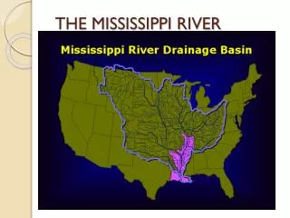
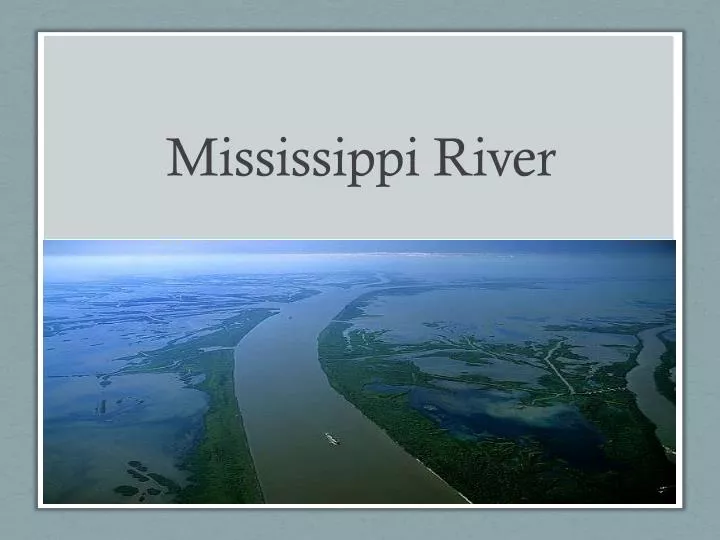
Mississippi River. River Facts. Begins 200 miles north of Minneapolis at Lake Itasca State Park. Length: 2,352 miles Width: 20 ft at headwaters to 1 mile across Louisiana Ends in Gulf of Mexico 31 states & 2 Canadian provinces drain into the Mississippi Rive.

E N D
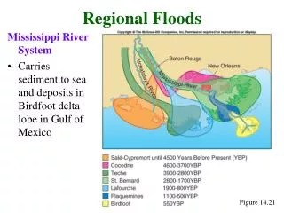
River Facts • Begins 200 miles north of Minneapolis at Lake Itasca State Park. • Length: 2,352 miles Width: 20 ft at headwaters to 1 mile across Louisiana • Ends in Gulf of Mexico • 31 states & 2 Canadian provinces drain into the Mississippi Rive. • Water discharged at a rate of 600,000 cubic ft. per second. • Takes 90 days for water to travel from MN to Gulf • Carries 436,000 tons of sediment each day
In the beginning… Red River and Mississippi River were separate rivers.
15th Century • Mississippi turned west and a loop called Turnbull’s Bend was formed. • Intercepted the Red River which became a tributary of the M. River. • Atchafalaya formed as a distributary.
1727 Construction of first levees along the Mississippi River completed.
1778 Log jam at entrance to Atchafalaya.
1831 Captain Henry M. Shreve dug a canal through the neck of Turnbull’s Bend and shortened river travel time.
1839 • Log jam at Atchafalaya is cleared. • As A.River got wider and deeper, it captured more of the M. River water. • When water in R. River was high and M. River low, water flowed east through Old River. • When water was high in the M. River, water flowed west through Old River.
1882 • River levees extended from Cairo, Illinois to the mouth of the river.
1928 • Flood Control Act of 1928 – instructed Corp of Engineers to tackle problem of flooding in lower M. River basin. • Levees, spillways, and related structures.
1931 • When river reaches a critical stage, the Bonne Carre spillway is opened to allow water to flow into Lake Pontchartrain. • It has been opened 10 times.
1953 • If river continues to rise after the Bonne Carre’ spillway is opened, then the Morganza Spillway is opened. • Only opened twice so far.
1963 • Old River Control Complex completed. • Decision made to control flow of river so that 70% of water will go down the Mississippi River and 30% down the Atchafalaya.
1985 -1986 1985: Vidalia hydroelectric plant put in place north of the outflow channel. 1986: Auxilliary Structure opened.
Effects of Hydrological Modifications • Sediment from river is not flowing through the wetlands. • Subsidence (sinking) is occurring and marsh vegetation going underwater and dying. • Loss of vegetation leads to increased erosion and habitat loss. • Sediment from river is falling off the Continental Shelf. • Saltwater is intruding into freshwater areas and killing plants.