Download
1 / 7
110 likes | 523 Views
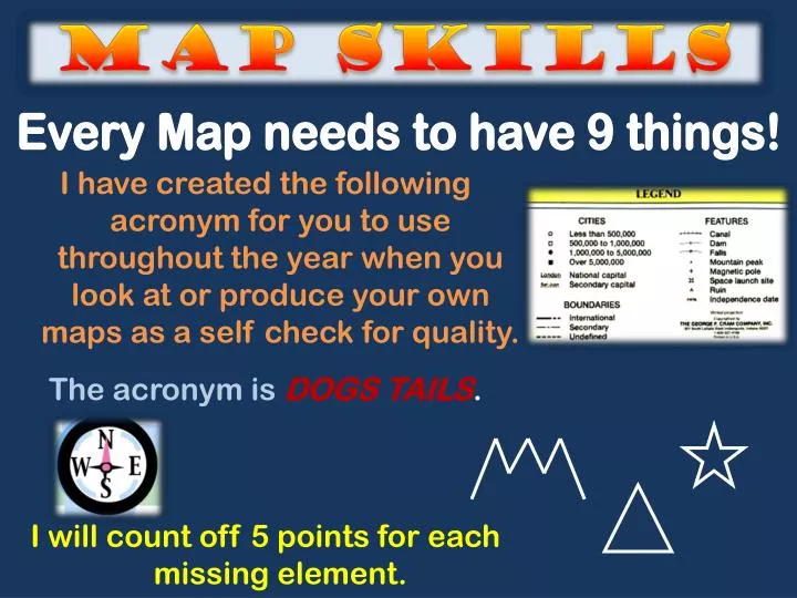
MAP SKILLS. Every Map needs to have 9 things!. I have created the following acronym for you to use throughout the year when you look at or produce your own maps as a self check for quality. The acronym is DOGS TAILS . I will count off 5 points for each missing element. Dogs tails.

E N D
MAP SKILLS Every Map needs to have 9 things! • I have created the following acronym for you to use throughout the year when you look at or produce your own maps as a self check for quality. • The acronym is DOGS TAILS. • I will count off 5 points for each missing element.
Dogs tails DOGS TAILS • Date: when the map was made • Orientation: directions, NSEW • Grid: locates places on a map using letters/numbers or latitude/longitude • Scale: what distances does a unit measure represent in the are shown on the map • Title: what, where • Author: who made the map • Index: map address of places usually an alphabetical listing such as used on a street map • Legend: (or key) what the symbols used on the map mean • Source: where did the information on the map come from
How to make an “A” on Your Map • USE NEAT LETTERING: • Always print. • Use pencil first – then blue/black ink pen. • Label straight across – except for rivers. • The only abbreviations that may be used are: • R. = rivers MTS. = mountains • Check your spelling!!! • COLOR CORRECTLY: • Only water should be colored blue. • Rivers = blue line • Coloring should be done in one direction only and light enough not to hide lettering. • Use map pencils only!!!! • USE MAP SYMBOLS CORRECTLY: • Draw the legend at the bottom of the map. • Use a black dot for cities. ● • Red Star for capital cities. • Mountain ranges = • Mountain peaks = • Draw a compass rose including intermediate • directions at the bottom of the map. N
3 TYPES OF MAPS Political Physical Population
Political: Used to show Boundaries
PHYSICAL: Used to show land features
POPULATION: Used to show population density. . . where people live.