Download
1 / 52
531 likes | 799 Views
SCIENCE . “Science does not know its debt to imagination” –Emerson . What are the 4 branches of Science ?. 1. Biology Study of life 2. Chemistry Study of composition of matter Physics Study of forces and motion Earth Science Study of the Earth and its surroundings.

E N D
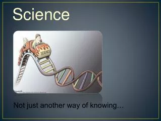
SCIENCE “Science does not know its debt to imagination” –Emerson
What are the 4 branches ofScience? 1. Biology Study of life 2. Chemistry Study ofcomposition of matter • Physics Study of forces and motion • Earth Science Study of the Earth and its surroundings
Four Branches ofEarth Science • Geology • Study of the solid earth • Oceanography • Study of the oceans • Meteorology • Study of the atmosphere and weather • Astronomy • Study of the universe
Earth as a System • System – any size group of interacting parts that form a complex whole. • Driving Forces - • The Sun • Internal Heat
So What? • Why do we study the earth and things that are around the earth?
So What? • Why do we study the earth and things that are around the earth? • Water Wars
Determining Location • Latitude – distance N or S of equator measured in degrees • Lines run east and west • Measures distances N & S • 0º = equator • 90º = poles
Determining Location • Longitude – distance E or W of the Prime Meridian measured in degrees • Lines run N and S • Measures distances E & W • 0º = Prime Meridian…Greenwich, Eng. • 180º = International Date Line
Latitude and Longitude • Written as follows: 118°00’00” meaning 118 degrees, 0 minutes, and 0 seconds. • 31°30’15” = 31 degrees, 30 minutes, and 15 seconds. • Remember that minutes and seconds only go to 60…not 100! • Always connect the top/bottom and left/right lines of lat or long
Maps • Projecting from a round earth/globe onto a flat map will always produce some type of distortion… • Land & distances at the poles are greatly enlarged • Land & distances at the equator are normal
Topographic Maps (Contour Maps) • Represents the 3-D earth in 2-D. • Shows elevations by contour lines (lines of equal elevation) • Contour interval – elevation difference between adjacent lines • Scale – a distance on the map = a distance on the surface (ratio, bar, verbal) • Legend/key – explains symbols on the map
5 Rules of Contour Lines • Never cross • “Vs” point upstream • Closely spaced lines = steep land • Farther spaced lines = flatter land • Form closed loops
Types of Rocks Chapter 3
What is a Rock? • Any consolidated material consisting of more than one mineral
3 Types of Rocks • Igneous • Metamorphic • Sedimentary
Igneous Rocks (from fire) • 2 main types 1. Intrusive • Cools and forms slowly (large crystals) • From magma • Underground 2. Extrusive • Cools and forms quickly (small crystals) • From lava • Above ground
Igneous Rocks Classification • 2 ways to classify igneous rocks • 1. Texture & 2. Composition • Texture (4 types) 1. Coarse grained – slow cooling, large crystals 2. Fine grained – fast cooling, small crystals 3. Glassy – super fast cooling, glassy 4. Porphyritic – slow and fast cooling, has both large and small crystals
2Magma Groups (families) • 1. Granitic (felsic) = continental High in silica, light colored, low density • 2. Basaltic (mafic) = oceanic Low in silica, dark colored, high density
Sedimentary Rocks • From (Latin) sedimentum = settling • Made from sediments
Sedimentary Rock Classification 3 MAIN TYPES: • 1. Clastic = form from sediment • 2. Chemical = form from precipitation or evaporation • 3. Biochemical (organic) = form from remains of once living organisms
Clastic Sedimentary Rocks categorized by size/shape • Conglomerate – rounded pebble sized • Breccia – angular pebble sized • Sandstone – sand sized • Siltstone– silt sized • Shale/mudstone – clay sized
Chemical Sedimentary Rocks • Crystalline limestone – precipitates from ocean water • Travertine – precipitates in caves • Chert/flint – quartz • Gypsum – precipitates from oceans, too • Rock salt – evaporated salt water
Biochemical Sedimentary Rocks • Fossil limestone – fossils remains • Coquina – shells and shell fragments • Chalk – microscopic shells and clay • Bituminous coal – plant remains
Sedimentary Rock Features • Ripple Marks • Mudcracks • Bedding • Foliation (layers)
Metamorphic Rocks Means to change form 2 types of metamorphism 1. Contact Metamorphism – small areas from magma 2. Regional Metamorphism – large areas from mountain building
3 Agents of Metamorphism • Heat (temperature) • Pressure (stress) • Chemicals
Metamorphic Rock Types • Foliated – easily seen layers due to heat and pressure. ex: gneiss and slate • Non foliated – no layers can be seen ex: marble and quartzite
1. Foliated Metamorphic • Slate – very thin layers, from shale • Phyllite – thin layers, sheen, wavy, from slate • Schist – medium layers,shiny, micas, from phyllite • Gneiss – distinct black & white layers, from schist or granite
Nonfoliated Metamorphic • Marble – shiny, fizzes in acid, H = 3, from limestone • Quartzite – shiny, won’t fizz, H = 6 – 7, from sandstone • Anthracite coal – shiny, black, from bituminous coal The carbon cycle…see page 85
Igneous Rocks= most common overall--never layered--can be spotty,glassy--can have holes--crystals rectangular
Sedimentary Rocks • Most common on surface • Usually dull earthy colors • Can have fossils • Can be layered • Rounded grains
Metamorphic Rocks = most common around NC • crystals flattened • may be layered/foliated • can be shiny/sheeny
The Rock Cycle • Continuous model that shows how rocks can change from 1 type into another. • Interactions among water, air, land, and living things can cause rocks to change. • types of energy that drive the rock cycle: 1. SUN=external forces = weathering, etc. produce sedimentary rocks 2. MAGMA=internal forces=heat produces igneous and metamorphic rocks
and deposition and chemicals and deposition and deposition and chemicals and crystallization and deposition Heat, pressure, and chemicals
Rock Cycle Driving Factors • Sun - Drives the water cycle that produces weathering and erosion. • Heat from Earth’s Interior • Heat produces igneous and metamorphic rocks. • Gravitational Energy - Gravity pulls everything down…rockslides, falling rain, tall mountains, etc.