Download
1 / 18
180 likes | 436 Views
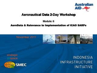
Aeronautical Data 2-Day Workshop. Module: 3 eTOD & Other AeroData : Data Quality Context. Objectives. Understanding of Annex 15… eTOD Requirements; and Requirements for Related Aeronautical Data Implications for Indonesia Treatment of existing data

E N D
Aeronautical Data 2-Day Workshop Module: 3 eTOD & Other AeroData: Data Quality Context
Objectives Understanding of Annex 15… • eTOD Requirements; and • Requirements for Related Aeronautical Data Implications for Indonesia • Treatment of existing data • Planning of future priorities & programmes for eTOD and other aeronautical data
ISO 19000 General Requirements Audit and traceability Other metadata • Provenance • Coverage • Description • Access status Data Quality Essential: Systems & Procedures*to enable the State to satisfy these requirements • For managing data within eTOD & Procedure Design environment • Particularly for supporting/enabling PBN and all RNAV flight procedure designs • For managing interchange of data with AIS/AIP – *particularly until systems are integrated, or interfaced!
Annex 15 Areas 1 & 2 1. Within the area covered by a 10-km radius from the ARP, terrain data shall be collected and recorded in accordance with the Area 2 numerical requirements. 2. In the area between 10 km and the TMA boundary or 45-km radius (whichever is smaller), data on terrain that penetrates the horizontal plane 120 m above the lowest runway elevation shall be collected and recorded in accordance with the Area 2 numerical requirements. 3. In the area between 10 km and the TMA boundary or 45-km radius (whichever is smaller), data on terrain that does not penetrate the horizontal plane 120 m above the lowest runway elevation shall be collected and recorded in accordance with the Area 1 numerical requirements. 4. In those portions of Area 2 where flight operations are prohibited due to very high terrain or other local restrictions and/or regulations, terrain data shall only be collected and recorded in accordance with the Area 1 numerical requirements. Note.— Terrain data numerical requirements for Areas 1 and 2 are specified in Table A8-1.
Obstacle Data Collection – Areas 1 & 2 1. Obstacle data shall be collected and recorded in accordance with the Area 2 numerical requirements specified in Table A8-2: a) any obstacle that penetrates the conical surface whose origin is at the edges of the 180-m wide rectangular area and at the nearest runway elevation measured along the runway centre line, extending at 1.2 per cent slope until it reaches 120 m above the lowest runway elevation of all operational runways at the aerodrome (1.2 per cent slope reaches 120 m at 10 km); in the remainder of Area 2 (between 10 km and the TMA boundary or 45-km radius, whichever is smaller), the horizontal surface 120 m above the lowest runway elevation; and b) in those portions of Area 2 where flight operations are prohibited due to very high terrain or other local restrictions and/or regulations, obstacle data shall be collected and recorded in accordance with the Area 1 requirements. 2. Data on every obstacle within Area 1 whose height above the ground is 100 m or higher shall be collected and recorded in the database in accordance with the Area 1 numerical requirements specified in Table A8-2.
Terrain & Obstacle Data Collection – Area 3 1. Data on terrain and obstacles that extend more than a half-metre (0.5 m) above the horizontal plane passing through the nearest point on the aerodrome/heliport movement area shall be collected and recorded. 2. Terrain and obstacle data in Area 3 shall be collected and recorded in accordance with numerical requirements specified in Table A8-1 and Table A8-2, respectively.
Terrain Data Collection Surface – Area 4 Only terrain data shall be collected and recorded in Area 4 in accordance with the numerical requirements specified in Table A8-1.
Annex 15 Classes of Data by Area Areas 1-4 Segmented by requirements for different applications • Procedure Design – TMA • Enroute – Different Requirements (eg, LSALT) • Area 4 – Precision Approach Cat II/III • Area 3 – Surface Movement (including Taxiways)
Data Quality Requirements Audit & traceability – important aspects • Why? • Allows you, as professionals, to judge what to do with the data • Quality control and data improvement • Security (eg, procedure integrity, restricted nature, etc) • Corporate knowledge in humans (previously) vs systems (increasingly necessary) • What’s required to support this capability? Metadata • Data Quality
Data Quality Requirements Metadata Data Quality Example for Actual Data
Data Quality Requirements • Metadata – Data Quality Terminology
Statistics ! Dark blue is less than one standard deviation from the mean. For the normal distribution, this accounts for 68.27% of the set; while two standard deviations from the mean (medium and dark blue) account for 95.45%; three standard deviations (light, medium, and dark blue) account for 99.73%; and four standard deviations account for 99.994%. The two points of the curve which are one standard deviation from the mean are also the inflection points. Source: <http://en.wikipedia.org/wiki/Standard_deviation>
Quality Management • Types of Errors • Refer RTCA-DO276 5.4 • Aeronautical Data Requirements • Annex 4, accuracy and integrity, but also resolution (all through the document) – eg, Annex 4, 14.6(g) Aerodrome Ground Movement Chart – ICAO* NB: in this case it conflicts with Annex 14 & 15 requirements for same data • Example of RESOLUTION • 1/100 second = approximately 0.3m or 1ft • Annex 14, App 5 • Annex 15, App 7 • Covered in our system since ~ 2002 • Being updated to include newer and still evolving requirements • Annex 15 - Aeronautical Data Requirements: applies to all aeronautical feature data, not just obstacles and terrain
Data Quality Requirements • Metadata • Data Quality - Obstacles
Data Quality Requirements • Metadata • Data Product Specification - Example
Q&A & Discussion • Suggested discussion points • Applying same principles to all aeronautical data – throughout data lifecycle and system-wide • Treatment of existing data • Planning of future priorities & programmes for eTOD and other aeronautical data