Download
1 / 22
220 likes | 233 Views
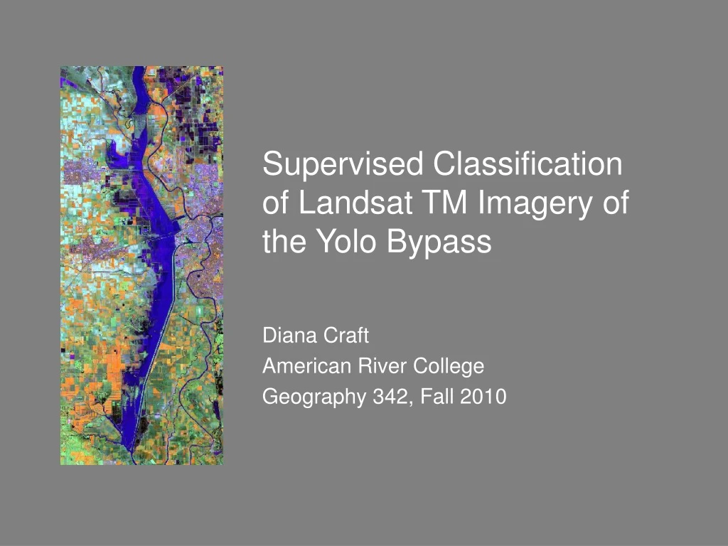
This project aims to perform supervised classification on Landsat TM imagery of the Yolo Bypass, analyzing seasonal variations and different uses of selected fields throughout the year, supporting agriculture, wildlife, and flood control.

E N D
Supervised Classification of Landsat TM Imagery of the Yolo Bypass Diana Craft American River College Geography 342, Fall 2010
Project Goals • Perform supervised classification on Landsat TM imagery using Spatial Analyst in ArcGIS • Obtain images showing seasonal variations in the Yolo Bypass • Show that selected fields in the Yolo Bypass have different uses throughout the year, supporting agriculture, wildlife, and flood control
The Yolo Bypass • 59,000 acre engineered flood bypass • Used for agriculture, wildlife habitat, flood protection • Diversion channel for Sacramento River; part of the Sacramento River Flood Control Project • Fed by Cache and Putah Creeks, Colusa Basin Drain, and Willow Slough • Crossed by Interstates 5 and 80 and railroads
Image Source • USGS’s Global Visualization Viewer (GLOVIS) • Several years’ worth of monthly satellite images • Download issues: CTRL for Pop-ups; opening .tar.gz files (use Winzip, not 7-zip); some images have to be ordered (delay); cloudiness may limit choices
GLOVIS Images: Easy to view month-by-month; seasonal trends emerge Screenshots from GLOVIS lined up to compare 2009 & 2010 month-to-month
Composite Bands • Problem: Unzipped Landsat image is set of 6 single-band images that each display as B/W • Use ArcGIS Toolbox > Data Management > Raster > Raster Processing > Composite Bands • This creates new single multiple-band raster dataset from multiple single-band raster datasets
Clip & Symbolize • Problem: Landsat TM image is huge; want to zero in on area of interest • Use ArcGIS Toolbox > Data Management > Raster > Raster Processing > Clip • This clips the image to extent of given coordinates • Next, go to Symbolize in Layer Properties to assign image bands to color channels: R=4, G=5, B=2
Classification • Use Spatial Analyst in ArcGIS • Run Create Signatures • Run Dendrogram routine • Run Maximum Likelihood Classification
What went wrong:Supervised Classification • Using multiple images was too ambitious for the allotted time; zeroed in on one image only • Preprocessing took too much time (batch processing might have helped) • Image interpretation was difficult without actual field data (or experience) • Initial bad result: Flawed training site selection, or problem with Max Likelihood Classification?
Lessons Learned:Project Design • Diagram the whole process first • Do small sample tests (rather than run multiple images down a dead end) • Keep a log to document steps including those that don’t work (for future reference) • Allow enough time to work it out when things go awry • Refine and repeat as needed