Download
1 / 60
600 likes | 622 Views
Learn about the benefits, coverage, and operation of CORS stations for accurate GPS positioning and geophysical data gathering.

E N D
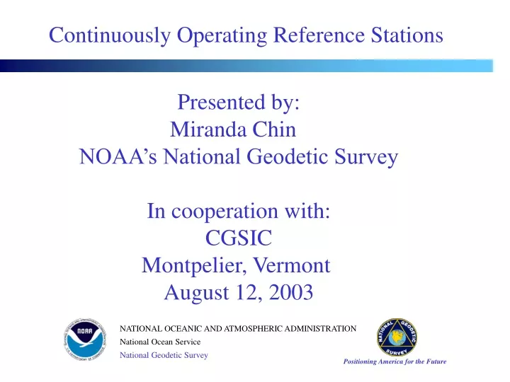
Continuously Operating Reference Stations Presented by: Miranda Chin NOAA’s National Geodetic Survey In cooperation with: CGSIC Montpelier, Vermont August 12, 2003
What? Why? OPUS-Online Positioning User Service Continuously Operating Reference Stations (CORS)
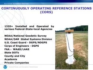
National CORS Network Cooperative CORS Network Combo CORS CORS OVERVIEW
Network contained over 400 stations as of July 2003 Growing at rate of 6 sites per month Provides code range (C/A, P1, P2) and carrier phase observations (L1, L2) Provides meteorological data at some sites Designed to meet requirements for High Accuracy Static & Kinematic Positioning Geophysics / Crustal Motion Meteorology / Water Vapor in Atmosphere Space Weather / Free Electrons in Ionosphere National CORS Network
National CORS data transferred to NOAA’s National Geodetic Survey in Silver Spring, MD GPS and “met” data converted to RINEX format Data made available to public via: World Wide Web File transfer protocol Currently 9 years of CORS data are online for immediate access Parallel CORS Data Site being established at NOAA’s National Geophysical Data Center in Boulder, CO National CORS Network (continued)
GPS base stations whose data are freely disseminated by cooperating organizations NGS provides link from its web site to that of each cooperating organization Site coordinates must be consistent with the National Spatial Reference System Cooperative CORS Network
National CORS Cooperative CORS - Station commits to a long-term and continuous operation - Station operates at least 8hrs/day; 5days/week - Data are available online from NOAA via the Internet - NOAA web site provides a link to the participant’s web page - All data are permanently archived at NOAA - Minimum 7 days’ data online at the participant’s web site - antenna position re-computed everyday - antenna position re-computed every 30 days or less National CORS & Cooperative CORS
COMBO CORS The term “Combo CORS” designates a station whose GPS data is distributed both by NOAA’s National Geodetic Survey and by a cooperating organization. Such accessibility to CORS data is highly desirable.
a a a a a a a a CORS Partners: Federal Federal Highway Administration Federal Railway Administration Federal Aviation Administration Forecast Systems Laboratory National Geophysical Data Center NASA US Geological Survey US Army Corps of Engineers US Air Force US Naval Observatory
CORS Partners: Scientific International GPS Service (IGS) University Navstar Consortium (UNAVCO) Scripps Orbit & Permanent Array Center PANGA EBRY BARD BAYONET BARGN SCIGN Plate Boundary Observatory SuomiNet
CORS Partners: International Canada International Earth Rotation Service (IERS) International GPS Service (IGS) Mexico Guatemala El Salvador Honduras Nicaragua Jamaica
CORS Partners: Private Industry “ If you want to see where GPS is going, then keep your eye on the GPS manufacturers.” Bill Strange Former Manager National CORS Program
Stations with Meteorological Sensors Forecast Systems Laboratory
Why CORS? CORS (cont.)
The National Spatial Reference System (NSRS) is a consistent national coordinate system that specifies latitude, longitude, height, scale, gravity, and orientation throughout the Nation, as well as how these values change with time. NATIONAL SPATIAL REFERENCE SYSTEMS
“A geodetic reference framework forms the spatial foundation for the creation of any Land-Information System (LIS).” National Research Counsel Procedures and Standards for a Multipurpose Cadastre (1983, p. 20). NSRS(GEODETIC REFERENCE FRAME)
NATIONAL SPATIAL REFERENCE SYSTEM ACCURATE -- cm accuracy on a global scale MULTIPURPOSE -- Supports Geodesy, Geophysics, Land Surveying, Navigation, Mapping, Charting and GIS activities ACTIVE-- Accessible through Continuously Operating Reference Stations (CORS) and derived products INTEGRATED-- Related to International services and standards (e.g. International Earth Rotation Service, International GPS Service etc.)
0.02 Meter - Horizontal 0.04 Meter - Ellipsoid Height CORS 1994 - IMPROVING POSITIONAL ACCURACY REFERENCE TIME NETWORK LOCAL FRAME SPAN ACCURACY ACCURACY NAD 27 1927-1986 10 Meters First-Order (1 part in 0.1 million) NAD 83 1986-1990 1 Meter First-Order (1 part in 0.1 million) HARN 1987-1997 0.1 Meter B-Order (1 part in 1 million) A-Order (1 part in 10 million)
ITRF00 POSITION (EPOCH 1997.0) Published by the IERS in Mar. 2001. X = 1369550.378 m latitude = 44 15 43.13960 N Y = -4365534.838 m longitude = 072 34 56.56028 W Z = 4429096.685 m ellipsoid height = 159.387 m ITRF00 VELOCITY Published by the IERS in Mar. 2001. VX = -0.0153 m/yr northward = 0.0039 m/yr VY = -0.0050 m/yr eastward = -0.0161 m/yr VZ = 0.0056 m/yr upward = 0.0040 m/yr VCAP Published Coordinates-ARP
NAD_83 POSITION (EPOCH 2002.0) Transformed from ITRF00 (epoch 1997.0) position in Mar. 2002. | X = 1369550.939 m latitude = 44 15 43.10706 N Y = -4365536.278 m longitude = 072 34 56.55559 W Z = 4429096.786 m ellipsoid height = 160.561 m NAD_83 VELOCITY Transformed from ITRF00 velocity in Mar. 2002. VX = 0.0025 m/yr northward = -0.0014 m/yr VY = -0.0031 m/yr eastward = 0.0015 m/yr VZ = 0.0016 m/yr upward = 0.0038 m/yr VCAP Published Coordinates-ARP (cont.)
ITRF00 POSITION (EPOCH 1997.0) Published by the IERS in Mar. 2001. X = 1369550.393 m latitude = 44 15 43.13960 N Y = -4365534.889 m longitude = 072 34 56.56031 W Z = 4429096.737 m ellipsoid height = 159.461 m The ITRF00 VELOCITY of the L1 PC is the same as that for the ARP. VCAP Published Coordinates-L1
NAD_83 POSITION (EPOCH 2002.0) Transformed from ITRF00 (epoch 1997.0) position in Mar. 2002. X = 1369550.954 m latitude = 44 15 43.10706 N Y = -4365536.329 m longitude = 072 34 56.55562 W Z = 4429096.837 m ellipsoid height = 160.636 m VCAP Published Coordinates-L1 (cont.)
CORS ADVANTAGES • 3-dimensional (Lat., Long., & Ellipsoid Ht. or X, Y, & Z) • Eliminates control points reconnaissance (time and money). • Eliminates needing people and equipment at a control points. • Direct tie to National Spatial Reference System (NSRS). • CORS positions and velocities are available in both NAD 83 and ITRF coordinate systems. • CORS positions are of the highest accuracy. • CORS positions are continuously monitored and will be updated if the site moves (2cm horizontal; 4cm vertical.)
Common Question • CORS GPS hardware differs from our GPS hardware. Do we have to use only CORS with the same hardware?
OPUS Online Positioning User Service http://www.ngs.noaa.gov/OPUS/ opus@ngs.noaa.gov
WHAT IS OPUS? • On-line Positioning User Service • Provide GPS users faster & easier access to the National Spatial Reference System (NSRS)
HOW DOES OPUS WORK? • Submit RINEX file through NGS web page • Processed automatically with NGS computers & software • With respect to 3 suitable National CORS • Solution via email (usually in minutes)
HOW DO I USE OPUS? Go to OPUS web pagewww.ngs.noaa.gov/OPUS • - Enter your email address • - Enter/Select RINEX file • - Select antenna type from menu • - Enter antenna height in meters (defaults to ARP) • - Optional:State Plane Coordinates • - Select up to 3 base stations (optional) • - Upload File Check your email (usually only takes a few minutes)
WHAT ARE SOME OPUS GUIDELINES? • Must submit dual-frequency (L1/L2) data • Must submit at least 1-hr of data • No kinematic/Rapid Static • No Glonass • Correct vertical requires: • antenna type • antenna height
ARP The height is measured vertically (NOT the slant height) from the mark to the ARP of the antenna. The height is measured in meters. The ARP is almost always the center of the bottom-most, permanently attached, surface of the antenna. See GPS Antenna Calibration for photo’s and diagrams that show where the ARP is on most antennas: http://www.ngs.noaa.gov/ANTCAL/ If the default height of 0.0000 is entered, OPUS will return the position of the ARP. MARK HOW IS THE ANTENNA HEIGHT MEASURED?
You do not need to know these offsets. They are passed to the processing software through the antenna type The antenna phase centers are located somewhere around here. The antenna offsets are the distance between the phase centers and the ARP If the user selects NONE as the antenna type, the offsets are set to 0.000 and the antenna phase center becomes the reference The Antenna Reference Point (ARP) is almost always located in the center of the bottom surface of the antenna. Incorrect or missing antenna type big vertical errors WHY DO I NEED THE ANTENNA TYPE?
Antenna Phase Center Variation . . . . . . . . . . . . SV 20 SV 20 SV 14 SV 14 Note that SV elevation and varying phase patterns affect signal interpretation differently Antenna Type B Antenna Type A
Antenna Phase Center Variation . . . . . . . . . . . . SV 20 SV 20 SV 14 SV 14 Different Phase Patterns Note that SV elevation and varying phase patterns affect signal interpretation differently Antenna Type B Antenna Type A
ELECTRONIC PHASE CENTER • Phase Center Variation (mm) • Elevation Angle (deg.)
HOW ARE OPUS POSITIONS COMPUTED? • NGS PAGES software • Ionosphere free • Tropospheric scale height adjusted • Fixed ambiguities • Average solution to 3 suitable CORS • ITRF and NAD83 positions returned