Download
1 / 50
510 likes | 771 Views
The weather and climate of Malaysia. Ahmad Fairudz Jamaluddin Malaysian Meteorological Department Ministry of Science, Technology and Innovation. Outline. General Climate of Malaysia Climate Long Term Mean of Malaysia Observed Trend of Climate Extremes in Malaysia

E N D
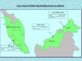
The weather and climate of Malaysia Ahmad Fairudz Jamaluddin Malaysian Meteorological Department Ministry of Science, Technology and Innovation
Outline General Climate of Malaysia Climate Long Term Mean of Malaysia Observed Trend of Climate Extremes in Malaysia How Regional Climate Model can enhance MMD’s services Seasonal / Monthly Weather Outlook Drought Monitoring Fire Danger Rating Summary
GENERAL CLIMATE OF MALAYSIA Tropical maritime climate with: - uniform temperature - high humidity - rainfall throughout the year The seasons:- - Northeast Monsoon (Nov – Mar) - Southwest Monsoon (June – August) - Two Inter-Monsoon (Apr-May & Sept-Oct)
Severe Weather in Malaysia Inter-Monsoon (Apr-May & Sep-Oct) Northeast Monsoon (Nov – Mac) Flood Flash Flood Southwest Monsoon (Jun – Aug) Haze Strong Wind and Rough Sea
Monsoon & Dominant Modes of Climate Variability SWM (Late May to Sept) NEM (Nov to March) PACIFC OCEAN MJO ENSO INDIAN OCEAN IOD Indian Ocean Dipole (IOD), El Nino-Southern Oscillation (ENSO) ---- Interannual oscillation (2-7 years) Madden-Julian Oscillation (MJO) – intra-seasonal oscillation (20-60 days)
Long Term Mean Monthly Rainfall Over PM Northeast Monsoon NOVEMBER JANUARY DECEMBER Southwest Monsoon JUNE AUGUST JULY > 500
Mean Monthly Average Temperature Over PM Northeast Monsoon Southwest Monsoon
Mean Monthly Average RH Over PM Northeast Monsoon NOVEMBER DECEMBER JANUARY Southwest Monsoon AUGUST SEPTEMBER JULY
Long Term Mean Monthly Rainfall Over EM Northeast Monsoon FEBRUARY DECEMBER JANUARY 0 – 50 50 – 100 100 – 150 150 – 200 200 – 250 250 – 300 300 – 400 400 – 500 > 500 Southwest Monsoon AUGUST JULY JUNE
Mean Monthly Average Temperature Over EM Northeast Monsoon Southwest Monsoon
CONVECTIVE TIME SCALE Trends in 2 hour maximum rainfall Frequency of Heavy Rainfall (blue) (>20mm) & Intensity (red) for 2 Hour Maximum Rainfall. Number in box indicates trends in PRCPTOT. (Diong et al.; MMD)
SEASONAL TIME SCALE Trends in heavy rainfall Frequency of Heavy Rainfall (blue) (>20mm) & Intensity (red) during Southwest Monsoon (JJA). Number in box indicates trends in PRCPTOT. (Diong et al.; MMD)
SEASONAL TIME SCALE Trends in heavy rainfall Frequency of Heavy Rainfall (blue) (>20mm) & Intensity (red) during Northeast Monsoon (DJF). Number in box indicates trends in PRCPTOT. (Diong et al.; MMD)
ANNUAL TIME SCALE Trends in heavy rainfall Frequency of Heavy Rainfall (blue) (>20mm) & Intensity (red) for annual rainfall. Number in box indicates trends in PRCPTOT. (Diong et al.; MMD)
In general the intensity and frequency of extreme rainfall events are on the rise. • The SW monsoon season is becoming wetter but at the same time prolonged dry spells are more frequent. • During the NE monsoon season the extreme rainfall events associated with the monsoon surges and other synoptic features are on the rise. • Notable increasing trend in the annual precipitation is observed in EM with both the monsoon seasons possibly contributing to this trend.
How Regional Climate Model can enhance MMD’s services
Seasonal / Monthly Weather Outlook
Climate Variability Moisture flux during JJA (1979-2000) Moisture convergence (mm/day) Tangang et. al. (2007) Indian Ocean experience warming SST relatively faster than other oceans including Pacific Ocean Indian Ocean as source of moisture for PM during JJA. South China Sea / Pacific Ocean as source of moisture for Malaysian region during DJF How this SST warming over Indian and Pacific Ocean modulate/change rainfall distribution and extreme weather event over the Malaysian region?
Indian Ocean Dipole (IOD) Composite Anomalous OLR, Mode -ve IOD years, Mode +ve IOD years during JJA • During Mode –ve IOD, Malaysian region experience neutral condition compare to wetter condition over the South of Sumatra during JJA • During Mode +ve IOD, Malaysian region experience dry condition over the south of PM and Sarawak during JJA. However, south of Sumatra and Borneo experience driest condition during the period. Anomalous OLR (W/m2)
El-Nino Southern Oscillation Index (ENSO) Composite Anomalous OLR & La-Nina years during JJA Composite Anomalous OLR & El-Nino years during JJA Anomalous OLR (W/m2) Anomalous OLR (W/m2) Wet condition over south of PM and Sarawak during La-Nina. Dry condition over south of PM, Sarawak and south of Sabah during El-Nino (JJA)
Conventional ENSO vs ENSO-Modoki Conventional El Nino Composites of Anomalous DJF Precipitation El Nino Modoki Composites of Anomalous DJF Precipitation, Anomalous wind at 850hPa (Ester Salimun, UKM)
Composites of MJO Phases, Anomalous Precipitation & wind at 925hPa during JJA (Fairudz et. al., MMD)
Diurnal Rainfall and MJO during JJA Phase 1 + 2 Phase 3 + 4 Phase 5 + 6 Phase 7 + 8 Afternoon (15 – 20 MST) Evening (21 – 02 MST) Composites of MJO Phases, standardized anomalous precipitation during afternoon and evening over PM (Fairudz et. al., MMD)
LOCAL ATMOSPERIC CIRCULATION CIN (J/kg) at 20 MST Phase 1 + 2 Afternoon (15 – 20 MST) H CAPE (J/kg) at 20 MST Relatively low CIN over the west cost of PM during phase 1+2 MJO. Relatively high CAPE over east coast of PM during phase 3+4 MJO. L Left panel: Composite of MJO’s phase, anomalous mslp (contour), anomalous RH (value) and direction of surface wind (vector). Right panel: Composite of MJO’s phase, anomalous surface divergence, anomalous surface temperature.
Composites of MJO Phases, Anomalous Precipitation & wind at 925hPa during DJF
STATISTICAL DOWNSCALING Statistical downscaling from JMA CGCM (three month lead time and 51 members) Method of “double leave one-out cross-validation” with multiple size of optimal window is used to validate the model at each meteorological station. The highest correlation coefficient with station's precipitation was selected as predictor. SON 2011 Probabilistic forecast for SON 2011 (Yip et. al., MMD)
GCM’S SEASONAL PRODUCTS NDJ NDJ ECMWF JAMSTEC
Meteorology Drought Event in Malaysia based on SPI Index Year (Fatin Nurashikin, UKM) Latest 3-month SPI Index less than -1.0
Meteorology Drought Monitoring & Latest 3-month SPI less than -1.5
Fire Danger Rating National & ASEAN Country (currently 3 days forecast (WRF) with 4km resolution for Malaysia & 36km for SEA region
Normal peatswamp (Neutral ENSO - August 2012) Situation of sudden mortality of peatswamp trees (too much water over the area – La-Nina 2011)
North Selangor PSF Sungai Karang FR Raja Musa FR Selangor
Pandangan daripada kompartmen 89 kiri terusan Forest fires at RMFR – August 2012 ( 407 ha)
Forest fires at RMFR – 2012 ( 407 ha) 6 ha 60 ha 341 ha
FFMC code during 18 – 29 August 2012 18 19 20 21 22 23 24 25 26 27 28 29
DMC code during 18 – 29 August 2012 18 19 20 21 22 23 24 25 26 27 28 29
ISI code during 1 – 10 June 2012 1 2 3 4 5 ISI extreme on 4 June 2012, same day burning start (rain on 9 June 2012) ISI : 1 – 10 Jun 2012 6 7 9 10 8
ISI code during 21 – 30 June 2012 21 22 23 24 25 ISI extreme throughout the burning period except on a few days due to rain (drastic change) ISI : 21 – 30 June 2012 26 27 29 30 28
Summary • In general, the intensity and frequency of extreme rainfall events are on rise • Climate variability over the Malaysian region is strongly influence by monsoon, ENSO, IOD and MJO • Malaysian forestry and water resources are too sensitive to any changes/shifting of the climate • Reliable RCMs are crucial and important to enhance MMD’s services such as accurate seasonal/monthly weather outlook, drought monitoring and fire danger rating
Agriculture; Agro-Climatological • Zonation
Suitability Areas (Marginal) for Oil Palm Cultivation in Johore Oil Palm Cultivation Areas for Johore Oil Palm Planted on Suitability (Marginal) land in Johor
Composites of MJO Phases, Anomalous OLR, Anomalous Geopotential Height at 500hPa & wind at 850hPa during JJA