Download
1 / 5
50 likes | 59 Views
Explore dynamic modeling in the Guadalupe watershed to analyze pollutant levels and improve land management. The project aims to include data from recent years, calibrate sediment models, and assess the impact of land-use changes.

E N D
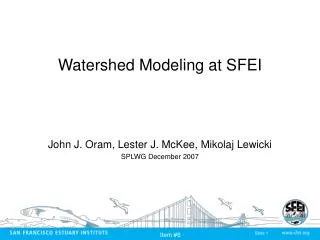
San Francisco Estuary Institute Item #3f Dynamic modeling in a representative watershed (Guadalupe) Michelle Lent, John Oram, and Lester McKee Sources Pathways and Loadings Workgroup May 6th 2010
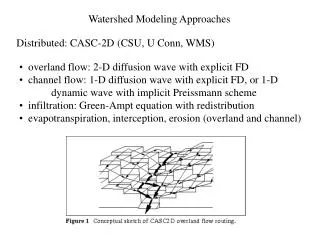
San Francisco Estuary Institute Item #3f Status update • Project put on hold in Sept. 2009 to leverage results of other studies, e.g. WY 2010 monitoring in Guadalupe • TRC approved carrier-over funds for 2010 • Project to resume shortly • Current status: • Fully calibrated and validated hydrology model • Partially calibrated sediment model • Data partially collated for pollutant (Hg & PCB) model
San Francisco Estuary Institute Item #3f Phase 2 (sediment, Hg & PCBs model) timeline
San Francisco Estuary Institute Item #3f Proposed Phase 3 - model improvements & usage • Extend model timeframe to include WY2008-2010 • Allows for further Hg & PCBs calibration to Guadalupe River sampling data collected in recent years • WY 2010 hydrology and rainfall will be preliminary data from USGS and Water District • Split lumped treatment of PCBs into the nine homologue groups • Model land management scenarios • Investigate impacts of land-use change and LID/BMP implementation scenarios of value to WG • Although not a focus of this group – we could also explore climate change scenarios
San Francisco Estuary Institute Item #3f Proposed Phase 3 budget options