Download
1 / 46
480 likes | 705 Views
Southern & Eastern Asia. Geography and Countries. Georgia Performance Standards. SS7G9 The student will locate selected features in Southern and Eastern Asia.

E N D
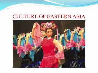
Southern & Eastern Asia Geography and Countries
Georgia Performance Standards SS7G9 The student will locate selected features in Southern and Eastern Asia. • a. Locate on a world and regional political-physical map: Ganges River, Huang He (Yellow River), Indus River, Mekong River, Yangtze (Chang Jiang) River, Bay of Bengal, Indian Ocean, Sea of Japan, South China Sea, Yellow Sea, Gobi Desert , Taklimakan Desert, Himalayan Mountains, and Korean Peninsula. • b. Locate on a world and regional political-physical map the countries of China, India, Indonesia, Japan, North Korea, South Korea, and Vietnam.
Ganges River • The Ganges also known by its Hindu name Ganga. • Starting at Gaumakh in the southern Himalayas on the Indian side of the Tibetan border. • Considered the most sacred river in India
Ganges River • It is 1,560 miles (2510 • The river flows through 29 cities and about 48 towns and flows through NE, India, Nepal and Bangladesh
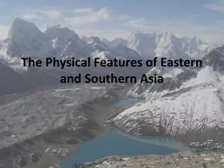
Himalayan Mountains • Located along the northern edge of the Indian subcontinent through Pakistan, Nepal, Bangladesh, Myanmar(Burma) • It is the world’s largest mountain region • Nine of the world’s ten tallest peaks are located in the Himalayas, including Mt. Everest, the highest in the world
Indus River • Largest river in Pakistan 1800 miles • Begins in the Himalayan mountain chain of Tibet and flows through India, Pakistan and into the Arabian Sea
Bay of Bengal • Shallow bay leading into the Indian Ocean • It is about 1,000 mi (1,600 km) wide, with an average depth exceeding 8,500 ft (2,600 m). • Located west of India and east of Myanmar. • Many large rivers, including the Godavari, Krishna, Kaveri (Cauvery), Ganges (Ganga), and Brahmaputra, flow into it.
Indian Ocean • The Indian Ocean is surrounded by Iran, Pakistan, India, and Bangladesh to the north; the Malay Peninsula in South Asia • 3rd largest ocean on the earth • It borders Australia, and the Southern ocean • About 69 million sq km long
Indian Ocean • Produces Storm systems such as Monsoons (December to April), (June to October) • Tropical cyclones occur during May/June and October/November and January/February
Gobi Desert • Known as the Shamo: sand desert, is the largest in Asia at 1,040,000 sq km (400,000 sq miles) • Sets between northern China and Mongolia • The northern part of Gobi is rich in minerals • Ex: chalk-like gypsum
DID YOU KNOW? Marco Polo and his brothers were the first relatives to cross the desert around 1260 to avoid entering Mongolia’s civil war
Mekong • The Mekong River is a major river in southeastern Asia • Longest in the region: 4,200 km (2,610 mi). • Begins in China's Qinghai Province near the border with Tibet • Flows southeast to the South China Sea Borders Myanmar (Burma) and Laos; and Laos and Thailand. • Helps poor farmers grow rice crops in its basin
Huang (Hwang)HeYellow River • China’s second longest river at 3395 miles long • Also called “China’s Sorrow” because of its devastating floods each year. • Huang He is named for the muddy yellow silt it carries along its path through China and empties in the Gulf of Bohai in the Northern Yellow Sea. • China’s civilization began in the central area of this river basin
Taklimakan Desert • Located in northwestern China, this desert sets between two rugged mountain ranges: Tien Shan and Kunlan. • One of the world’s largest sandy wastes, it is about 600 mi (960 km) across, with an area of 123,550 sq mi (320,000 sq km). • Its sand dunes cover 85 percent of its surface
Yangtze (Chang Jiang) River • Largest and longest river in China and Asia at 3964 miles. 3rd largest in world. • Flows east from the Qinghai glacier and empties into the China Sea (east). • Receives water from over 700 tributaries • Divides China north and south • Provides hydroelectric power, water for irrigation, and transportation for cargo ships
Yellow Sea (Huang Hai) • Lying between mainland China and the Korean Peninsula and merges with the E China Sea. • About 600 miles (960 km) from N to S and about 435 miles (700 km) from E to W and occupies an area of about 380,000 km² • The Yellow Sea derives its name from the color of the silt-laden water discharged from the numerous Chinese rivers that drain into its waters. (Yellow River, Huai River, Liao River, and Yalu River).
South China Sea • Lies between Vietnam and the Philippines and borders other Asian countries • It is the largest sea and is part of the Pacific Ocean • The Pearl, Red, Mekong, and Chao Phraya are the major rivers flowing into the South China Sea. • It has a large amount of biological diversity, as well as abundant oil and natural gas resources.
Korean Peninsula • A peninsula in East Asia that extends southwards for about 684 miles or 1,100 km from the continental Asia into the Pacific Ocean. • The East Sea/Sea of Japan surrounds the peninsula on the east, the East China Sea to the south, the Yellow Sea
Korean Peninsula • Since 1948, this peninsula has divided Korea into 2 countries: • North Korea (Democratic Republic) • South Korea (Republic of Korea)
Sea of Japan • Also known as the East Sea," "Sea of Korea," "Sea of Japan" and "Oriental Sea“ • Located between Asia and Japan it is almost closed by the surrounding land masses • 978,000 sq miles it is highly developed for transportation, fishing industry, oil spills,waste dumps, and petroleum exploration