Download
1 / 23
230 likes | 409 Views
GIS Internet Map Servers for Health Applications. Carol L. Hanchette, Ph.D. Rebecca D. Martin, Ph.D. Research Triangle Institute Research Triangle Park, NC. GIS and Health Services Research. Physician/facility location and allocation Market and hospital service areas

E N D
GIS Internet Map Servers for Health Applications Carol L. Hanchette, Ph.D. Rebecca D. Martin, Ph.D. Research Triangle Institute Research Triangle Park, NC
GIS and Health Services Research • Physician/facility location and allocation • Market and hospital service areas • Delivery of health and community services to welfare recipients (DSS clients, childcare, employment, public transit) • Census tract rankings for family services (factors identified, ranked, mapped by quintile)
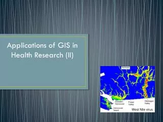
Health and Risk Factor Data to ID High Risk Areas • Childhood lead poisoning • Immunization “Pockets of Need” (logistic regression model used with immunization survey, birth certificates, census data) • Prediction of Teen Live Birth Rates using Census Data (logistic regression using 4 indicators)
What is GIS? • A set of tools for processing spatial data into information for enhanced decision making • A relational database management system where each record in every database is tied to a geographic location
Spatial and Attribute Data • Spatial data contain information about location, dimensions, shape, associations and relationships. • Attribute data describe the non-spatial components of the database. • Linked through a geocode (e.g. county, zip code, street address)
Barriers to GIS Use • Lack of trained GIS staff • Cost of unavailibility of spatial data • Costs of purchasing GIS software
GIS Technology Trends • Mini-computers Unix workstations PCs • Command line Graphical User Interfaces Internet Map Server
Internet Map Server Technology • Hardware, software and data reside on GIS server • Mapping and spatial analysis capabilities are accessed via Web browser • Access: public OR password-protected • No training needed • Customization/tool development
Internet Map Server Technology National Cancer Institute Atlas of Cancer Mortality
Central Cancer Registry Operations Management Iowa: patients, cities, hospitals and reporting rates
Central Cancer Registry Operations Management Tennessee: View all patients within 75 miles of Johnson City
Central Cancer Registry Operations Management Spatial Query of Reporting Rate
Visualization and Analysis of Cancer Data Spatially enabling cancer data: • Automated geocoding • Address matching • Data aggregation to maintain confidentiality • Provision of services • Distance to patient • Access to care
Visualization and Analysis of Cancer Data • Link to census and health outcomes data
Quality Control of Geographic Identifiers • Geocode data • Use polygon overlay techniques or spatial query to examine correspondence of geographic identifiers (geocodes) • Overlay GIS county boundary file to assign correct county to patient records, then compare.
North Carolina Toxic Release Inventory Sites Sites (represented by pink dots) that lie outside North Carolina have incorrect latitude/longitude coordinates. Over 1300 sites in NC, more than 100 located outside of state. Greenland sites: reversed lat/longs
Quality Control of Geographic Identifiers • North Carolina state agency health database example • 265,492 records • Only 158,552 (59.72%) with zip code, county and city correspondence • County of patient vs. county of health department • Duplication of county/city names: Henderson County in western North Carolina; town of Henderson in north-central North Carolina • Duplicate place names: 9 Bethel, 9 Five Points, 9 New Hope • Different coding schemes (use Federal Information Processing Standard (FIPS) whenever possible