Download
1 / 35
350 likes | 435 Views
ESTIMATION OF MONTHLY NATURAL FLOWS IN A HIGHLY DEVELOPED BASIN – the case study of Krishna. BUILDING FUTURE WATER ASSESMENTS SCENARIOS FROM MONTHLY NATURAL FLOWS IN A HIGHLY DEVELOPED BASIN – the case study of Krishna

E N D
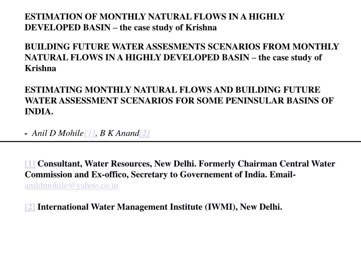
ESTIMATION OF MONTHLY NATURAL FLOWS IN A HIGHLY DEVELOPED BASIN – the case study of Krishna BUILDING FUTURE WATER ASSESMENTS SCENARIOS FROM MONTHLY NATURAL FLOWS IN A HIGHLY DEVELOPED BASIN – the case study of Krishna ESTIMATING MONTHLY NATURAL FLOWS AND BUILDING FUTURE WATER ASSESSMENT SCENARIOS FOR SOME PENINSULAR BASINS OF INDIA. - Anil D Mohile[1], B K Anand[2] [1] Consultant, Water Resources, New Delhi. Formerly Chairman Central Water Commission and Ex-offico, Secretary to Governement of India. Email- anildmohile@yahoo.co.in [2] International Water Management Institute (IWMI), New Delhi.
ICID - IAH CPSP Study Application of CPSP Model to selected basins in India – Location of basins
Correct for Anthropogenic Changes in the Surface flow. Estimated time series of monthly Natural flows of the basin. The Monthly time series of Observed Flows at terminal site of the Basin Correct for Anthropogenic Changes in the Outflows from Groundwater reservoir. Conceptual schematic for Part 1 of study
Likely Anthropogenic Changes in the Surface flow under the future scenario. Resultant time series of residual monthly flows under the future scenario. The Monthly time series of Natural Flows of the Basin Likely Anthropogenic Changes in the Outflows from Groundwater reservoir under the Future scenario. Conceptual Schematic for Part 2 of study
NATURAL ET PRECIPITATION LAND SURFACE AND ROOT ZONE NATURAL FLOW OF BASIN NATURAL DEEP PERCOLATION (NAT URAL RECHARGE) G W RESERVOIR NATURAL GW OUT FLOW Hydrologic Concept-Natural Condition
NATURAL ET ANTHROPOGENIC ET (CONSUMPTION,) IMPORTS EXPORTS PRECIPITATION NATURAL FLOW OF BASIN LAND SURFACE AND ROOT ZONE SUR WITHDRAWAL ANTPLY CHANGED FLOW AT TERMINAL SITE LAKE ET NATURAL DEEP PERCOLATION (NAT URAL RECHARGE) SUR FACE STORAGE CHANGES ANTP RETURN TO SW ANTP GW WDR ANTP WATER USE ANTP GW RETN G W RESERVOIR NATURAL GW OUT FLOW ANTP CHANGE IN GW OUTFLOW Anthropogenically Modified
Main Strengths or Advantages • Ø Could work in monthly time steps, not annual • Ø Instead of a single value, or average pattern, could establish a 15 yr. Time series of natural flows • This could highlight the “negative flow” problem, required relook at data, and improved credibility of the natural flow series. • 2. Encompassed annual flow variability, as required in studying the “over the year “ storages • Could establish a computational process, which included water balances and accounts • We could, thus study the effects of both the developmental and environmental actions on residual flows. Through this process, we could establish the “limits of utilization”
Limitations of the approach • Did not model the whole land phase of the hydrologic cycle. • Modelled the cycle only regarding anthropogenic changes. • Did not model sub-basins. Used a lumped approach; however averaged irrigation • requirements from distributed ET0 and effective rainfall.
Illustration of negative natural flow computation. Observed flow 200 Add for withdrawals and reservoir evaporation 1600 Subtract estimated returns 600 Add, exports minus imports 200 Subtract reservoirs depletion 1500 Estimate of natural flow Minus 100 This is not possible. Some data is inaccurate.
How we tackled this problem?ØAllowed large Evapotranspiration through anthropogenic swamps. This reduced the returns.Ø Looked into, and reduced reservoir capacities due to likely sedimentationØ Slightly increased irrigated area estimates from Governmental sources.
“Ultimate utilization” and “ Limits of Utilisation” In strict hydrologic sense, there is no Utilisation! Is utilization to be measured as “Withdrawal” or as “ Consumption” Utilisation, as withdrawal depends on: Ø Availability Ø Limits imposed on the use (EFR, legal,etc) ØHow you use ( Avoiding wasteful ET, efficiencies,etc.) We prefer to establish the different limits under each scenario. This is illustrated in our results.
PART-2 SCENARIO BUILDING
Live capacities-Present and Projected ( Billion Cubic Metre)
Part-2 Studies * Not attempted, as yet
Assumed Imports and Exports (Annual, BCM, by 2025)Without considering the perspective peninsular and Himalayan water transfers plan.
Assumed Additional ET Requirements, above effective rainfall, to be met from Irrigation (millimetre)
Issues for discussion Can we obtain more data about irrigated areas? Can the irrigated areas be underestimated in Governmental figures? Can we use the “Limits of Utilisation” approach? Is the water assessment model sufficiently detailed and simple? Do we need to adopt a more complicated hydrologic model, which models the entire land phase, and depicts effects of land use changes on hydrology? The large evaporation through swamps has been assumed by NCIWRD as also in the present studies. Is this depicting the true Picture? Is the “Scenario Building” approach a better planning and decision tool as compared to development of single plan”.