Download
1 / 12
120 likes | 228 Views
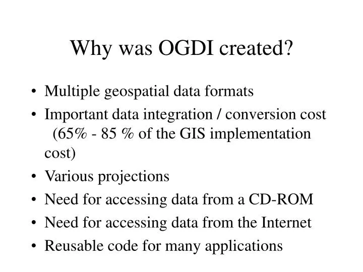
Why was OGDI created?. Multiple geospatial data formats Important data integration / conversion cost (65% - 85 % of the GIS implementation cost) Various projections Need for accessing data from a CD-ROM Need for accessing data from the Internet Reusable code for many applications.

E N D
Why was OGDI created? • Multiple geospatial data formats • Important data integration / conversion cost (65% - 85 % of the GIS implementation cost) • Various projections • Need for accessing data from a CD-ROM • Need for accessing data from the Internet • Reusable code for many applications
What does OGDI do? • Direct and transparent access to local and networked geospatial datastores • Multiple and simultaneous access to heterogeneous datastores • Extraction of geometry and attributes • Transparent and on-the-fly transformation of • Projections • Coordinates systems • Hardware representation • Runs under Win32 (Windows 95/NT) and Unix
Open Geospatial Datastore Interface T. Fisher
Intergraph ESRI Canada Global Geomatics CubeWerx CIRI NRCan National Defence GTIS SpatialWare Socomar Infomar IDON Corp Health Canada Navitrak Engineering and others Who maintains OGDI? • The Information Interoperability Institute • members include: (not exclusive)
What implementations exist and what has made them successful: • CubeSTOR from CubeWERX • OGDI Servers and adapters from Global Geomatics • Java OGDI from Global Geomatics • JViews from ILOG • SpatialFX from ObjectFX
Lockheed Martin - Radar Simulation • DND Research Establishment - various prototypes • GEOMedia from Intergraph (Vector Formats) • ARCView from ESRI (Raster formats) • MARINET Project Multi-dimension OGDI
New or near Future Developments • ARCView Vector formats • ESRI Map Objects OLE-OGDI • Integration of Remote Database Access based on SQL/MM • Meta-data services
How does OGDI relate to OGC, TC211 • OGC- Submitted to Simple Feature Access Internet Thread • Thread stopped • OGDI moved to WWW working group • ISO - Submitted as a reference platform • ISO still in process of deciding what services are
How extensible is OGDI to additional data formats • Approximately 25 drivers available commercially • GRASS, DXF, DGN, DOQ, PAMAP, ARCInfo, SHAPE, MID/MIF, MrSID, CubeSTOR, etc... • Public Domain or Gov’t owned drivers • ADRG, CADRG, CIB, VRF/VPF, DTED, GRID, CEOS, NTDB/CCOGIF 3.0
How extensible is OGDI to other DCP’s (distributed computing platforms) • The OGDI is written in ANSI C and in SUN JAVA making it very portable • Can be wrapped into a CORBA or OLE environment • Can also be adapted to map connect to a CORBA or OLE source as a driver
Applications Access, Query and Update - in compliance with the General Feature Model ISO/TC211 Feature API ISO Simple Feature Data Access, OGC-RFP-1 OGC OGC CORBA OGC OLE/DB Records OGC SQL Table, rows ISO/TC211 WI 19 Services
Applications ISO/TC211 Feature API ISO OGDI API OGC CORBA OGC OGC OLE/DB OGC SQL OGDI integration into ISO