Download
1 / 56
560 likes | 571 Views
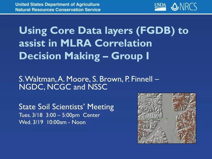
Using Core Data layers (FGDB) to assist in MLRA Correlation Decision Making – Group I. S. Waltman, A. Moore, S. Brown, P. Finnell – NGDC, NCGC and NSSC State Soil Scientists’ Meeting Tues. 3/18 3: 00 – 5:00pm Center Wed. 3/19 10:00am - Noon. Introduction. Laws of Krynine

E N D
Using Core Data layers (FGDB) to assist in MLRA Correlation Decision Making – Group I S. Waltman, A. Moore, S. Brown, P. Finnell – NGDC, NCGC and NSSC State Soil Scientists’ Meeting Tues. 3/18 3:00 – 5:00pm Center Wed. 3/19 10:00am - Noon
Introduction • Laws of Krynine • Let us see things in their proper places • Let us know what we are talking about • Let us think straight • Let us not fool ourselves P.D. Krynine, known as the Father of Sedimentology, practiced Sedimentary Petrology in the 1930’s - 1950’s
Purpose • After this seminar you should be able to recognize the four core geospatial data layers provided by NCGC in file geodatabase (FGDB – ArcGIS 9.2) format and to be aware of queries/analyses that your staff can perform to assess the published/historic soil survey database to support soil correlation decisions during MLRA Soil Survey Updates
Geospatial Data assessment is part of a sequential three step process: • Data assessment/GIS analyses • Correlation Decision making • Geometry editing (SSURGO polygons, lines, points) – merge, split, re-label, or adjust
Introduction • FGDB of core data layers • DEM (NEDS) • Hydrography (National Hydrology Dataset-NHD) • Soils (SDM FY07 Q3 – next edition soon) • TeleAtlas reference layers (roads, zip codes, counties, states, etc.) • Combine with Web Map Service through NCGC (e.g DOQQ imagery)
Introduction • Web Map Services (WMS) demos • Weather Station summaries (MAP, MAAT) • WMS Server connection • http://gis2/arcgis/services/WeatherStation/Mapserver/WMSserver • ArcGIS Server connection • http://gis2.ftw.nrcs.usda.gov/arcgis/services
Management of Soil Survey by MLRA Course • Marc Crouch is point of contact • Roles/Responsibility and Soil Correlation • Evaluation of historic soil survey • Prioritization and planning • MLRA (long range) work plan (e.g. MLRA 105) • Project (mid range) plan (MLRA SSA 10-10) • Annual work plan (plan of operations )
Management of Soil Survey by MLRA Course • Project Management • Role of Benchmark Soils • Assessment/Evaluation/Validation • geospatial and attribute • Correlation Decision Making • Certification and publication
Working with File Geodatabases (new in ArcGIS 9.2) • A series of instructions is under development • Assistance is needed! If you have ideas or documents, let us know… • The first set of instructions introduces relationship classes and provides examples of how to use them. • Future instructions will (hopefully) include: • Querying and mapping data from component and horizon tables; • Working with the MUAGGATT table; • Working with External Tables (e.g., SSURGO template); and • Visualizing Queries with Raster Data. • http://www.ngdc.wvu.edu/software
Example I: Identifying soil survey areas in which a series is mapped
Example II: Viewing related mapunit, component, and horizon records.
Using the Mapunit Aggregate Table • Part of the standard SSURGO download • Included in MO-wide file geodatabase • Includes variety of soil attributes and interpretations that have been aggregated from the component level to a single value at the map unit level • Can be joined to the MUPOLYGON feature class for easy mapping
Using the Mapunit Aggregate Table • Fields include • Slope gradient, bedrock depth, water table depth, flooding frequency, ponding frequency, available water storage, drainage class, hydrologic group, et.c… • Refer to the SSURGO Metadata Table Columns Description report for a complete list of columns and their associated aggregation methods • http://soildatamart.nrcs.usda.gov/documents/SSURGOMetadataTableColumnDescriptions.pdf Slope Gradient, Drainage Class, and Hydrologic Group
Slope Gradient – Weighted Average • MLRA 105
Drainage Class – Dominant Component • MLRA 105 Can also map Wettest component
Hydrologic Group – Dominant Condition • MLRA 105
Analyzing Data Outside of ArcGIS • Soil attribute data can be analyzed and summarized in • NASIS • MS Access (SSURGO Template), 2 GB limit • SQL Server Enterprise, no size limit • SQL Server Express, 4 GB limit • Excel .xls and Dbase4 .dbf (~60,000 record limit) • Other…
Analyzing Data Outside of ArcGIS • Tables and queries developed in these systems can be mapped in ArcGIS, provided that MUKEY is included and the attribute summarized or aggregated to the map unit level • Save or export queries and reports as *.dbf files, then join (or relate) using the MUKEY to the MUPOLYGON feature class for visualization • Can join all records or only matching records
Working in the SSURGO Template • Data for all soil survey areas that overlap an MLRA can be exported easily from NASIS • Use NSSC Pangaea query Area2/Mapunit/Datamapunit for mapunits by MLRA (uses MLRA overlap) • If MLRA Overlap is not properly populated, additional survey areas may have to be added to the selected set • Run SSURGO export, excluding interpretations and text notes
Working in the SSURGO Template • Import SSURGO export into the SSURGO template • Final database must be less than 2 GB • 162 SSAs in MO 13 resulted in a 500 MB database w/o interp and text tables • Build queries to analyze data across the MLRA • Existing reports and queries in the SSURGO template operate on a SSA basis • Develop new queries using the Access query builder • Export results as *.dbf or *.xls files
Working in the SSURGO Template • Map the results • Add *.dbf / *.xls files to ArcMap • Join to MUPOLYGON feature class (in the file geodatabase) on MUKEY • Choose a field to map, and symbolize appropriately • Instructions on working with the SSURGO template can be found at http://soils.usda.gov/technical/access/
Correlation Date Tables from NASIS export excludes SSAs that do not have Area Overlaps populated. Tables in the file geodatabase include all data available from Soil Data Mart
NM NM NM NM NM NI NM NI NI NI NI NM NM NM NI NM NM NM = Fayette series not mapped NI = Survey area not included in export MN WI IA IL
Sand Loamy sand Sandy loam Loam Silt loam Clay loam Silty clay loam Silty clay Soil Texture • MLRA 105 • Dominant component • First horizon, mineral • Sandy textures generalized to Sand, Loamy Sand, and Sandy Loam
<Null>, <Null> Lithic Lithic, Indurated Paralithic Paralithic, Extremely weakly cemented Paralithic, Weakly cemented Paralithic, Moderately cemented Paralithic, Indurated Component Restrictions • MLRA 105 • Dominant component • Lithic vs paralithic bedrock • Cementation classes
Working with Soil Data Mart Data in Raster Format • At small scales (large extents), raster data may display more quickly in ArcMap than vector data • Depends on pixel size • In ArcGIS 9.2, rasters in various formats can be joined directly to other tables (*.dbf files, tables in file geodatabases, etc.) • MUPOLYGON_AlbersEqualAreaUSGS feature class • Grid on MUKEY (this is possible in Arc 9.2) • 30 meter cell size is recommended • Join to *.dbf / *.xls files on MUKEY
Working with Soil Data Mart Data in Raster Format • Use raster representation to view data for large areas • Switch to raster data at scales of ~ 1:50,000 – 1:100,000 or smaller • Some detail may be lost, but general shapes, locations, and patterns will be apparent • Use vector representation to view data for small areas • Switch to vector data when zoomed in to map scales of ~ 1:50:000 – 1:100,000 or larger • See exact location and shape of polygons
MLRA 105 Surface Texture, Fayette Soils Raster Data Images
MLRA 105 Geomorphic Description, Dubuque Soils Raster Data Images
Analyzing Data Outside of ArcGIS • Using MS SQL Server Enterprise or MS SQL Server Express to prepare MO-wide and Nation-wide queries • Major Component queries – Series • All component queries – Series • Summed Component Percent for each map unit • All component queries – Taxonomic • Summed component Percent for each map unit
Spatial selection of SSURGO or General Soil Map (GSM) polygons • Those polygons that intersect or touch the MLRA SSA or MLRA line • In the MLRA 105 example, the MLRA SSA coincides with the Ag Handbook 296 MLRA region called 105 • Note: this is not always the case across the nation
Spatial Selection of SSURGO Polygons • Those that intersect or touch the • MLRA 105 or MLRA SSA 10-10 • Boundary (1:250,000)
Spatial Selection of SSURGO Polygons • Those that intersect or touch the • MLRA 105 or MLRA SSA 10-10 • Boundary (1:250,000) 1:250,000 1:250,000 Scale
Attribute selection of soil polygons joined to the MO-wide File GDB • Major component queries can be performed and joined to MO-wide soils core layer using the MUKEY • This will illustrate the MO-wide extent of the attribute in question • These queries can be performed on the National Soil Data Mart attribute tables using MS SQL Server Enterprise
Major Component attribute query joined to MUPOLYGON • Query for component like ‘Fayette%’ and major component flag = ‘Yes’
Selected table records are exported And later linked to MO10 MUPOLYGON
General Soil Map of the US (GSM) Summed Component Percent Fayette map unit components
Detailed Soil Survey (SSURGO) Within MLRA 105 (MLRA SSA 10-10) Major Component - Fayette
Detailed Soil Survey (SSURGO) Full Exent of Fayette Series Major Component
Detailed Soil Survey (SSURGO) Fayette Series, Major Component 1:250,000 Scale
All Components attribute query joined to MUPOLYGON • Query for component like ‘Fayette%’ and comppct summed for those flagged components by map unit