Download
1 / 19
190 likes | 386 Views
FEMA Region II Bergen County Digital Flood Insurance Rate Map (DFIRM). FEMA Region 2 Mitigation Division June 9th, 2010 10:00-11:00.

E N D
FEMA Region IIBergen County Digital Flood Insurance Rate Map (DFIRM) FEMA Region 2 Mitigation Division June 9th, 2010 10:00-11:00
Risk MAP Vision: Through collaboration with State, Tribal, and local entities, Risk MAP will deliver quality data that increases public awareness and leads to action that reduces risk to life and property • Purpose of this Coordination Call: To establish the awareness and understanding in the ongoing efforts to update Community’s flood risk analysis and mapping (ie. FIS and DFIRM). • Whois Involved:Federal/State/Local/Mapping Partners • Federal – FEMA, Region II Project Manager; Paul K. Weberg, PE Communications/Outreach Support; Adie Koby Technical Assistance; Alan Springett • State – NJDEP, Joseph Ruggeri, P.E., CFM Supervising Engineer NJ State NFIP Coordinator's Office Bureau of Dam Safety & Flood Control Office of Engineering & Construction • Mapping Partner: RAMPP – Robyn Boyd, project manager • Local – Bergen County & Communities Purpose
WHY: maintain an up-to-date and accurate flood risk analysis and delineation for local decision makers in flood risk management. • This SUCCESS of this effort and outcome relies on the active participation of EACH COMMUNITY Purpose
Overview of current Risk MAP status of Bergen County • Future projects and next steps • QA/QC & Feedback from the communities affected (Passaic and Saddle Rivers, Ho-Ho-Kus Brook, Ramsey Brook) Objective
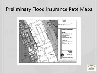
Mapping partner to deliver preliminary maps to affected Bergen County communities in September, 2011 • Project Team • Risk Assessment, Mapping, and Planning Partners (RAMPP), a joint venture of Dewberry, URS, and ESP • Key team member: Sun Engineers • Tasks -New Detailed Hydrology & Hydraulics (H&H) -FIS Report Production -DFIRM panel and database production -Preliminary DFIRM Production and Distribution Bergen County Preliminary Maps – Overview
Incorporation of approximately 35 miles of detailed analysis for three streams and 14 miles for the Passaic River • The 35 miles mentioned were scoped to be incorporated into the DFIRM from a study that was conducted in 2006 • Converts flood hazard data from the National Geodetic Vertical Datum of 1929 (NGVD 29) to the North American Vertical Datum of 1988 (NAVD 88) in only affected panels – remaining panels will be converted in the near future under the CTP (NJDEP) agreement with the FEMA • NAVD 88 = NGVD 29 (-0.962) Bergen County Preliminary Maps -Scope
Bergen County – September, 2011 PreliminaryNew Detailed Studies
Bergen County – September, 2011 PreliminaryAffected Communities & Panels
Bergen County – Community Assistance Contact (CAC) & Community Assistance Visit (CAV)
Bergen County – NFIP Policies, Claims, Repetitive Losses & CRS
Current Status: • The gathering and review of data from the previous studies for the approximately 35 miles of detailed analysis for various streams has been completed. • Survey field work of the 14 miles of the Passaic River is complete, QC of survey information is in progress. • Awaiting response from communities to the letters sent out in November and December, 2009 regarding data request Bergen County Preliminary Maps -Current Status
Contacted each community letting them know about field surveys taking place in their communities back in November, 2009 and data request in December, 2009 • No response received • Is this an accurate representation of your communities? • Roles & Responsibilities of Local Communities: • Response to the letters sent out in November and December, 2009 • Flood Risk communications with residents Local Communities
Target Dates • Next coordination call: December, 2010 • Passaic River and Saddle River mapping completed by: May, 2011 • Preliminary maps to be distributed: September, 2011 Milestones
Preliminary delivery • Community Consultation Official (CCO) meeting • Initial 30-day comment period • Appeals & Protests • 6 month: FEMA 6-month Letter of Final Determination (LFD) • 5 month: NJDEP Assistance Letter • 3 ½ month: Draft Ordinance • 3 month: NJDEP review of draft ordinance • 3 month: FEMA 90-day Reminder Letter • 1 month: FEMA 30-day Reminder Letter • 0: Ordinance Adopted The Road to Ordinance Adoption
www.RAMPP-TEAM.com: PowerPoint Presentation & Fact Sheets & additional information will be posted • Next coordination meeting: December, 2010 Contact Information • FEMA Region II Paul Weberg, DHS/FEMA Region II 290 Broadway, 29th Floor New York, NY (212) 680-3638 Paul.weberg@dhs.gov • NJDEP office: John Scordato / Joseph Ruggeri / Chris Gould NJDEP, Bureau of Dam Safety & Flood Control (609) 292-2296 phone, (609) 984-1908 fax Visit NJDEP website: www.nj.gov/dep/floodcontrol Download Model Ordinances: http://www.nj.gov/dep/floodcontrol/modelord.htm Questions & Feedback


![Risk MAP and Discovery FEMA Region [#], [WATERSHED NAME] Watershed](https://cdn1.slideserve.com/2868558/risk-map-and-discovery-fema-region-watershed-name-watershed-dt.jpg)