Download
1 / 24
240 likes | 445 Views
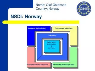
2nd National GIS in Transit Conference May 18, 1999 Tampa, FL. NSDI. The National Spatial Data Infrastructure: A Geographic Information Resource for Transit Management. John Moeller Staff Director Federal Geographic Data Committee. NSDI. Geographic Information.

E N D
2nd National GIS in Transit Conference May 18, 1999 Tampa, FL NSDI
The National Spatial Data Infrastructure: A Geographic Information Resource for Transit Management John Moeller Staff Director Federal Geographic Data Committee NSDI
Geographic Information • Place matters to people • Geographic Information important to 50% of US economic activity • Government activities often are geography based • Cross jurisdictional approaches call for common understanding • Devolution of government has placed focus on community solutions • Effective “place based” government requires data available to citizens
However . . . Geographic information is collected by thousands of organizations and often is: • Hard to find • Difficult to access • Hard to integrate • Not documented • Not coordinated NSDI
Geospatial DataSome Examples Field Measurements Maps Remotely-sensed Images Spatially-referenced Data
The NSDI • Established by Executive Order 12906 in April 1994 to: • Advance goals of the NII • Reduce duplication of effort • Promote effective management by all levels of government • Improve the acquisition, distribution and use of geographic information NSDI
The Vision of NSDI “Current and accurate geospatial data will be readily available to contribute locally, nationally, and globally to economic growth, environmental quality and stability, and social progress.” NSDI
Clearinghouse (catalog) Metadata GEOdata Framework Standards Partnerships The NSDI NSDI NSDI
Major Public Purposes supported by GeoData(From NAPA Report 1/98) • Property Rights • Revenues from Property • Transportation Navigation and Commerce • Public Land and Marine Sanctuary Management • Agriculture and Natural Resource Development • Environmental Protection and Ecosystem Management • Community and Economic Development • Emergency Management • Public Service Delivery • National Defense • Earth System Sciences • Public Information NSDI NSDI
Some Examples of Transit Activities supported by NSDI • Transportation and traffic flow • Environmental Analyses • Property ownership • Land Use • Routing and Scheduling • Demographics • Utilities management • Travel Information NSDI NSDI
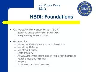
The Federal Geographic Data Committee (FGDC) • 16 Cabinet and Executive Level Agencies • Chaired by Secretary Babbitt • Subcommittees and Working Groups • Transportation Subcommittee Chaired by DOT, addresses ground transportation related issues NSDI NSDI
The FGDC • Numerous Stakeholders • National Association of Counties • National League of Cities • National States Geographic Information Council • International City/County Management Association • Open GIS Consortium • University Consortium for Geographic Information Sciences • GIS Coordinating Groups from 30 States • Intertribal GIS Council (pending) NSDI NSDI
The Federal Geographic Data Committee Role: • Promote coordinated development, use sharing and dissemination of geospatial data • Facilitate coordination among organizations and interact with other geospatial data coordinating entities • Promote and coordinate NSDI development and implementation NSDI NSDI
FGDC Ground Transportation Subcommittee Chair Bruce Spear Bureau of Transportation Statistics U.S. Department of Transportation
FGDC Ground Transportation Subcommittee … … promotes the coordination of geo-spatial data for ground transportation related activities. The Subcommittee will establish mechanisms for coordinated development, use, sharing and dissemination of geo-spatial data for ground transportation financed in whole or in part by Federal funds.
Ground Transportation Subcommittee (GTS) • Active members from federal agencies • Non-federal members from NACo and NSGIC • GTS is developing a Road Data Model - Content Standard & Implementation Guide to enable updating and data exchange. Significant non-federal involvement • Information available through FGDC or BTS Websites
Community/Federal Information Partnership:An FY2000 FGDC Initiative • GOALS • informed decision-making at the community level • improved land and resource use • a more informed public • greater opportunity for public participation in decision-making • ready transfer of data between the Federal government and communities NSDI NSDI
Components of the Initiative • Component 1: Multi-agency grant, cooperative agreement and partnership program to support communities (matching funds) • Component 2: Improving federal agency capability to meet community information needs and to implement NSDI NSDI NSDI
1999 National GeoData Forum: Making Livable Communities a Reality “Using common solutions and sharing data will dramatically improve the way we make decisions. This is a great opportunity to get involved in setting the direction for this important national initiative.”Congressman Paul Kanjorski
National GeoData Forum: Making Livable Communities A Reality • June 7-9, 1999 • Washington, D.C. • Marriott at Metro Center
Spatial Decision-Support Systems “No limits” Information Technology Accessing Data Finance & Commercial Aspects Digital Data Products and Framework Research and Education Coordination of GeoData Communities Forum Threads
The NSDI: A Summary • NSDI promotes public access to data • NSDI not restricted to public data • NSDI involves all sectors and levels of government • Geographic Information is increasingly vital to decision needs of communities • Strategies that address common interests and needs will be most successful • NSDI is a new way of doing business NSDI
To find out more about the NSDI . . . www.fgdc.gov Federal Geographic Data Committee USGS, 590 National Center Reston, Virginia 20192 703.648.5514 703.648.5575 (f) gdc@usgs.gov NSDI