Download
1 / 27
270 likes | 461 Views
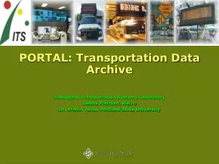
Transportation Data Portal. Wrap-Up of Phase 1 Oregon Explorer Institute for Natural Resources & Oregon State University Libraries RENEE DAVIS-BORN Kuuipo Walsh Marc Rempel 6/30/11. Meeting Objectives. Wrap up of Transportation Portal project (Oregon Spatial Data Library revision)

E N D
Transportation Data Portal Wrap-Up of Phase 1 Oregon Explorer Institute for Natural Resources & Oregon State University Libraries RENEE DAVIS-BORN Kuuipo Walsh Marc Rempel 6/30/11
Meeting Objectives • Wrap up of Transportation Portal project (Oregon Spatial Data Library revision) • Plan for Phase 2 of the Oregon Transportation Portal project • Bring each other up-to-date on related efforts
Thank You ODOT: Project Sponsor and Funder USGS/DAS GEO: Core team members
Transportation Portal Project Deliverables • Have a functional beta website available for internal use by June 30, 2011 • Assessment of Open Source and non-Open Source solutions • Sharing of transportation data through the Oregon Spatial Data Library • Limited access to restricted data based on user-login • Capability for downloads using a map interface • Expose the ArcGIS Server geo-processing task so that it can be incorporated into other ODOT applications if desired.
The Oregon Spatial Data Library http://spatialdata.oregonexplorer.info
Implementation • Installed and upgraded the Oregon Spatial Data Library to ESRI’s Geoportal Server 1.1. • Harvested current OSDL records. • Created a new “gpt_transportation” role. • Customized code to add “Transportation” tab when a user with “gpt_transporation” role logs in. • Created a new generic user with transportation role.
User Workflow • Login • Select “Transportation” tab • Select Area of Interest • Pre-defined areas • User drawn • Select output format • Select output projection • Enter email address (for large downloads only) • Extract • Download • In application for small areas (less than 30,000 sq miles) • Email with link for large areas.
Choice List:File Geodatabase - GDB - .gdb Shapefile - SHP - .shp Autodesk AutoCAD - DXF_R2007 - .dxf Autodesk AutoCAD - DWG_R2007 - .dwg Bentley Microstation Design (V8) - DGN_V8 - .dgn Intergraph GeoMedia Access Warehouse - FM0 - .mdb
Choice List:NAD 1983 Oregon Statewide Lambert Feet Intl NAD 1927 StatePlane Oregon North FIPS 3601 NAD 1927 StatePlane Oregon South FIPS 3602 NAD 1927 UTM Zone 10N NAD 1927 UTM Zone 11N NAD 1983 HARN Oregon Statewide Lambert (Intl Feet) NAD 1983 HARN StatePlane Oregon North FIPS 3601 (Intl Feet) NAD 1983 HARN StatePlane Oregon South FIPS 3602 (Intl Feet) NAD 1983 StatePlane Oregon North FIPS 3601 (Intl Feet) NAD 1983 StatePlane Oregon South FIPS 3602 (Intl Feet) NAD 1983 UTM Zone 10N NAD 1983 UTM Zone 11N WGS 1984 WGS 1984 Web Mercator NAD 1983 Albers Region 6
Usage: Spatial Data Library Total # of visits since 2/10: 18,017 Note: Began tracking usage tracked on February 15, 2010
Requests for road information Yurok Tribe staff, April2011 “I got the NAIP imagery layer. Do you have any road layers that I can download. I am looking for the logging roads and forest service roads that are throughout Eastern Curry county. .” “We are working on a project to identify and document the most remote location of each state. I would like to obtain the most recent and detailed road data for Oregon. I saw a file for highways, are there more detailed road data available?” Wildlife ecologist, June 2011
Phase 2 Additional funding for Phase 2 is anticipated to be made available in the summer to allow for the completion of the portal and a public launch
Phase 2 • Working with DAS GEO on interagency agreement for Phase 2 • May include the following deliverables: • Additional spatial data (traffic counts and crashes) • Ability to check-in data • Standard symbolization of road center line data • Other?