Download
1 / 14
220 likes | 618 Views
Coastal Vulnerability Assessment. Robert J. Nicholls University of Southampton and Tyndall Centre for Climate Change Research, UK. T he Question is Key?. Needs definition – vulnerability of what entity to what driver(s). Vulnerability of what? People Habitats and Ecosystems

E N D
Coastal Vulnerability Assessment Robert J. Nicholls University of Southampton and Tyndall Centre for Climate Change Research, UK
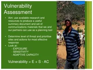
The Question is Key? Needs definition – vulnerability of what entity to what driver(s). Vulnerability of what? • People • Habitats and Ecosystems Vulnerability to what? • Climate change and sea-level rise • Socio-economic pressures Why? • To support EU policy (e.g. Habitats, or Flood Directives)
What’s the Problem • Defining the issues, the drivers and the causal links • For example sea-level rise causes • Erosion (morphodynamics) • Flooding (hydrodynamics – river and coastal) • Habitat change (morphodynamics, ecology) • Salinisation (surface and groundwater hydrology) • Translation of physical impacts into socio-economic impacts • Responses (Mitigation and Adaptation)
Assessment Tools purpose (1) • Tyndall Coastal Simulator – assessment of coastal evolution and flooding to support shoreline management planning (50 to 100 km scale)
Assessment Tools purpose (1) • Tyndall Coastal Simulator
Assessment Tools purpose (1)Flood and erosion risk under different management decisions (a) Erosion Risk (b) Flood Risk
Assessment Tools purpose (2) • Regional Impact Simulator (RegIS) – cross-sectoral impacts of climate change “floods” to “land use” to “water quantity and quality” to “habitats” Availability for arable agriculture Originally for UK regions at 5 km scale – now in CLIMSAVE for EU at 18 km scale.
Assessment Tools purpose (3) • DIVA – national to global impacts of sea-level rise, with and without adaptation (protection) responses BRANCH Project: Relative loss of saltmarsh under the IPCC high TAR scenario
Levels of Assessment • Index methods • first look, scoping, organization of data and methods (easy, but limited) • Sector analyses • more detailed analysis, allows for non-linearities, more qualitative analysis of sectoral interactions (more realistic, but more work) • Integrated assessment • quantitative analysis of sectoral interaction (most realistic, but are they needed?)
Input Needs • Data is generally a problem • Scenarios often emphasise the physical and ignore the socio-economic dimension Foresight Analysis Using RASP High Level Model (Evans et al., 2004a; 2004b)
OECD Global Port City AnalysisExposed Population in 2005 and the 2070s
OECD Global Port City AnalysisExposed Assets in 2005 and the 2070s
Thoughts • I would structure methods by the practical questions being posed – conceptualising the problem and defining what is required is key and often ignored.- in this way a “proper” method can be developed for your problem • There is a lot of relevant experience, but most work focuses on the index approach – less sectoral or integrated assessment examples – (many not in the Working Paper) • On the shelf approaches will not always exist – use when available, but the expertise in the room can help to develop new approaches as needed • Beware the physical aspects dominating as socio-economic issues are often an afterthought, and yet they are important to the result
Coastal Vulnerability Assessment Robert J. Nicholls University of Southampton and Tyndall Centre for Climate Change Research, UK