Download
1 / 27
270 likes | 452 Views
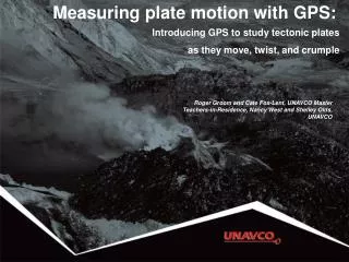
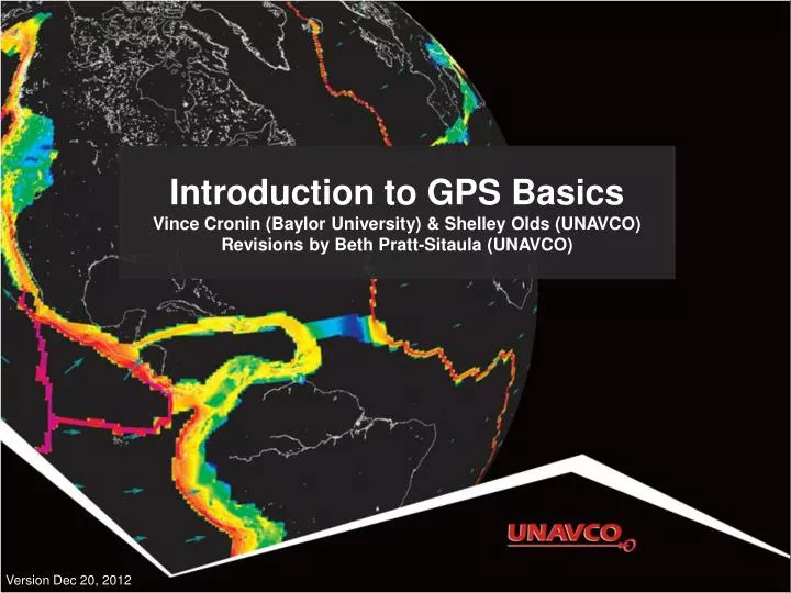
Introduction to GPS Basics Vince Cronin (Baylor University) & Shelley Olds (UNAVCO) Revisions by Beth Pratt-Sitaula (UNAVCO). Version Dec 20, 2012. GPS receiver. GPS receiver. GPS receiver. The Global Positioning System. 24-32 satellites 20,200 km altitude 55 degrees inclination

E N D
Introduction to GPS BasicsVince Cronin (Baylor University) & Shelley Olds (UNAVCO)Revisions by Beth Pratt-Sitaula (UNAVCO) Version Dec 20, 2012
The Global Positioning System • 24-32 satellites • 20,200 km altitude • 55 degrees inclination • 12 hour orbital period • 5 ground control stations • Need 4 satellites to be accurate • Each satellite passes over a ground monitoring station every 12 hours
GPS Satellite Images from Lockeed-Martin (http://www.lockheedmartin.com/products/GPS/)
Horizontal: +/- 10 m (30 ft) error Vertical: +/- 15 m (45 ft) error Your location is: 37o 23.323’ N 122o 02.162’ W Consumer-grade GPS accuracy
GPS antenna inside of dome Monument solidly attached into the ground with braces. If the ground moves, the station moves. Solar panel for power Equipment enclosure GPS receiver Power/batteries Communications/ radio/ modem Data storage/ memory Anatomy of a High-precision Permanent GPS Station
High-precision GPS • Current accuracies sub-cm. • Use the carrier phase • Dual-frequency receivers • High-precision orbital information • Good monuments • Multiple stations • Sophisticated processing software • Collect lots of data
GPS & atomic clocks Each GPS satellite has 4 atomic clocks, to be sure that one is always working. Each costs ~$100,000, and is accurate to 1 billionth of a second (1 nanosecond). http://www.kowoma.de/en/gps/satellites.htm
Almanac & Ephemeris data GPS satellites include almanac and ephemeris data in the signals they transmit Almanac data are coarse orbital parameters for all GPS satellites Ephemeris data are very precise orbital and clock correction for that particular GPS satellite--necessary for precise positioning http://gpsinformation.net/main/almanac.txt
How satellite-receiver distance is measured Radio signal from satellite tells GPS receiver the satellite-clock time and provides the most recent corrections to the satellite’s position relative to Earth (ephemeris) GPS receiver compares the satellite-times to receiver-time to determine the distance to each satellite
How actual location is determined Receiver position is triangulated using at least 3 satellites, 4th needed to adjust the receiver’s time.
Some GPS Error Sources Selective Availability Satellite orbits Satellite and receiver clock errors Atmospheric delays Ionosphere Troposphere Multi-path Human errors Sources of Error The New Yorker, Roz Chast
GNSS/GPS stations globally >4000 stations with more added all the time Some data freely available, some not GNSS = Global Navigation Satellite System http://gsrm.unavco.org/data/images/1.2/sites.jpg
Plate Boundary Observatory (PBO) PBO involves installation, operation and maintenance of >1100 continuously operating high-precision GPS stations (plus >170 other instruments: strainmeters, borehole seismometers and tiltmeters) http://pbo.unavco.org/network/gps/; http://www.earthscope.org/
Where is that chunk of crust going? • Two PBO stations in California • Twenty-nine Palms,(BEMT) • Mission Viejo (SBCC) Example: using GPS velocities to understand plate motions
GPS time series data • Station position over time • North-South • East-West • Up-Down http://pbo.unavco.org/station/overview/SBCC
GPS time series data From the changing position velocity can be calculated using slope (rise-over-run) http://pbo.unavco.org/station/overview/SBCC
Detrended GPS time data PBO also supplies “detrended” data with the average velocity subtracted out to observe other phenomena. In that case official velocity is given.
What is a site’s 3D speed? Using the Pythagorean Theorem (high school math...),
What compass direction is the site moving? Using the horizontal components of velocity, and a bit of high-school trigonometry… 43.9°west of north or 316.1°azimuth
Map view of velocity 20 mm/yr
Two different velocities Why the difference? 20 mm/yr Same process yields much slower velocity at BEMT
San Andreas Fault! 20 mm/yr
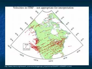
Reference Frames All velocities are RELATIVE to a given reference frame Velocities compared to International Terrestrial Reference Frame 2000 Hot spot constellation as “stable”
Reference Frames All velocities are RELATIVE to a given reference frame Velocities compared to Stable North America Reference Frame Eastern North America as “stable”